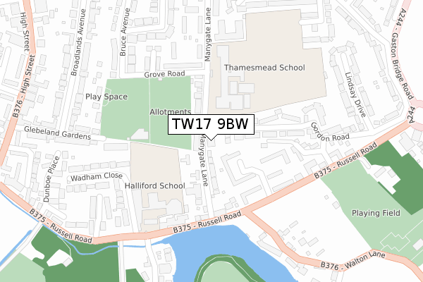
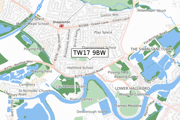
TW17 9BW is located in the Shepperton Town electoral ward, within the local authority district of Spelthorne and the English Parliamentary constituency of Spelthorne. The Sub Integrated Care Board (ICB) Location is NHS Surrey Heartlands ICB - 92A and the police force is Surrey. This postcode has been in use since February 2020.


GetTheData
Source: OS Open Zoomstack (Ordnance Survey)
Licence: Open Government Licence (requires attribution)
Attribution: Contains OS data © Crown copyright and database right 2024
Source: Open Postcode Geo
Licence: Open Government Licence (requires attribution)
Attribution: Contains OS data © Crown copyright and database right 2024; Contains Royal Mail data © Royal Mail copyright and database right 2024; Source: Office for National Statistics licensed under the Open Government Licence v.3.0
| Easting | 508461 |
| Northing | 167028 |
| Latitude | 51.391935 |
| Longitude | -0.442504 |
GetTheData
Source: Open Postcode Geo
Licence: Open Government Licence
| Country | England |
| Postcode District | TW17 |
| ➜ TW17 open data dashboard ➜ See where TW17 is on a map ➜ Where is Shepperton? | |
GetTheData
Source: Land Registry Price Paid Data
Licence: Open Government Licence
| Ward | Shepperton Town |
| Constituency | Spelthorne |
GetTheData
Source: ONS Postcode Database
Licence: Open Government Licence
| December 2023 | Burglary | On or near Parking Area | 499m |
| November 2023 | Violence and sexual offences | On or near Green Lane | 499m |
| July 2023 | Anti-social behaviour | On or near Parking Area | 499m |
| ➜ Get more crime data in our Crime section | |||
GetTheData
Source: data.police.uk
Licence: Open Government Licence
| Thamesmead School (Manygate Lane) | Shepperton | 135m |
| Gordon Drive (Russell Road) | Lower Halliford | 215m |
| Gordon Drive (Russell Road) | Lower Halliford | 269m |
| Old Ship Hotel (Russell Road) | Shepperton | 281m |
| Old Ship Hotel (Russell Road) | Shepperton | 297m |
| Shepperton Station | 0.6km |
| Upper Halliford Station | 2.5km |
| Walton-on-Thames Station | 2.9km |
GetTheData
Source: NaPTAN
Licence: Open Government Licence
GetTheData
Source: ONS Postcode Database
Licence: Open Government Licence


➜ Get more ratings from the Food Standards Agency
GetTheData
Source: Food Standards Agency
Licence: FSA terms & conditions
| Last Collection | |||
|---|---|---|---|
| Location | Mon-Fri | Sat | Distance |
| Russell Road | 16:30 | 11:15 | 175m |
| Gaston Bridge Road | 16:30 | 11:15 | 452m |
| Cliveden Placehigh Street | 17:30 | 12:00 | 477m |
GetTheData
Source: Dracos
Licence: Creative Commons Attribution-ShareAlike
| Facility | Distance |
|---|---|
| Shepperton Recreation Ground Grove Road, Shepperton Grass Pitches | 182m |
| Fresh Sports Centre Manygate Lane, Shepperton Health and Fitness Gym, Grass Pitches, Sports Hall, Studio | 217m |
| Halliford School Russell Road, Shepperton Health and Fitness Gym, Grass Pitches, Sports Hall | 239m |
GetTheData
Source: Active Places
Licence: Open Government Licence
| School | Phase of Education | Distance |
|---|---|---|
| Thamesmead School Manygate Lane, Shepperton, TW17 9EE | Secondary | 213m |
| Halliford School Russell Road, Shepperton, TW17 9HX | Not applicable | 239m |
| St Nicholas CofE Primary School Manor Farm Avenue, Shepperton, TW17 9AD | Primary | 690m |
GetTheData
Source: Edubase
Licence: Open Government Licence
The below table lists the International Territorial Level (ITL) codes (formerly Nomenclature of Territorial Units for Statistics (NUTS) codes) and Local Administrative Units (LAU) codes for TW17 9BW:
| ITL 1 Code | Name |
|---|---|
| TLJ | South East (England) |
| ITL 2 Code | Name |
| TLJ2 | Surrey, East and West Sussex |
| ITL 3 Code | Name |
| TLJ25 | West Surrey |
| LAU 1 Code | Name |
| E07000213 | Spelthorne |
GetTheData
Source: ONS Postcode Directory
Licence: Open Government Licence
The below table lists the Census Output Area (OA), Lower Layer Super Output Area (LSOA), and Middle Layer Super Output Area (MSOA) for TW17 9BW:
| Code | Name | |
|---|---|---|
| OA | E00156718 | |
| LSOA | E01030732 | Spelthorne 013C |
| MSOA | E02006415 | Spelthorne 013 |
GetTheData
Source: ONS Postcode Directory
Licence: Open Government Licence
| TW17 9EJ | Manygate Lane | 80m |
| TW17 9ED | Manygate Lane | 81m |
| TW17 9EQ | Manygate Lane | 96m |
| TW17 8JL | Mulberry Trees | 117m |
| TW17 9EZ | River Court | 150m |
| TW17 8JY | Gordon Road | 152m |
| TW17 8JJ | Russell Road | 163m |
| TW17 9HZ | Russell Road | 176m |
| TW17 8JN | Mulberry Trees | 177m |
| TW17 9EL | Grove Road | 194m |
GetTheData
Source: Open Postcode Geo; Land Registry Price Paid Data
Licence: Open Government Licence