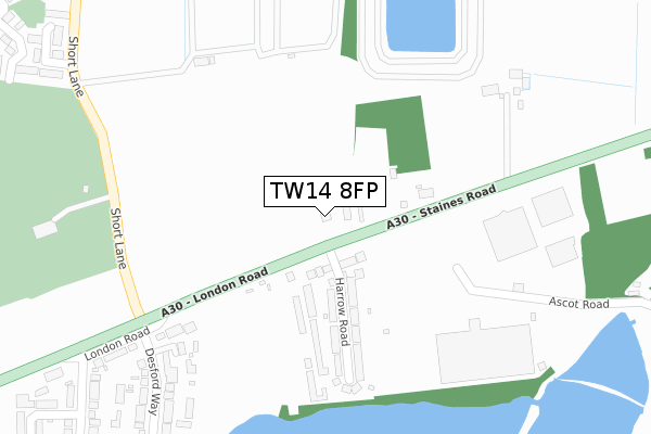
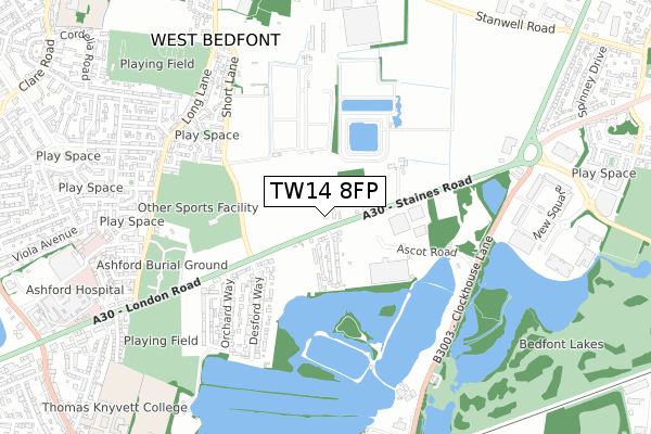
TW14 8FP is located in the Ashford North and Stanwell South electoral ward, within the local authority district of Spelthorne and the English Parliamentary constituency of Spelthorne. The Sub Integrated Care Board (ICB) Location is NHS Surrey Heartlands ICB - 92A and the police force is Surrey. This postcode has been in use since January 2020.


GetTheData
Source: OS Open Zoomstack (Ordnance Survey)
Licence: Open Government Licence (requires attribution)
Attribution: Contains OS data © Crown copyright and database right 2024
Source: Open Postcode Geo
Licence: Open Government Licence (requires attribution)
Attribution: Contains OS data © Crown copyright and database right 2024; Contains Royal Mail data © Royal Mail copyright and database right 2024; Source: Office for National Statistics licensed under the Open Government Licence v.3.0
| Easting | 507232 |
| Northing | 173123 |
| Latitude | 51.446953 |
| Longitude | -0.458318 |
GetTheData
Source: Open Postcode Geo
Licence: Open Government Licence
| Country | England |
| Postcode District | TW14 |
| ➜ TW14 open data dashboard ➜ See where TW14 is on a map ➜ Where is London? | |
GetTheData
Source: Land Registry Price Paid Data
Licence: Open Government Licence
| Ward | Ashford North And Stanwell South |
| Constituency | Spelthorne |
GetTheData
Source: ONS Postcode Database
Licence: Open Government Licence
| June 2022 | Public order | On or near Harrow Road | 152m |
| June 2022 | Violence and sexual offences | On or near Desford Way | 450m |
| June 2022 | Violence and sexual offences | On or near Desford Way | 450m |
| ➜ Get more crime data in our Crime section | |||
GetTheData
Source: data.police.uk
Licence: Open Government Licence
| Harrow Road (Tw14) (London Road) | East Bedfont | 48m |
| Harrow Road (Tw14) (London Road) | East Bedfont | 58m |
| Short Lane (London Road) | Ashford | 295m |
| Short Lane (London Road) | Ashford | 372m |
| Clockhouse Roundabout | East Bedfont | 645m |
| Heathrow Terminal 4 Underground Station | Heathrow Airport Terminal 4 | 1,555m |
| Ashford (Surrey) Station | 1.3km |
| Heathrow Terminal 4 Station | 1.5km |
| Heathrow Terminal 4 (Rail-Air) | 1.6km |
GetTheData
Source: NaPTAN
Licence: Open Government Licence
GetTheData
Source: ONS Postcode Database
Licence: Open Government Licence


➜ Get more ratings from the Food Standards Agency
GetTheData
Source: Food Standards Agency
Licence: FSA terms & conditions
| Last Collection | |||
|---|---|---|---|
| Location | Mon-Fri | Sat | Distance |
| The Green Man, Green Man Lane | 18:30 | 11:45 | 1,135m |
| Parkland Road | 18:30 | 11:30 | 1,224m |
| Knapp Road | 18:30 | 12:00 | 1,370m |
GetTheData
Source: Dracos
Licence: Creative Commons Attribution-ShareAlike
| Facility | Distance |
|---|---|
| Ashford Sports Club (Short Lane Centre) Short Lane, Staines-upon-thames Artificial Grass Pitch, Grass Pitches | 430m |
| Ashford Town (Middlesex) Football Club Short Lane, Stanwell Grass Pitches | 615m |
| Princes Sporting Club (Closed) Clockhouse Lane, Bedfont Health and Fitness Gym, Studio, Squash Courts | 922m |
GetTheData
Source: Active Places
Licence: Open Government Licence
| School | Phase of Education | Distance |
|---|---|---|
| St James Senior Boys' School Church Road, Ashford, TW15 3DZ | Not applicable | 1.2km |
| Fordway Centre Southway, Guildford, GU2 8AA | Not applicable | 1.2km |
| Thomas Knyvett College Stanwell Road, Ashford, TW15 3DU | Secondary | 1.2km |
GetTheData
Source: Edubase
Licence: Open Government Licence
The below table lists the International Territorial Level (ITL) codes (formerly Nomenclature of Territorial Units for Statistics (NUTS) codes) and Local Administrative Units (LAU) codes for TW14 8FP:
| ITL 1 Code | Name |
|---|---|
| TLJ | South East (England) |
| ITL 2 Code | Name |
| TLJ2 | Surrey, East and West Sussex |
| ITL 3 Code | Name |
| TLJ25 | West Surrey |
| LAU 1 Code | Name |
| E07000213 | Spelthorne |
GetTheData
Source: ONS Postcode Directory
Licence: Open Government Licence
The below table lists the Census Output Area (OA), Lower Layer Super Output Area (LSOA), and Middle Layer Super Output Area (MSOA) for TW14 8FP:
| Code | Name | |
|---|---|---|
| OA | E00156592 | |
| LSOA | E01030709 | Spelthorne 002A |
| MSOA | E02006404 | Spelthorne 002 |
GetTheData
Source: ONS Postcode Directory
Licence: Open Government Licence
| TW14 8RW | London Road | 125m |
| TW14 8RT | Harrow Road | 188m |
| TW15 3FF | The Kemptons | 299m |
| TW15 3AW | London Road | 372m |
| TW15 3AR | Desford Way | 379m |
| TW15 3BB | Barry Terrace | 481m |
| TW15 3AT | Desford Way | 483m |
| TW19 7BN | Nuthatch Close | 491m |
| TW15 3AZ | Edward Way | 509m |
| TW15 3AU | Orchard Way | 518m |
GetTheData
Source: Open Postcode Geo; Land Registry Price Paid Data
Licence: Open Government Licence