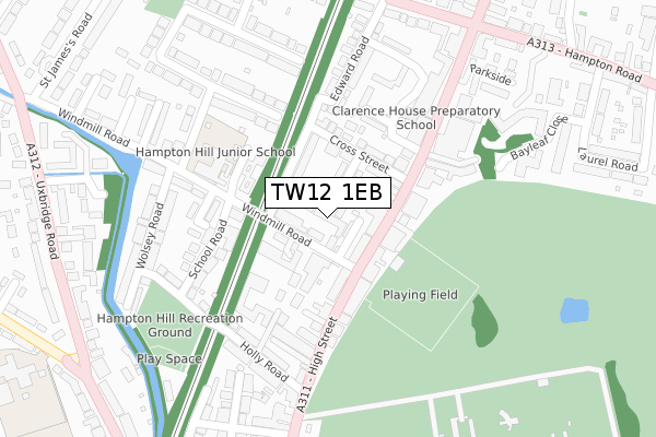
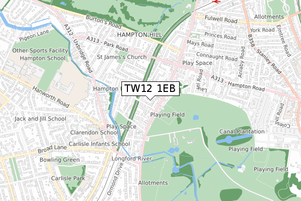
TW12 1EB is located in the Fulwell & Hampton Hill electoral ward, within the London borough of Richmond upon Thames and the English Parliamentary constituency of Twickenham. The Sub Integrated Care Board (ICB) Location is NHS South West London ICB - 36L and the police force is Metropolitan Police. This postcode has been in use since January 2020.


GetTheData
Source: OS Open Zoomstack (Ordnance Survey)
Licence: Open Government Licence (requires attribution)
Attribution: Contains OS data © Crown copyright and database right 2024
Source: Open Postcode Geo
Licence: Open Government Licence (requires attribution)
Attribution: Contains OS data © Crown copyright and database right 2024; Contains Royal Mail data © Royal Mail copyright and database right 2024; Source: Office for National Statistics licensed under the Open Government Licence v.3.0
| Easting | 514282 |
| Northing | 170997 |
| Latitude | 51.426467 |
| Longitude | -0.357598 |
GetTheData
Source: Open Postcode Geo
Licence: Open Government Licence
| Country | England |
| Postcode District | TW12 |
| ➜ TW12 open data dashboard ➜ See where TW12 is on a map ➜ Where is London? | |
GetTheData
Source: Land Registry Price Paid Data
Licence: Open Government Licence
| Ward | Fulwell & Hampton Hill |
| Constituency | Twickenham |
GetTheData
Source: ONS Postcode Database
Licence: Open Government Licence
| July 2023 | Violence and sexual offences | On or near Bayleaf Close | 349m |
| July 2023 | Other crime | On or near Bayleaf Close | 349m |
| April 2023 | Vehicle crime | On or near Bayleaf Close | 349m |
| ➜ Get more crime data in our Crime section | |||
GetTheData
Source: data.police.uk
Licence: Open Government Licence
| Cross Street (Tw12) (Hampton Hill High Street) | Hampton Hill | 95m |
| Cross Street (Tw12) (Hampton Hill High Street) | Hampton Hill | 124m |
| Holly Road | Hampton Hill | 184m |
| Holly Road | Hampton Hill | 221m |
| Parkside (Hampton Hill High Street) | Hampton Hill | 261m |
| Fulwell Station | 1km |
| Hampton (London) Station | 1.5km |
| Teddington Station | 1.7km |
GetTheData
Source: NaPTAN
Licence: Open Government Licence
GetTheData
Source: ONS Postcode Database
Licence: Open Government Licence


➜ Get more ratings from the Food Standards Agency
GetTheData
Source: Food Standards Agency
Licence: FSA terms & conditions
| Last Collection | |||
|---|---|---|---|
| Location | Mon-Fri | Sat | Distance |
| Post Office, 58 High Street | 18:30 | 12:15 | 87m |
| High Street | 18:30 | 12:15 | 104m |
| Windmill Road | 17:00 | 12:15 | 246m |
GetTheData
Source: Dracos
Licence: Creative Commons Attribution-ShareAlike
| Facility | Distance |
|---|---|
| Hampton Hill Cricket Club Cricket Lane, Hampton Hill, Hampton Grass Pitches | 188m |
| Energie Fitness (Hampton Hill) High Street, Hampton Hill Health and Fitness Gym | 230m |
| Bushy Park - Hampton Hill Bushy Park, Hampton Hill, Hampton Grass Pitches | 320m |
GetTheData
Source: Active Places
Licence: Open Government Licence
| School | Phase of Education | Distance |
|---|---|---|
| Hampton Hill Junior School St James's Avenue, Hampton Hill, Hampton, TW12 1HW | Primary | 190m |
| Carlisle Infant School Broad Lane, Hampton, TW12 3AJ | Primary | 564m |
| Lady Eleanor Holles School Hanworth Road, Hampton, TW12 3HF | Not applicable | 803m |
GetTheData
Source: Edubase
Licence: Open Government Licence
The below table lists the International Territorial Level (ITL) codes (formerly Nomenclature of Territorial Units for Statistics (NUTS) codes) and Local Administrative Units (LAU) codes for TW12 1EB:
| ITL 1 Code | Name |
|---|---|
| TLI | London |
| ITL 2 Code | Name |
| TLI7 | Outer London - West and North West |
| ITL 3 Code | Name |
| TLI75 | Hounslow and Richmond upon Thames |
| LAU 1 Code | Name |
| E09000027 | Richmond upon Thames |
GetTheData
Source: ONS Postcode Directory
Licence: Open Government Licence
The below table lists the Census Output Area (OA), Lower Layer Super Output Area (LSOA), and Middle Layer Super Output Area (MSOA) for TW12 1EB:
| Code | Name | |
|---|---|---|
| OA | E00019159 | |
| LSOA | E01003815 | Richmond upon Thames 019D |
| MSOA | E02000802 | Richmond upon Thames 019 |
GetTheData
Source: ONS Postcode Directory
Licence: Open Government Licence
| TW12 1RN | Archer Mews | 14m |
| TW12 1RH | Windmill Road | 36m |
| TW12 1RU | Windlesham Mews | 36m |
| TW12 1RS | Chelsea Close | 64m |
| TW12 1NJ | High Street | 70m |
| TW12 1RF | Windmill Road | 77m |
| TW12 1RP | Eastbank Road | 83m |
| TW12 1BP | Library Mews | 96m |
| TW12 1RR | Cross Street | 98m |
| TW12 1PD | High Street | 110m |
GetTheData
Source: Open Postcode Geo; Land Registry Price Paid Data
Licence: Open Government Licence