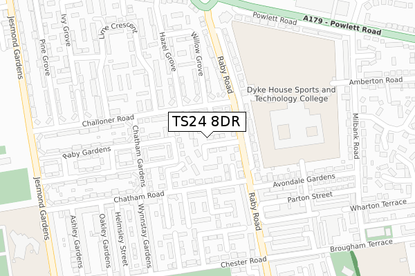
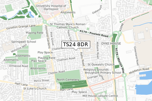
TS24 8DR is located in the Throston electoral ward, within the unitary authority of Hartlepool and the English Parliamentary constituency of Hartlepool. The Sub Integrated Care Board (ICB) Location is NHS North East and North Cumbria ICB - 16C and the police force is Cleveland. This postcode has been in use since August 2018.


GetTheData
Source: OS Open Zoomstack (Ordnance Survey)
Licence: Open Government Licence (requires attribution)
Attribution: Contains OS data © Crown copyright and database right 2024
Source: Open Postcode Geo
Licence: Open Government Licence (requires attribution)
Attribution: Contains OS data © Crown copyright and database right 2024; Contains Royal Mail data © Royal Mail copyright and database right 2024; Source: Office for National Statistics licensed under the Open Government Licence v.3.0
| Easting | 450279 |
| Northing | 533718 |
| Latitude | 54.696005 |
| Longitude | -1.221440 |
GetTheData
Source: Open Postcode Geo
Licence: Open Government Licence
| Country | England |
| Postcode District | TS24 |
| ➜ TS24 open data dashboard ➜ See where TS24 is on a map ➜ Where is Hartlepool? | |
GetTheData
Source: Land Registry Price Paid Data
Licence: Open Government Licence
| Ward | Throston |
| Constituency | Hartlepool |
GetTheData
Source: ONS Postcode Database
Licence: Open Government Licence
| January 2024 | Anti-social behaviour | On or near Willow Grove | 175m |
| January 2024 | Criminal damage and arson | On or near Willow Grove | 175m |
| January 2024 | Other crime | On or near Willow Grove | 175m |
| ➜ Get more crime data in our Crime section | |||
GetTheData
Source: data.police.uk
Licence: Open Government Licence
| Raby Gardens (Raby Road) | Dyke House | 69m |
| Willow Grove (Challoner Road) | Dyke House | 89m |
| Chatham Road End (Chatham Road) | Dyke House | 109m |
| Chatham Road End (Chatham Road) | Dyke House | 139m |
| Raby Gardens (Raby Road) | Dyke House | 149m |
| Hartlepool Station | 1.4km |
| Seaton Carew Station | 4.4km |
GetTheData
Source: NaPTAN
Licence: Open Government Licence
| Percentage of properties with Next Generation Access | 100.0% |
| Percentage of properties with Superfast Broadband | 100.0% |
| Percentage of properties with Ultrafast Broadband | 71.4% |
| Percentage of properties with Full Fibre Broadband | 67.9% |
Superfast Broadband is between 30Mbps and 300Mbps
Ultrafast Broadband is > 300Mbps
| Percentage of properties unable to receive 2Mbps | 0.0% |
| Percentage of properties unable to receive 5Mbps | 0.0% |
| Percentage of properties unable to receive 10Mbps | 0.0% |
| Percentage of properties unable to receive 30Mbps | 0.0% |
GetTheData
Source: Ofcom
Licence: Ofcom Terms of Use (requires attribution)
GetTheData
Source: ONS Postcode Database
Licence: Open Government Licence


➜ Get more ratings from the Food Standards Agency
GetTheData
Source: Food Standards Agency
Licence: FSA terms & conditions
| Last Collection | |||
|---|---|---|---|
| Location | Mon-Fri | Sat | Distance |
| Brougham Terrace | 18:00 | 12:15 | 387m |
| Milton Road | 17:45 | 12:30 | 985m |
| Park Road | 18:00 | 12:30 | 1,032m |
GetTheData
Source: Dracos
Licence: Creative Commons Attribution-ShareAlike
| Facility | Distance |
|---|---|
| Dyke House School (Closed) Mapleton Road, Hartlepool Sports Hall, Swimming Pool, Artificial Grass Pitch, Grass Pitches, Studio, Health and Fitness Gym | 160m |
| Dyke House Sport & Technology College Mapleton Road, Hartlepool Health and Fitness Gym, Swimming Pool, Sports Hall, Studio, Artificial Grass Pitch, Grass Pitches, Outdoor Tennis Courts | 224m |
| Jesmond Gardens Primary School Jesmond Gardens, Hartlepool Grass Pitches | 515m |
GetTheData
Source: Active Places
Licence: Open Government Licence
| School | Phase of Education | Distance |
|---|---|---|
| Dyke House Sports and Technology College Mapleton Road, Hartlepool, TS24 8NQ | Secondary | 233m |
| Jesmond Gardens Primary School Jesmond Gardens, Hartlepool, TS24 8PJ | Primary | 514m |
| Brougham Primary School Brougham Terrace, Hartlepool, TS24 8EY | Primary | 598m |
GetTheData
Source: Edubase
Licence: Open Government Licence
The below table lists the International Territorial Level (ITL) codes (formerly Nomenclature of Territorial Units for Statistics (NUTS) codes) and Local Administrative Units (LAU) codes for TS24 8DR:
| ITL 1 Code | Name |
|---|---|
| TLC | North East (England) |
| ITL 2 Code | Name |
| TLC1 | Tees Valley and Durham |
| ITL 3 Code | Name |
| TLC11 | Hartlepool and Stockton-on-Tees |
| LAU 1 Code | Name |
| E06000001 | Hartlepool |
GetTheData
Source: ONS Postcode Directory
Licence: Open Government Licence
The below table lists the Census Output Area (OA), Lower Layer Super Output Area (LSOA), and Middle Layer Super Output Area (MSOA) for TS24 8DR:
| Code | Name | |
|---|---|---|
| OA | E00060295 | |
| LSOA | E01033466 | Hartlepool 003I |
| MSOA | E02002485 | Hartlepool 003 |
GetTheData
Source: ONS Postcode Directory
Licence: Open Government Licence
| TS24 8HY | Challoner Road | 70m |
| TS24 8HH | Raby Square | 98m |
| TS24 8HG | Raby Road | 101m |
| TS24 8LB | Raby Road | 109m |
| TS24 8FE | Chatham Road | 134m |
| TS24 8HJ | Chatham Gardens | 157m |
| TS24 8FJ | Wattie Moore Grove | 171m |
| TS24 8JP | Lime Crescent | 173m |
| TS24 8QG | Chatham Road | 184m |
| TS24 8HT | Chatham Gardens | 187m |
GetTheData
Source: Open Postcode Geo; Land Registry Price Paid Data
Licence: Open Government Licence