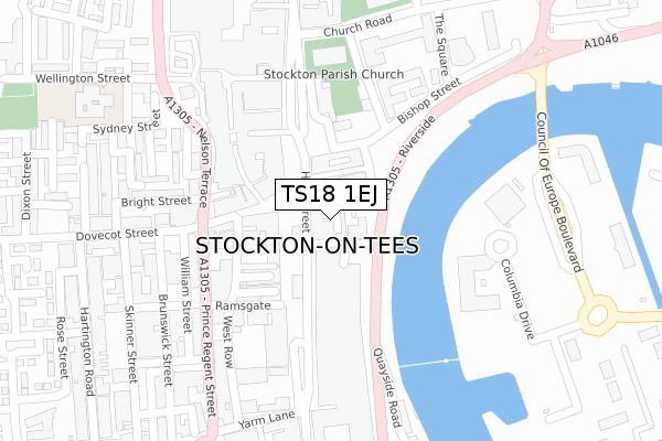
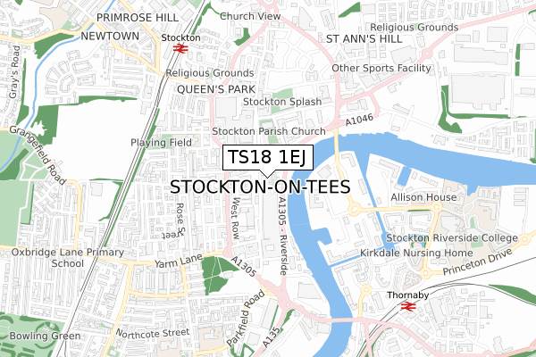
TS18 1EJ is located in the Stockton Town Centre electoral ward, within the unitary authority of Stockton-on-Tees and the English Parliamentary constituency of Stockton North. The Sub Integrated Care Board (ICB) Location is NHS North East and North Cumbria ICB - 16C and the police force is Cleveland. This postcode has been in use since March 2019.


GetTheData
Source: OS Open Zoomstack (Ordnance Survey)
Licence: Open Government Licence (requires attribution)
Attribution: Contains OS data © Crown copyright and database right 2024
Source: Open Postcode Geo
Licence: Open Government Licence (requires attribution)
Attribution: Contains OS data © Crown copyright and database right 2024; Contains Royal Mail data © Royal Mail copyright and database right 2024; Source: Office for National Statistics licensed under the Open Government Licence v.3.0
| Easting | 444578 |
| Northing | 519003 |
| Latitude | 54.564312 |
| Longitude | -1.312118 |
GetTheData
Source: Open Postcode Geo
Licence: Open Government Licence
| Country | England |
| Postcode District | TS18 |
| ➜ TS18 open data dashboard ➜ See where TS18 is on a map ➜ Where is Stockton-on-Tees? | |
GetTheData
Source: Land Registry Price Paid Data
Licence: Open Government Licence
| Ward | Stockton Town Centre |
| Constituency | Stockton North |
GetTheData
Source: ONS Postcode Database
Licence: Open Government Licence
| January 2024 | Other theft | On or near Castlegate Shopping Centre | 148m |
| January 2024 | Anti-social behaviour | On or near Parking Area | 179m |
| January 2024 | Anti-social behaviour | On or near Parking Area | 179m |
| ➜ Get more crime data in our Crime section | |||
GetTheData
Source: data.police.uk
Licence: Open Government Licence
| High Street Stand F (High Street) | Stockton | 102m |
| Driver Changeover Only Stand X (High Street) | Stockton | 107m |
| High Street Stand G (High Street) | Stockton | 128m |
| High Street Stand E (High Street) | Stockton | 149m |
| High Street Stand H (High Street) | Stockton | 154m |
| Stockton Station | 0.7km |
| Thornaby Station | 0.9km |
| Eaglescliffe Station | 4.6km |
GetTheData
Source: NaPTAN
Licence: Open Government Licence
| Percentage of properties with Next Generation Access | 0.0% |
| Percentage of properties with Superfast Broadband | 0.0% |
| Percentage of properties with Ultrafast Broadband | 0.0% |
| Percentage of properties with Full Fibre Broadband | 0.0% |
Superfast Broadband is between 30Mbps and 300Mbps
Ultrafast Broadband is > 300Mbps
| Percentage of properties unable to receive 2Mbps | 0.0% |
| Percentage of properties unable to receive 5Mbps | 0.0% |
| Percentage of properties unable to receive 10Mbps | 0.0% |
| Percentage of properties unable to receive 30Mbps | 100.0% |
GetTheData
Source: Ofcom
Licence: Ofcom Terms of Use (requires attribution)
GetTheData
Source: ONS Postcode Database
Licence: Open Government Licence


➜ Get more ratings from the Food Standards Agency
GetTheData
Source: Food Standards Agency
Licence: FSA terms & conditions
| Last Collection | |||
|---|---|---|---|
| Location | Mon-Fri | Sat | Distance |
| St Cuthberts Road | 17:30 | 11:30 | 99m |
| Yarm Lane | 18:30 | 11:45 | 223m |
| Post Office, High Street | 18:30 | 13:15 | 260m |
GetTheData
Source: Dracos
Licence: Creative Commons Attribution-ShareAlike
| Facility | Distance |
|---|---|
| Swallow Leisure (Stockton) (Closed) John Walker Square, Stockton-on-tees Health and Fitness Gym, Swimming Pool | 308m |
| Elle - All Gym - No Him (Closed) Riverside, Stockton-on-tees Studio, Health and Fitness Gym | 314m |
| Energie Fitness (Stockton) (Closed) Wellington Street, Wellington Street, Stockton-on-tees Health and Fitness Gym | 321m |
GetTheData
Source: Active Places
Licence: Open Government Licence
| School | Phase of Education | Distance |
|---|---|---|
| Mill Lane Primary School Wellington Street, Stockton-on-Tees, TS18 1QX | Primary | 407m |
| St Cuthbert's Catholic Primary School, Stockton Parkfield Road, Stockton-on-Tees, TS18 3SY | Primary | 782m |
| Bowesfield Primary School Northcote Street, Stockton-on-Tees, TS18 3JB | Primary | 890m |
GetTheData
Source: Edubase
Licence: Open Government Licence
The below table lists the International Territorial Level (ITL) codes (formerly Nomenclature of Territorial Units for Statistics (NUTS) codes) and Local Administrative Units (LAU) codes for TS18 1EJ:
| ITL 1 Code | Name |
|---|---|
| TLC | North East (England) |
| ITL 2 Code | Name |
| TLC1 | Tees Valley and Durham |
| ITL 3 Code | Name |
| TLC11 | Hartlepool and Stockton-on-Tees |
| LAU 1 Code | Name |
| E06000004 | Stockton-on-Tees |
GetTheData
Source: ONS Postcode Directory
Licence: Open Government Licence
The below table lists the Census Output Area (OA), Lower Layer Super Output Area (LSOA), and Middle Layer Super Output Area (MSOA) for TS18 1EJ:
| Code | Name | |
|---|---|---|
| OA | E00061864 | |
| LSOA | E01012267 | Stockton-on-Tees 014F |
| MSOA | E02002548 | Stockton-on-Tees 014 |
GetTheData
Source: ONS Postcode Directory
Licence: Open Government Licence
| TS18 1SB | High Street | 22m |
| TS18 1AR | Finkle Street | 28m |
| TS18 1AS | Finkle Street | 45m |
| TS18 1SX | Silver Street | 82m |
| TS18 1AY | High Street | 108m |
| TS18 1LP | High Street | 115m |
| TS18 1BB | High Street | 135m |
| TS18 1LN | Dovecot Street | 145m |
| TS18 1LH | Dovecot Street | 149m |
| TS18 1BS | Ramsgate | 181m |
GetTheData
Source: Open Postcode Geo; Land Registry Price Paid Data
Licence: Open Government Licence