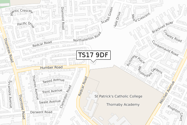
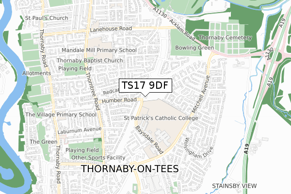
TS17 9DF is located in the Mandale & Victoria electoral ward, within the unitary authority of Stockton-on-Tees and the English Parliamentary constituency of Stockton South. The Sub Integrated Care Board (ICB) Location is NHS North East and North Cumbria ICB - 16C and the police force is Cleveland. This postcode has been in use since April 2018.


GetTheData
Source: OS Open Zoomstack (Ordnance Survey)
Licence: Open Government Licence (requires attribution)
Attribution: Contains OS data © Crown copyright and database right 2024
Source: Open Postcode Geo
Licence: Open Government Licence (requires attribution)
Attribution: Contains OS data © Crown copyright and database right 2024; Contains Royal Mail data © Royal Mail copyright and database right 2024; Source: Office for National Statistics licensed under the Open Government Licence v.3.0
| Easting | 445907 |
| Northing | 516936 |
| Latitude | 54.545620 |
| Longitude | -1.291889 |
GetTheData
Source: Open Postcode Geo
Licence: Open Government Licence
| Country | England |
| Postcode District | TS17 |
| ➜ TS17 open data dashboard ➜ See where TS17 is on a map ➜ Where is Thornaby-on-Tees? | |
GetTheData
Source: Land Registry Price Paid Data
Licence: Open Government Licence
| Ward | Mandale & Victoria |
| Constituency | Stockton South |
GetTheData
Source: ONS Postcode Database
Licence: Open Government Licence
| January 2024 | Violence and sexual offences | On or near Richmond Place | 238m |
| January 2024 | Violence and sexual offences | On or near Redcar Road | 381m |
| January 2024 | Anti-social behaviour | On or near Thorntree Road | 429m |
| ➜ Get more crime data in our Crime section | |||
GetTheData
Source: data.police.uk
Licence: Open Government Licence
| Clarendon Road (Humber Road) | Thornaby | 93m |
| Clarendon Road (Humber Road) | Thornaby | 109m |
| St Patrick's Rc School (Baysdale Road) | Thornaby | 310m |
| St Patrick's Rc School (Turning Circle) | Thornaby | 318m |
| Saltburn Road (Diamond Road) | Thornaby | 364m |
| Thornaby Station | 1.6km |
| Stockton Station | 3.2km |
| Eaglescliffe Station | 4.1km |
GetTheData
Source: NaPTAN
Licence: Open Government Licence
GetTheData
Source: ONS Postcode Database
Licence: Open Government Licence


➜ Get more ratings from the Food Standards Agency
GetTheData
Source: Food Standards Agency
Licence: FSA terms & conditions
| Last Collection | |||
|---|---|---|---|
| Location | Mon-Fri | Sat | Distance |
| Mitchell Avenue, Thornaby | 17:30 | 12:00 | 431m |
| Thornaby Post Office | 17:15 | 12:00 | 601m |
| Thorntree Road | 17:30 | 11:15 | 744m |
GetTheData
Source: Dracos
Licence: Creative Commons Attribution-ShareAlike
| Facility | Distance |
|---|---|
| St Patricks Catholic College Baysdale Road, Thornaby, Stockton-on-tees Grass Pitches, Sports Hall | 240m |
| Thornaby Academy Baysdale Road, Thornaby, Stockton-on-tees Sports Hall, Grass Pitches, Studio, Artificial Grass Pitch | 387m |
| Thornaby C Of E Primary School Baysdale Road, Thornaby, Stockton-on-tees Grass Pitches | 453m |
GetTheData
Source: Active Places
Licence: Open Government Licence
| School | Phase of Education | Distance |
|---|---|---|
| St Patrick's Catholic College, A Voluntary Catholic Academy Baysdale Road, Thornaby, Stockton-on-Tees, TS17 9DE | Secondary | 240m |
| Thornaby Academy Baysdale Road, Thornaby, Stockton-on-Tees, TS17 9DB | Secondary | 374m |
| Thornaby Church of England Primary School Baysdale Road, Thornaby, Stockton-on-Tees, TS17 9DB | Primary | 453m |
GetTheData
Source: Edubase
Licence: Open Government Licence
The below table lists the International Territorial Level (ITL) codes (formerly Nomenclature of Territorial Units for Statistics (NUTS) codes) and Local Administrative Units (LAU) codes for TS17 9DF:
| ITL 1 Code | Name |
|---|---|
| TLC | North East (England) |
| ITL 2 Code | Name |
| TLC1 | Tees Valley and Durham |
| ITL 3 Code | Name |
| TLC11 | Hartlepool and Stockton-on-Tees |
| LAU 1 Code | Name |
| E06000004 | Stockton-on-Tees |
GetTheData
Source: ONS Postcode Directory
Licence: Open Government Licence
The below table lists the Census Output Area (OA), Lower Layer Super Output Area (LSOA), and Middle Layer Super Output Area (MSOA) for TS17 9DF:
| Code | Name | |
|---|---|---|
| OA | E00061720 | |
| LSOA | E01012239 | Stockton-on-Tees 018B |
| MSOA | E02002552 | Stockton-on-Tees 018 |
GetTheData
Source: ONS Postcode Directory
Licence: Open Government Licence
| TS17 8JG | Humber Road | 81m |
| TS17 8JF | Humber Road | 84m |
| TS17 8JQ | Clarendon Road | 127m |
| TS17 8ER | Northallerton Road | 146m |
| TS17 8JE | Avon Close | 149m |
| TS17 8LR | Redcar Road | 168m |
| TS17 8FT | Blencathra Close | 184m |
| TS17 8JD | Humber Road | 194m |
| TS17 8JB | Humber Road | 208m |
| TS17 9EJ | Richmond Place | 216m |
GetTheData
Source: Open Postcode Geo; Land Registry Price Paid Data
Licence: Open Government Licence