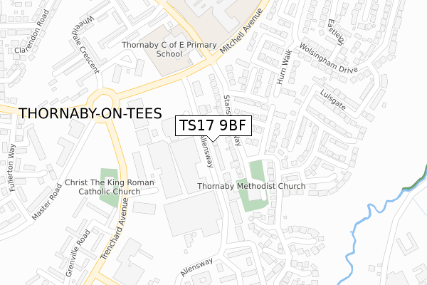
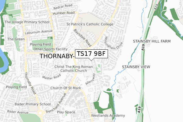
TS17 9BF is located in the Stainsby Hill electoral ward, within the unitary authority of Stockton-on-Tees and the English Parliamentary constituency of Stockton South. The Sub Integrated Care Board (ICB) Location is NHS North East and North Cumbria ICB - 16C and the police force is Cleveland. This postcode has been in use since January 2020.


GetTheData
Source: OS Open Zoomstack (Ordnance Survey)
Licence: Open Government Licence (requires attribution)
Attribution: Contains OS data © Crown copyright and database right 2024
Source: Open Postcode Geo
Licence: Open Government Licence (requires attribution)
Attribution: Contains OS data © Crown copyright and database right 2024; Contains Royal Mail data © Royal Mail copyright and database right 2024; Source: Office for National Statistics licensed under the Open Government Licence v.3.0
| Easting | 446062 |
| Northing | 516252 |
| Latitude | 54.539459 |
| Longitude | -1.289600 |
GetTheData
Source: Open Postcode Geo
Licence: Open Government Licence
| Country | England |
| Postcode District | TS17 |
| ➜ TS17 open data dashboard ➜ See where TS17 is on a map ➜ Where is Thornaby-on-Tees? | |
GetTheData
Source: Land Registry Price Paid Data
Licence: Open Government Licence
| Ward | Stainsby Hill |
| Constituency | Stockton South |
GetTheData
Source: ONS Postcode Database
Licence: Open Government Licence
| January 2024 | Violence and sexual offences | On or near Thornaby Shopping Centre | 102m |
| January 2024 | Criminal damage and arson | On or near Thornaby Shopping Centre | 102m |
| December 2023 | Burglary | On or near Thornaby Shopping Centre | 102m |
| ➜ Get more crime data in our Crime section | |||
GetTheData
Source: data.police.uk
Licence: Open Government Licence
| Anson House (Mitchell Avenue) | Thornaby | 204m |
| Golden Eagle (Trenchard Avenue) | Thornaby | 207m |
| Anson House (Mitchell Avenue) | Thornaby | 212m |
| Baysdale Road | Thornaby | 249m |
| Golden Eagle (Trenchard Avenue) | Thornaby | 272m |
| Thornaby Station | 2.3km |
| Stockton Station | 3.8km |
| Eaglescliffe Station | 4km |
GetTheData
Source: NaPTAN
Licence: Open Government Licence
GetTheData
Source: ONS Postcode Database
Licence: Open Government Licence


➜ Get more ratings from the Food Standards Agency
GetTheData
Source: Food Standards Agency
Licence: FSA terms & conditions
| Last Collection | |||
|---|---|---|---|
| Location | Mon-Fri | Sat | Distance |
| Thorntree Road | 17:30 | 11:15 | 626m |
| Mitchell Avenue, Thornaby | 17:30 | 12:00 | 759m |
| Thornaby Post Office | 17:15 | 12:00 | 1,124m |
GetTheData
Source: Dracos
Licence: Creative Commons Attribution-ShareAlike
| Facility | Distance |
|---|---|
| Thornaby Pavilion Thornaby, Stockton-on-tees Sports Hall, Health and Fitness Gym, Squash Courts, Indoor Bowls | 141m |
| Thornaby C Of E Primary School Baysdale Road, Thornaby, Stockton-on-tees Grass Pitches | 251m |
| Thornaby Academy Baysdale Road, Thornaby, Stockton-on-tees Sports Hall, Grass Pitches, Studio, Artificial Grass Pitch | 328m |
GetTheData
Source: Active Places
Licence: Open Government Licence
| School | Phase of Education | Distance |
|---|---|---|
| Thornaby Church of England Primary School Baysdale Road, Thornaby, Stockton-on-Tees, TS17 9DB | Primary | 251m |
| Thornaby Academy Baysdale Road, Thornaby, Stockton-on-Tees, TS17 9DB | Secondary | 338m |
| St Patrick's Catholic College, A Voluntary Catholic Academy Baysdale Road, Thornaby, Stockton-on-Tees, TS17 9DE | Secondary | 471m |
GetTheData
Source: Edubase
Licence: Open Government Licence
The below table lists the International Territorial Level (ITL) codes (formerly Nomenclature of Territorial Units for Statistics (NUTS) codes) and Local Administrative Units (LAU) codes for TS17 9BF:
| ITL 1 Code | Name |
|---|---|
| TLC | North East (England) |
| ITL 2 Code | Name |
| TLC1 | Tees Valley and Durham |
| ITL 3 Code | Name |
| TLC11 | Hartlepool and Stockton-on-Tees |
| LAU 1 Code | Name |
| E06000004 | Stockton-on-Tees |
GetTheData
Source: ONS Postcode Directory
Licence: Open Government Licence
The below table lists the Census Output Area (OA), Lower Layer Super Output Area (LSOA), and Middle Layer Super Output Area (MSOA) for TS17 9BF:
| Code | Name | |
|---|---|---|
| OA | E00061941 | |
| LSOA | E01012284 | Stockton-on-Tees 020C |
| MSOA | E02002554 | Stockton-on-Tees 020 |
GetTheData
Source: ONS Postcode Directory
Licence: Open Government Licence
| TS17 9HA | Allensway | 3m |
| TS17 9PR | Stanstead Mews | 38m |
| TS17 9EA | Stanstead Way | 61m |
| TS17 9EB | Lydd Gardens | 86m |
| TS17 9DZ | Stanstead Way | 108m |
| TS17 9ED | Yeadon Grove | 116m |
| TS17 9JR | Allensway | 120m |
| TS17 9EE | Yeadon Grove | 150m |
| TS17 9DY | Stanstead Way | 152m |
| TS17 9DX | Brough Close | 161m |
GetTheData
Source: Open Postcode Geo; Land Registry Price Paid Data
Licence: Open Government Licence