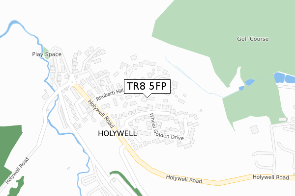
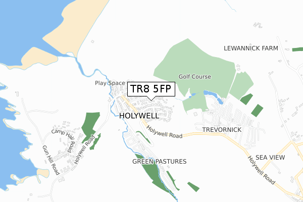
TR8 5FP is located in the St Newlyn East, Cubert & Goonhavern electoral ward, within the unitary authority of Cornwall and the English Parliamentary constituency of Truro and Falmouth. The Sub Integrated Care Board (ICB) Location is NHS Cornwall and the Isles of Scilly ICB - 11N and the police force is Devon & Cornwall. This postcode has been in use since August 2018.


GetTheData
Source: OS Open Zoomstack (Ordnance Survey)
Licence: Open Government Licence (requires attribution)
Attribution: Contains OS data © Crown copyright and database right 2024
Source: Open Postcode Geo
Licence: Open Government Licence (requires attribution)
Attribution: Contains OS data © Crown copyright and database right 2024; Contains Royal Mail data © Royal Mail copyright and database right 2024; Source: Office for National Statistics licensed under the Open Government Licence v.3.0
| Easting | 177032 |
| Northing | 58850 |
| Latitude | 50.387151 |
| Longitude | -5.138022 |
GetTheData
Source: Open Postcode Geo
Licence: Open Government Licence
| Country | England |
| Postcode District | TR8 |
| ➜ TR8 open data dashboard ➜ See where TR8 is on a map ➜ Where is Holywell? | |
GetTheData
Source: Land Registry Price Paid Data
Licence: Open Government Licence
| Ward | St Newlyn East, Cubert & Goonhavern |
| Constituency | Truro And Falmouth |
GetTheData
Source: ONS Postcode Database
Licence: Open Government Licence
2022 12 OCT £785,000 |
2020 22 JAN £499,500 |
3, THE ROCKS, RHUBARB HILL, HOLYWELL BAY, NEWQUAY, TR8 5FP 2018 2 NOV £627,500 |
1, THE ROCKS, RHUBARB HILL, HOLYWELL BAY, NEWQUAY, TR8 5FP 2018 1 NOV £640,000 |
4, THE ROCKS, RHUBARB HILL, HOLYWELL BAY, NEWQUAY, TR8 5FP 2018 30 OCT £615,000 |
2, THE ROCKS, RHUBARB HILL, HOLYWELL BAY, NEWQUAY, TR8 5FP 2018 3 AUG £635,000 |
GetTheData
Source: HM Land Registry Price Paid Data
Licence: Contains HM Land Registry data © Crown copyright and database right 2024. This data is licensed under the Open Government Licence v3.0.
| June 2022 | Violence and sexual offences | On or near Wheal Golden Drive | 97m |
| June 2022 | Other theft | On or near Parking Area | 340m |
| May 2022 | Burglary | On or near Wheal Golden Drive | 97m |
| ➜ Get more crime data in our Crime section | |||
GetTheData
Source: data.police.uk
Licence: Open Government Licence
| Treguth Inn (Holywell Road) | Holywell Bay | 174m |
| Treguth Inn (Holywell Road) | Holywell Bay | 181m |
| St Pirans Inn (Holywell Road) | Holywell Bay | 320m |
| Car Prk (Holywell Road) | Holywell Bay | 357m |
| Holywell Bay Holiday Park (Holywell Road) | Holywell Bay | 482m |
| Newquay Station | 5.4km |
GetTheData
Source: NaPTAN
Licence: Open Government Licence
➜ Broadband speed and availability dashboard for TR8 5FP
| Percentage of properties with Next Generation Access | 100.0% |
| Percentage of properties with Superfast Broadband | 100.0% |
| Percentage of properties with Ultrafast Broadband | 0.0% |
| Percentage of properties with Full Fibre Broadband | 0.0% |
Superfast Broadband is between 30Mbps and 300Mbps
Ultrafast Broadband is > 300Mbps
| Median download speed | 40.0Mbps |
| Average download speed | 47.1Mbps |
| Maximum download speed | 78.05Mbps |
| Median upload speed | 10.0Mbps |
| Average upload speed | 11.9Mbps |
| Maximum upload speed | 19.90Mbps |
| Percentage of properties unable to receive 2Mbps | 0.0% |
| Percentage of properties unable to receive 5Mbps | 0.0% |
| Percentage of properties unable to receive 10Mbps | 0.0% |
| Percentage of properties unable to receive 30Mbps | 0.0% |
➜ Broadband speed and availability dashboard for TR8 5FP
GetTheData
Source: Ofcom
Licence: Ofcom Terms of Use (requires attribution)
GetTheData
Source: ONS Postcode Database
Licence: Open Government Licence


➜ Get more ratings from the Food Standards Agency
GetTheData
Source: Food Standards Agency
Licence: FSA terms & conditions
| Last Collection | |||
|---|---|---|---|
| Location | Mon-Fri | Sat | Distance |
| Holywell Bay | 16:00 | 08:30 | 178m |
| Ellenglaze | 09:30 | 09:30 | 1,230m |
| Cubert Post Office | 16:00 | 11:00 | 1,741m |
GetTheData
Source: Dracos
Licence: Creative Commons Attribution-ShareAlike
| Facility | Distance |
|---|---|
| Cubert Primary School Chynowen Lane, Cubert, Newquay Grass Pitches | 1.8km |
| Crantock Bay Hotel (Closed) West Pentire, Crantock, Newquay Health and Fitness Gym, Swimming Pool, Outdoor Tennis Courts | 1.9km |
| Perran Sands Holiday Park Road From Haven Leisure To B3285 At Tollgate Farm, Perransands Holiday Park, Perranporth Swimming Pool | 3.2km |
GetTheData
Source: Active Places
Licence: Open Government Licence
| School | Phase of Education | Distance |
|---|---|---|
| Cubert School Chynowen Lane, Cubert, Newquay, TR8 5HE | Primary | 1.8km |
| Trenance Learning Academy Trenance Road, Newquay, TR7 2LU | Primary | 4.9km |
| Goonhavern Primary School Newquay Road, Goonhavern, Truro, TR4 9QD | Primary | 5.3km |
GetTheData
Source: Edubase
Licence: Open Government Licence
The below table lists the International Territorial Level (ITL) codes (formerly Nomenclature of Territorial Units for Statistics (NUTS) codes) and Local Administrative Units (LAU) codes for TR8 5FP:
| ITL 1 Code | Name |
|---|---|
| TLK | South West (England) |
| ITL 2 Code | Name |
| TLK3 | Cornwall and Isles of Scilly |
| ITL 3 Code | Name |
| TLK30 | Cornwall and Isles of Scilly |
| LAU 1 Code | Name |
| E06000052 | Cornwall |
GetTheData
Source: ONS Postcode Directory
Licence: Open Government Licence
The below table lists the Census Output Area (OA), Lower Layer Super Output Area (LSOA), and Middle Layer Super Output Area (MSOA) for TR8 5FP:
| Code | Name | |
|---|---|---|
| OA | E00095069 | |
| LSOA | E01018832 | Cornwall 032C |
| MSOA | E02003905 | Cornwall 032 |
GetTheData
Source: ONS Postcode Directory
Licence: Open Government Licence
| TR8 5PB | Bay View Close | 53m |
| TR8 5PT | 72m | |
| TR8 5PE | Wheal Golden Drive | 106m |
| TR8 5PP | 154m | |
| TR8 5PQ | 232m | |
| TR8 5DD | Treguth Close | 259m |
| TR8 5HG | Seaview | 1085m |
| TR8 5HL | Lewannick Road | 1106m |
| TR8 5HW | Commons Road | 1172m |
| TR8 5HQ | 1328m |
GetTheData
Source: Open Postcode Geo; Land Registry Price Paid Data
Licence: Open Government Licence