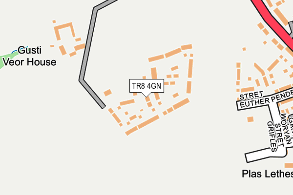
TR8 4GN is located in the Newquay Porth & Tretherras electoral ward, within the unitary authority of Cornwall and the English Parliamentary constituency of St Austell and Newquay. The Sub Integrated Care Board (ICB) Location is NHS Cornwall and the Isles of Scilly ICB - 11N and the police force is Devon & Cornwall. This postcode has been in use since April 2017.


GetTheData
Source: OS OpenMap – Local (Ordnance Survey)
Source: OS VectorMap District (Ordnance Survey)
Licence: Open Government Licence (requires attribution)
| Easting | 183891 |
| Northing | 61376 |
| Latitude | 50.412397 |
| Longitude | -5.043132 |
GetTheData
Source: Open Postcode Geo
Licence: Open Government Licence
| Country | England |
| Postcode District | TR8 |
| ➜ TR8 open data dashboard ➜ See where TR8 is on a map ➜ Where is Newquay? | |
GetTheData
Source: Land Registry Price Paid Data
Licence: Open Government Licence
| Ward | Newquay Porth & Tretherras |
| Constituency | St Austell And Newquay |
GetTheData
Source: ONS Postcode Database
Licence: Open Government Licence
38, STRET GORYAN, NANSLEDAN, NEWQUAY, TR8 4GN 2021 20 DEC £339,950 |
2021 11 JUN £355,000 |
17, STRET GORYAN, NANSLEDAN, NEWQUAY, TR8 4GN 2020 21 AUG £256,950 |
8, STRET GORYAN, NANSLEDAN, NEWQUAY, TR8 4GN 2018 22 JUN £322,500 |
6, STRET GORYAN, NANSLEDAN, NEWQUAY, TR8 4GN 2018 12 JUN £320,000 |
2017 20 APR £295,000 |
GetTheData
Source: HM Land Registry Price Paid Data
Licence: Contains HM Land Registry data © Crown copyright and database right 2024. This data is licensed under the Open Government Licence v3.0.
| June 2022 | Violence and sexual offences | On or near Quintrell Road | 326m |
| June 2022 | Violence and sexual offences | On or near Quintrell Road | 326m |
| June 2022 | Criminal damage and arson | On or near Quintrell Road | 326m |
| ➜ Get more crime data in our Crime section | |||
GetTheData
Source: data.police.uk
Licence: Open Government Licence
| Quintrell Road | St Columb Minor | 322m |
| Quintrell Road | St Columb Minor | 337m |
| Railton Road (Quintrell Road) | St Columb Minor | 447m |
| Shop Corner (Henver Road) | St Columb Minor | 525m |
| Shop Corner (Henver Road) | St Columb Minor | 551m |
| Quintrell Downs Station | 1.4km |
| Newquay Station | 2.3km |
GetTheData
Source: NaPTAN
Licence: Open Government Licence
| Percentage of properties with Next Generation Access | 100.0% |
| Percentage of properties with Superfast Broadband | 100.0% |
| Percentage of properties with Ultrafast Broadband | 100.0% |
| Percentage of properties with Full Fibre Broadband | 100.0% |
Superfast Broadband is between 30Mbps and 300Mbps
Ultrafast Broadband is > 300Mbps
| Percentage of properties unable to receive 2Mbps | 0.0% |
| Percentage of properties unable to receive 5Mbps | 0.0% |
| Percentage of properties unable to receive 10Mbps | 0.0% |
| Percentage of properties unable to receive 30Mbps | 0.0% |
GetTheData
Source: Ofcom
Licence: Ofcom Terms of Use (requires attribution)
GetTheData
Source: ONS Postcode Database
Licence: Open Government Licence


➜ Get more ratings from the Food Standards Agency
GetTheData
Source: Food Standards Agency
Licence: FSA terms & conditions
| Last Collection | |||
|---|---|---|---|
| Location | Mon-Fri | Sat | Distance |
| St Columb Minor Post Office | 17:05 | 11:00 | 589m |
| Church Street | 17:00 | 11:00 | 804m |
| Trencreek | 12:00 | 11:00 | 1,088m |
GetTheData
Source: Dracos
Licence: Creative Commons Attribution-ShareAlike
| Facility | Distance |
|---|---|
| St Columb Minor Recreation Ground Church Street, St Columb Minor, Newquay Grass Pitches | 764m |
| St Columb Minor Academy Porth Bean Road, Newquay Grass Pitches | 789m |
| Treviglas Academy Bradley Road, Newquay Indoor Tennis Centre, Grass Pitches, Sports Hall | 912m |
GetTheData
Source: Active Places
Licence: Open Government Licence
| School | Phase of Education | Distance |
|---|---|---|
| St Columb Minor Academy Porth Bean Road, St Columb Minor, Newquay, TR7 3JF | Primary | 788m |
| Treviglas Academy Bradley Road, Newquay, TR7 3JA | Secondary | 919m |
| Nansledan School William Hosking Road, Newquay, TR8 4FX | Primary | 972m |
GetTheData
Source: Edubase
Licence: Open Government Licence
The below table lists the International Territorial Level (ITL) codes (formerly Nomenclature of Territorial Units for Statistics (NUTS) codes) and Local Administrative Units (LAU) codes for TR8 4GN:
| ITL 1 Code | Name |
|---|---|
| TLK | South West (England) |
| ITL 2 Code | Name |
| TLK3 | Cornwall and Isles of Scilly |
| ITL 3 Code | Name |
| TLK30 | Cornwall and Isles of Scilly |
| LAU 1 Code | Name |
| E06000052 | Cornwall |
GetTheData
Source: ONS Postcode Directory
Licence: Open Government Licence
The below table lists the Census Output Area (OA), Lower Layer Super Output Area (LSOA), and Middle Layer Super Output Area (MSOA) for TR8 4GN:
| Code | Name | |
|---|---|---|
| OA | E00096272 | |
| LSOA | E01019049 | Cornwall 018B |
| MSOA | E02003952 | Cornwall 018 |
GetTheData
Source: ONS Postcode Directory
Licence: Open Government Licence
| TR8 4GU | Trevenson Road | 180m |
| TR8 4JU | 279m | |
| TR8 4FG | Stret Lugan | 281m |
| TR8 4FQ | Garth Iger | 294m |
| TR7 3DY | Quintrell Road | 339m |
| TR8 4FX | William Hosking Road | 373m |
| TR7 3EN | School Close | 417m |
| TR7 3BE | Quintrell Court | 437m |
| TR7 3DZ | Quintrell Road | 448m |
| TR7 3DX | Quintrell Road | 497m |
GetTheData
Source: Open Postcode Geo; Land Registry Price Paid Data
Licence: Open Government Licence