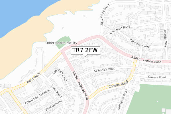
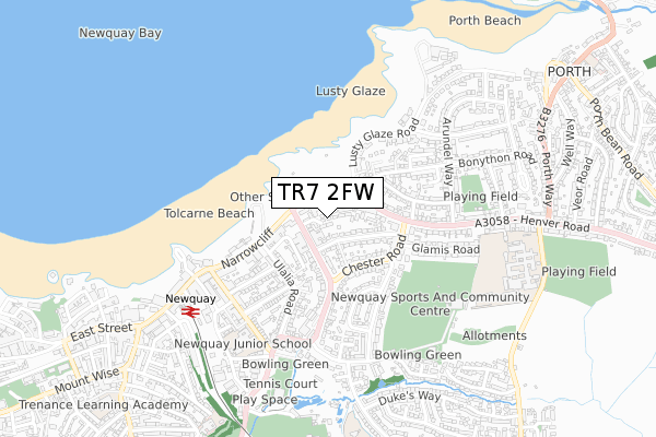
TR7 2FW is located in the Newquay Porth & Tretherras electoral ward, within the unitary authority of Cornwall and the English Parliamentary constituency of St Austell and Newquay. The Sub Integrated Care Board (ICB) Location is NHS Cornwall and the Isles of Scilly ICB - 11N and the police force is Devon & Cornwall. This postcode has been in use since May 2018.


GetTheData
Source: OS Open Zoomstack (Ordnance Survey)
Licence: Open Government Licence (requires attribution)
Attribution: Contains OS data © Crown copyright and database right 2024
Source: Open Postcode Geo
Licence: Open Government Licence (requires attribution)
Attribution: Contains OS data © Crown copyright and database right 2024; Contains Royal Mail data © Royal Mail copyright and database right 2024; Source: Office for National Statistics licensed under the Open Government Licence v.3.0
| Easting | 182131 |
| Northing | 62092 |
| Latitude | 50.418177 |
| Longitude | -5.068282 |
GetTheData
Source: Open Postcode Geo
Licence: Open Government Licence
| Country | England |
| Postcode District | TR7 |
| ➜ TR7 open data dashboard ➜ See where TR7 is on a map ➜ Where is Newquay? | |
GetTheData
Source: Land Registry Price Paid Data
Licence: Open Government Licence
| Ward | Newquay Porth & Tretherras |
| Constituency | St Austell And Newquay |
GetTheData
Source: ONS Postcode Database
Licence: Open Government Licence
| June 2022 | Anti-social behaviour | On or near Barrowfield View | 74m |
| June 2022 | Anti-social behaviour | On or near Colvreath Road | 175m |
| June 2022 | Violence and sexual offences | On or near Colvreath Road | 175m |
| ➜ Get more crime data in our Crime section | |||
GetTheData
Source: data.police.uk
Licence: Open Government Licence
| Kilbirnie Hotel (Narrowcliff) | Newquay | 99m |
| Barrowfield Hotel | Newquay | 105m |
| Kilbirnie Hotel (Narrowcliff) | Newquay | 109m |
| Barrowfield Hotel (Hilgrove Road) | Newquay | 116m |
| Whitegate Shopping Centre (Henver Road) | Newquay | 220m |
| Newquay Station | 0.6km |
| Quintrell Downs Station | 3.2km |
GetTheData
Source: NaPTAN
Licence: Open Government Licence
➜ Broadband speed and availability dashboard for TR7 2FW
| Percentage of properties with Next Generation Access | 75.0% |
| Percentage of properties with Superfast Broadband | 75.0% |
| Percentage of properties with Ultrafast Broadband | 0.0% |
| Percentage of properties with Full Fibre Broadband | 0.0% |
Superfast Broadband is between 30Mbps and 300Mbps
Ultrafast Broadband is > 300Mbps
| Median download speed | 23.5Mbps |
| Average download speed | 42.1Mbps |
| Maximum download speed | 80.00Mbps |
| Median upload speed | 1.2Mbps |
| Average upload speed | 8.1Mbps |
| Maximum upload speed | 20.00Mbps |
| Percentage of properties unable to receive 2Mbps | 0.0% |
| Percentage of properties unable to receive 5Mbps | 0.0% |
| Percentage of properties unable to receive 10Mbps | 0.0% |
| Percentage of properties unable to receive 30Mbps | 25.0% |
➜ Broadband speed and availability dashboard for TR7 2FW
GetTheData
Source: Ofcom
Licence: Ofcom Terms of Use (requires attribution)
GetTheData
Source: ONS Postcode Database
Licence: Open Government Licence


➜ Get more ratings from the Food Standards Agency
GetTheData
Source: Food Standards Agency
Licence: FSA terms & conditions
| Last Collection | |||
|---|---|---|---|
| Location | Mon-Fri | Sat | Distance |
| Hilgrove Road | 17:45 | 11:00 | 216m |
| Ulalia Road | 17:30 | 11:00 | 247m |
| Edgcumbe Avenue | 17:30 | 11:00 | 482m |
GetTheData
Source: Dracos
Licence: Creative Commons Attribution-ShareAlike
| Facility | Distance |
|---|---|
| Newquay Junior Academy Edgcumbe Avenue, Newquay Grass Pitches, Sports Hall | 556m |
| Godolphin Way Pitch Godolphin Way, Henver Road, Newquay Grass Pitches | 585m |
| Koncept Gym Cliff Road, Newquay Health and Fitness Gym, Studio | 588m |
GetTheData
Source: Active Places
Licence: Open Government Licence
| School | Phase of Education | Distance |
|---|---|---|
| Newquay Junior Academy Edgcumbe Avenue, Newquay, TR7 2NL | Primary | 544m |
| Newquay Tretherras Trevenson Road, Newquay, TR7 3BH | Secondary | 765m |
| Newquay Primary Academy Yeoman Way, Tretherras Road, Newquay, TR7 2SL | Primary | 765m |
GetTheData
Source: Edubase
Licence: Open Government Licence
The below table lists the International Territorial Level (ITL) codes (formerly Nomenclature of Territorial Units for Statistics (NUTS) codes) and Local Administrative Units (LAU) codes for TR7 2FW:
| ITL 1 Code | Name |
|---|---|
| TLK | South West (England) |
| ITL 2 Code | Name |
| TLK3 | Cornwall and Isles of Scilly |
| ITL 3 Code | Name |
| TLK30 | Cornwall and Isles of Scilly |
| LAU 1 Code | Name |
| E06000052 | Cornwall |
GetTheData
Source: ONS Postcode Directory
Licence: Open Government Licence
The below table lists the Census Output Area (OA), Lower Layer Super Output Area (LSOA), and Middle Layer Super Output Area (MSOA) for TR7 2FW:
| Code | Name | |
|---|---|---|
| OA | E00096097 | |
| LSOA | E01019019 | Cornwall 021B |
| MSOA | E02003955 | Cornwall 021 |
GetTheData
Source: ONS Postcode Directory
Licence: Open Government Licence
| TR7 2QW | Hilgrove Road | 54m |
| TR7 2PD | Astor Court | 66m |
| TR7 2QH | Barrowfield View | 72m |
| TR7 2QY | Hilgrove Road | 88m |
| TR7 2RZ | Narrowcliff | 99m |
| TR7 2SA | St Annes Road | 145m |
| TR7 3BJ | Henver Road | 147m |
| TR7 2SD | St Annes Lane | 150m |
| TR7 2QZ | Hilgrove Road | 176m |
| TR7 2PY | Colvreath Road | 192m |
GetTheData
Source: Open Postcode Geo; Land Registry Price Paid Data
Licence: Open Government Licence