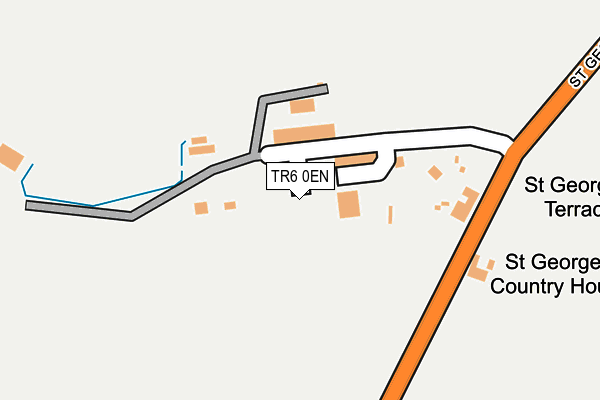
TR6 0EN is located in the Perranporth electoral ward, within the unitary authority of Cornwall and the English Parliamentary constituency of Truro and Falmouth. The Sub Integrated Care Board (ICB) Location is NHS Cornwall and the Isles of Scilly ICB - 11N and the police force is Devon & Cornwall. This postcode has been in use since July 2017.


GetTheData
Source: OS OpenMap – Local (Ordnance Survey)
Source: OS VectorMap District (Ordnance Survey)
Licence: Open Government Licence (requires attribution)
| Easting | 174473 |
| Northing | 53409 |
| Latitude | 50.337318 |
| Longitude | -5.170703 |
GetTheData
Source: Open Postcode Geo
Licence: Open Government Licence
| Country | England |
| Postcode District | TR6 |
| ➜ TR6 open data dashboard ➜ See where TR6 is on a map | |
GetTheData
Source: Land Registry Price Paid Data
Licence: Open Government Licence
| Ward | Perranporth |
| Constituency | Truro And Falmouth |
GetTheData
Source: ONS Postcode Database
Licence: Open Government Licence
| St George's Terrace | Perranporth | 204m |
| St George's Terrace | Perranporth | 205m |
| Tredinnick Way (St George's Hill) | Perranporth | 850m |
| Tredinnick Way (St George's Hill) | Perranporth | 852m |
| Tredinnick Way | Perranporth | 860m |
GetTheData
Source: NaPTAN
Licence: Open Government Licence
GetTheData
Source: ONS Postcode Database
Licence: Open Government Licence


➜ Get more ratings from the Food Standards Agency
GetTheData
Source: Food Standards Agency
Licence: FSA terms & conditions
| Last Collection | |||
|---|---|---|---|
| Location | Mon-Fri | Sat | Distance |
| Quay | 16:15 | 10:30 | 3,102m |
| Goonhavern Post Office | 17:00 | 11:30 | 4,418m |
| Ellenglaze | 09:30 | 09:30 | 5,417m |
GetTheData
Source: Dracos
Licence: Creative Commons Attribution-ShareAlike
| Facility | Distance |
|---|---|
| St George's Hill Field St George's Hill, Perranporth Grass Pitches | 340m |
| Bolenna Park St. George's Hill, Perranporth Grass Pitches | 1.1km |
| Perran Tennis Perrancoombe, Perranporth Outdoor Tennis Courts | 1.1km |
GetTheData
Source: Active Places
Licence: Open Government Licence
| School | Phase of Education | Distance |
|---|---|---|
| Perranporth Community Primary School Liskey Hill, Perranporth, TR6 0EU | Primary | 1.5km |
| Mithian School Buckshead, St Agnes, TR5 0XW | Primary | 2.5km |
| St Agnes Academy Trelawney Road, St Agnes, TR5 0LZ | Primary | 3.9km |
GetTheData
Source: Edubase
Licence: Open Government Licence
The below table lists the International Territorial Level (ITL) codes (formerly Nomenclature of Territorial Units for Statistics (NUTS) codes) and Local Administrative Units (LAU) codes for TR6 0EN:
| ITL 1 Code | Name |
|---|---|
| TLK | South West (England) |
| ITL 2 Code | Name |
| TLK3 | Cornwall and Isles of Scilly |
| ITL 3 Code | Name |
| TLK30 | Cornwall and Isles of Scilly |
| LAU 1 Code | Name |
| E06000052 | Cornwall |
GetTheData
Source: ONS Postcode Directory
Licence: Open Government Licence
The below table lists the Census Output Area (OA), Lower Layer Super Output Area (LSOA), and Middle Layer Super Output Area (MSOA) for TR6 0EN:
| Code | Name | |
|---|---|---|
| OA | E00095129 | |
| LSOA | E01018843 | Cornwall 033C |
| MSOA | E02003906 | Cornwall 033 |
GetTheData
Source: ONS Postcode Directory
Licence: Open Government Licence
| TR6 0EH | St Georges Terrace | 166m |
| TR6 0ED | St Georges Hill | 194m |
| TR6 0HY | 656m | |
| TR6 0JE | Anchor Lane | 695m |
| TR6 0FB | Bethan View | 720m |
| TR6 0BE | St Georges Hill | 732m |
| TR6 0EL | St Georges Hill Close | 734m |
| TR6 0JH | Perrancoombe Garden Court | 745m |
| TR6 0EQ | Gwythian Way | 773m |
| TR6 0JJ | Coombe View | 783m |
GetTheData
Source: Open Postcode Geo; Land Registry Price Paid Data
Licence: Open Government Licence