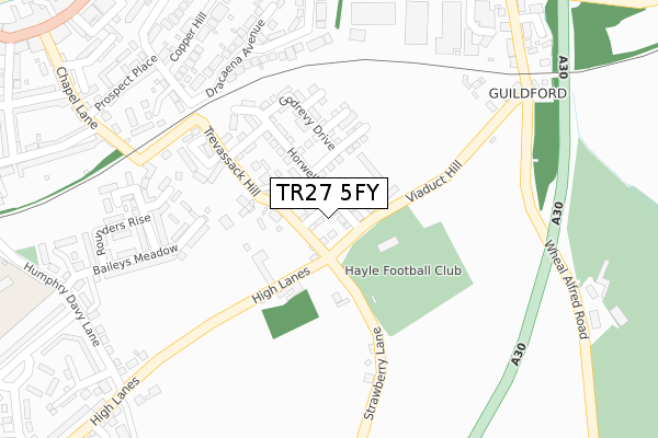
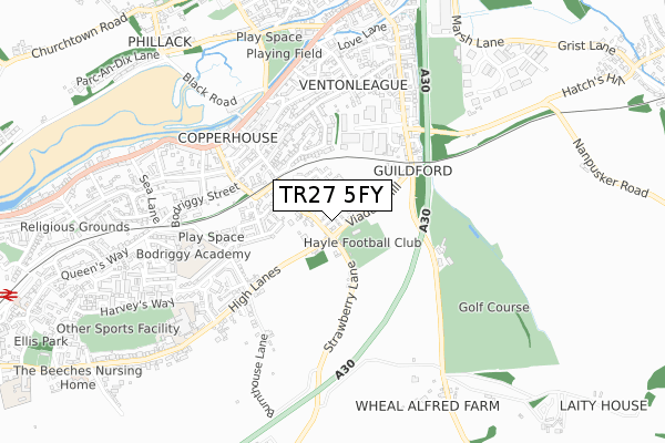
TR27 5FY is located in the Hayle West electoral ward, within the unitary authority of Cornwall and the English Parliamentary constituency of Camborne and Redruth. The Sub Integrated Care Board (ICB) Location is NHS Cornwall and the Isles of Scilly ICB - 11N and the police force is Devon & Cornwall. This postcode has been in use since December 2019.


GetTheData
Source: OS Open Zoomstack (Ordnance Survey)
Licence: Open Government Licence (requires attribution)
Attribution: Contains OS data © Crown copyright and database right 2024
Source: Open Postcode Geo
Licence: Open Government Licence (requires attribution)
Attribution: Contains OS data © Crown copyright and database right 2024; Contains Royal Mail data © Royal Mail copyright and database right 2024; Source: Office for National Statistics licensed under the Open Government Licence v.3.0
| Easting | 157219 |
| Northing | 37757 |
| Latitude | 50.189943 |
| Longitude | -5.402699 |
GetTheData
Source: Open Postcode Geo
Licence: Open Government Licence
| Country | England |
| Postcode District | TR27 |
| ➜ TR27 open data dashboard ➜ See where TR27 is on a map ➜ Where is Hayle? | |
GetTheData
Source: Land Registry Price Paid Data
Licence: Open Government Licence
| Ward | Hayle West |
| Constituency | Camborne And Redruth |
GetTheData
Source: ONS Postcode Database
Licence: Open Government Licence
1, PIPIT CLOSE, HAYLE, TR27 5FY 2020 18 AUG £325,000 |
4, PIPIT CLOSE, HAYLE, TR27 5FY 2019 20 DEC £282,500 |
2, PIPIT CLOSE, HAYLE, TR27 5FY 2019 19 DEC £287,950 |
GetTheData
Source: HM Land Registry Price Paid Data
Licence: Contains HM Land Registry data © Crown copyright and database right 2024. This data is licensed under the Open Government Licence v3.0.
| October 2022 | Violence and sexual offences | On or near Pool'S Court | 411m |
| September 2022 | Violence and sexual offences | On or near Prospect Place | 336m |
| August 2022 | Vehicle crime | On or near Prospect Place | 336m |
| ➜ Get more crime data in our Crime section | |||
GetTheData
Source: data.police.uk
Licence: Open Government Licence
| Phillack Turn (Copper Terrace) | Hayle | 411m |
| Copperhouse Co-op (Copper Terrace) | Hayle | 429m |
| Co-op | Hayle | 432m |
| Phillack Turn (Beatrice Terrace) | Hayle | 444m |
| Phillack Turn (Lethlean Lane) | Hayle | 467m |
| Hayle Station | 1.3km |
| Lelant Station | 2.5km |
| Lelant Saltings Station | 3km |
GetTheData
Source: NaPTAN
Licence: Open Government Licence
GetTheData
Source: ONS Postcode Database
Licence: Open Government Licence


➜ Get more ratings from the Food Standards Agency
GetTheData
Source: Food Standards Agency
Licence: FSA terms & conditions
| Last Collection | |||
|---|---|---|---|
| Location | Mon-Fri | Sat | Distance |
| Copper House Post Office | 17:00 | 11:15 | 455m |
| Caroline Row | 17:05 | 11:00 | 486m |
| Belle Vue | 17:10 | 11:15 | 804m |
GetTheData
Source: Dracos
Licence: Creative Commons Attribution-ShareAlike
| Facility | Distance |
|---|---|
| Trevassack Park (Site 1) (Closed) Viaduct Hill, Hayle Grass Pitches | 200m |
| Trevassack Park (Hayle Afc) Viaduct Hill, Hayle Grass Pitches, Artificial Grass Pitch | 208m |
| Hayle Golf Range Wheal Alfred Road, Hayle Golf | 452m |
GetTheData
Source: Active Places
Licence: Open Government Licence
| School | Phase of Education | Distance |
|---|---|---|
| Bodriggy Academy Humphry Davy Lane, Hayle, TR27 4DR | Primary | 607m |
| Hayle Academy 3 High Lanes, Hayle, TR27 4DN | Secondary | 810m |
| Penpol School 2 St George's Road, Hayle, TR27 4AH | Primary | 1.4km |
GetTheData
Source: Edubase
Licence: Open Government Licence
The below table lists the International Territorial Level (ITL) codes (formerly Nomenclature of Territorial Units for Statistics (NUTS) codes) and Local Administrative Units (LAU) codes for TR27 5FY:
| ITL 1 Code | Name |
|---|---|
| TLK | South West (England) |
| ITL 2 Code | Name |
| TLK3 | Cornwall and Isles of Scilly |
| ITL 3 Code | Name |
| TLK30 | Cornwall and Isles of Scilly |
| LAU 1 Code | Name |
| E06000052 | Cornwall |
GetTheData
Source: ONS Postcode Directory
Licence: Open Government Licence
The below table lists the Census Output Area (OA), Lower Layer Super Output Area (LSOA), and Middle Layer Super Output Area (MSOA) for TR27 5FY:
| Code | Name | |
|---|---|---|
| OA | E00095892 | |
| LSOA | E01018984 | Cornwall 057E |
| MSOA | E02003944 | Cornwall 057 |
GetTheData
Source: ONS Postcode Directory
Licence: Open Government Licence
| TR27 5HW | Trevassack Parc | 164m |
| TR27 4EN | Dracaena Crescent | 190m |
| TR27 5HP | Trevassack Hill | 209m |
| TR27 4LZ | Dracaena Avenue | 210m |
| TR27 4QZ | Guildford Road Industrial Estate | 219m |
| TR27 5HT | Viaduct Hill | 238m |
| TR27 4LY | Copper Hill | 258m |
| TR27 5HS | Strawberry Lane | 281m |
| TR27 5HU | Guildford Road | 286m |
| TR27 4NA | Trevassack Court | 289m |
GetTheData
Source: Open Postcode Geo; Land Registry Price Paid Data
Licence: Open Government Licence