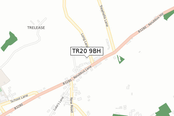
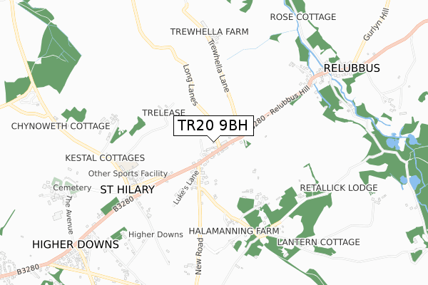
TR20 9BH is located in the Long Rock, Marazion & St Erth electoral ward, within the unitary authority of Cornwall and the English Parliamentary constituency of St Ives. The Sub Integrated Care Board (ICB) Location is NHS Cornwall and the Isles of Scilly ICB - 11N and the police force is Devon & Cornwall. This postcode has been in use since September 2017.


GetTheData
Source: OS Open Zoomstack (Ordnance Survey)
Licence: Open Government Licence (requires attribution)
Attribution: Contains OS data © Crown copyright and database right 2024
Source: Open Postcode Geo
Licence: Open Government Licence (requires attribution)
Attribution: Contains OS data © Crown copyright and database right 2024; Contains Royal Mail data © Royal Mail copyright and database right 2024; Source: Office for National Statistics licensed under the Open Government Licence v.3.0
| Easting | 155964 |
| Northing | 31534 |
| Latitude | 50.133560 |
| Longitude | -5.416261 |
GetTheData
Source: Open Postcode Geo
Licence: Open Government Licence
| Country | England |
| Postcode District | TR20 |
| ➜ TR20 open data dashboard ➜ See where TR20 is on a map | |
GetTheData
Source: Land Registry Price Paid Data
Licence: Open Government Licence
| Ward | Long Rock, Marazion & St Erth |
| Constituency | St Ives |
GetTheData
Source: ONS Postcode Database
Licence: Open Government Licence
| May 2022 | Anti-social behaviour | On or near Relubbus Lane | 114m |
| August 2021 | Burglary | On or near Relubbus Lane | 114m |
| April 2021 | Anti-social behaviour | On or near Luke'S Lane | 309m |
| ➜ Get more crime data in our Crime section | |||
GetTheData
Source: data.police.uk
Licence: Open Government Licence
| Post Box (Relubbus Lane) | St Hilary | 47m |
| Post Box (Relubbus Lane) | St Hilary | 56m |
| Chynoweth Lane (B3280) | Halamanning | 546m |
| Chynoweth Lane | Halamanning | 557m |
| Relubbus (Tregembo Hill) | Halamanning | 752m |
| St Erth Station | 4.6km |
GetTheData
Source: NaPTAN
Licence: Open Government Licence
GetTheData
Source: ONS Postcode Database
Licence: Open Government Licence


➜ Get more ratings from the Food Standards Agency
GetTheData
Source: Food Standards Agency
Licence: FSA terms & conditions
| Last Collection | |||
|---|---|---|---|
| Location | Mon-Fri | Sat | Distance |
| Plantation | 09:00 | 09:00 | 1,056m |
| Rosudgeon Post Office | 16:35 | 11:15 | 2,032m |
| Plain An Gwarry | 09:45 | 09:45 | 2,375m |
GetTheData
Source: Dracos
Licence: Creative Commons Attribution-ShareAlike
| Facility | Distance |
|---|---|
| St Hilary School School Lane, St. Hilary, Penzance Grass Pitches, Sports Hall | 535m |
| Goldsithney Cricket Club Tregurtha View, Goldsithney, Penzance Grass Pitches | 1.8km |
| Rosudgeon And Kenneggy Playing Field Rosudgeon, Penzance Grass Pitches | 2.1km |
GetTheData
Source: Active Places
Licence: Open Government Licence
| School | Phase of Education | Distance |
|---|---|---|
| St Hilary School School Lane, St Hilary, Penzance, TR20 9DR | Primary | 535m |
| Germoe Community Primary School Germoe Lane, Germoe, Penzance, TR20 9QY | Primary | 3.4km |
| Marazion School School Lane, Marazion, TR17 0DG | Primary | 3.6km |
GetTheData
Source: Edubase
Licence: Open Government Licence
The below table lists the International Territorial Level (ITL) codes (formerly Nomenclature of Territorial Units for Statistics (NUTS) codes) and Local Administrative Units (LAU) codes for TR20 9BH:
| ITL 1 Code | Name |
|---|---|
| TLK | South West (England) |
| ITL 2 Code | Name |
| TLK3 | Cornwall and Isles of Scilly |
| ITL 3 Code | Name |
| TLK30 | Cornwall and Isles of Scilly |
| LAU 1 Code | Name |
| E06000052 | Cornwall |
GetTheData
Source: ONS Postcode Directory
Licence: Open Government Licence
The below table lists the Census Output Area (OA), Lower Layer Super Output Area (LSOA), and Middle Layer Super Output Area (MSOA) for TR20 9BH:
| Code | Name | |
|---|---|---|
| OA | E00096042 | |
| LSOA | E01019007 | Cornwall 061E |
| MSOA | E02003946 | Cornwall 061 |
GetTheData
Source: ONS Postcode Directory
Licence: Open Government Licence
| TR20 9EQ | Relubbus Lane | 51m |
| TR20 9EF | Relubbus Lane | 61m |
| TR20 9EG | Relubbus Lane | 79m |
| TR20 9EH | Relubbus Hill | 152m |
| TR20 9DX | Relubbus Lane | 168m |
| TR20 9DY | Lukes Lane | 196m |
| TR20 9EA | New Road | 304m |
| TR20 9DZ | Lukes Lane | 369m |
| TR20 9HT | Chapel Villas | 447m |
| TR20 9DR | Trelease Croft | 499m |
GetTheData
Source: Open Postcode Geo; Land Registry Price Paid Data
Licence: Open Government Licence