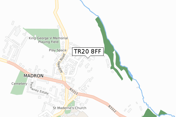
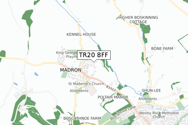
TR20 8FF is located in the Ludgvan, Madron, Gulval & Heamoor electoral ward, within the unitary authority of Cornwall and the English Parliamentary constituency of St Ives. The Sub Integrated Care Board (ICB) Location is NHS Cornwall and the Isles of Scilly ICB - 11N and the police force is Devon & Cornwall. This postcode has been in use since January 2018.


GetTheData
Source: OS Open Zoomstack (Ordnance Survey)
Licence: Open Government Licence (requires attribution)
Attribution: Contains OS data © Crown copyright and database right 2024
Source: Open Postcode Geo
Licence: Open Government Licence (requires attribution)
Attribution: Contains OS data © Crown copyright and database right 2024; Contains Royal Mail data © Royal Mail copyright and database right 2024; Source: Office for National Statistics licensed under the Open Government Licence v.3.0
| Easting | 145456 |
| Northing | 32099 |
| Latitude | 50.134217 |
| Longitude | -5.563386 |
GetTheData
Source: Open Postcode Geo
Licence: Open Government Licence
| Country | England |
| Postcode District | TR20 |
| ➜ TR20 open data dashboard ➜ See where TR20 is on a map | |
GetTheData
Source: Land Registry Price Paid Data
Licence: Open Government Licence
| Ward | Ludgvan, Madron, Gulval & Heamoor |
| Constituency | St Ives |
GetTheData
Source: ONS Postcode Database
Licence: Open Government Licence
| June 2022 | Criminal damage and arson | On or near Trafalar Fields | 76m |
| June 2022 | Anti-social behaviour | On or near Parc-Abnac | 438m |
| April 2022 | Vehicle crime | On or near Hillside Parc | 74m |
| ➜ Get more crime data in our Crime section | |||
GetTheData
Source: data.police.uk
Licence: Open Government Licence
| Fore Street | Madron | 192m |
| Fore Street | Madron | 206m |
| Trelawney Estate (Fore Street) | Madron | 350m |
| Trelawney Estate | Madron | 369m |
| Trelawney Estate (Fore Street) | Madron | 410m |
| Penzance Station | 2.6km |
GetTheData
Source: NaPTAN
Licence: Open Government Licence
➜ Broadband speed and availability dashboard for TR20 8FF
| Percentage of properties with Next Generation Access | 100.0% |
| Percentage of properties with Superfast Broadband | 100.0% |
| Percentage of properties with Ultrafast Broadband | 0.0% |
| Percentage of properties with Full Fibre Broadband | 0.0% |
Superfast Broadband is between 30Mbps and 300Mbps
Ultrafast Broadband is > 300Mbps
| Median download speed | 33.8Mbps |
| Average download speed | 26.9Mbps |
| Maximum download speed | 43.84Mbps |
| Median upload speed | 5.0Mbps |
| Average upload speed | 6.3Mbps |
| Maximum upload speed | 11.88Mbps |
| Percentage of properties unable to receive 2Mbps | 0.0% |
| Percentage of properties unable to receive 5Mbps | 0.0% |
| Percentage of properties unable to receive 10Mbps | 0.0% |
| Percentage of properties unable to receive 30Mbps | 0.0% |
➜ Broadband speed and availability dashboard for TR20 8FF
GetTheData
Source: Ofcom
Licence: Ofcom Terms of Use (requires attribution)
GetTheData
Source: ONS Postcode Database
Licence: Open Government Licence


➜ Get more ratings from the Food Standards Agency
GetTheData
Source: Food Standards Agency
Licence: FSA terms & conditions
| Last Collection | |||
|---|---|---|---|
| Location | Mon-Fri | Sat | Distance |
| Boscathnoe Way | 16:10 | 09:00 | 490m |
| Heamoor Post Office | 17:25 | 11:30 | 962m |
| Richmond Street | 16:45 | 11:30 | 1,171m |
GetTheData
Source: Dracos
Licence: Creative Commons Attribution-ShareAlike
| Facility | Distance |
|---|---|
| King George V Playing Field (Madron) Aldreath Road, Madron, Penzance Grass Pitches | 323m |
| Boscathnoe Lane Off Boscathnoe Way, Penzance Grass Pitches | 758m |
| Mounts Bay Academy Boscathnoe Lane, Penzance Health and Fitness Gym, Grass Pitches, Indoor Tennis Centre, Sports Hall, Artificial Grass Pitch, Studio, Outdoor Tennis Courts | 817m |
GetTheData
Source: Active Places
Licence: Open Government Licence
| School | Phase of Education | Distance |
|---|---|---|
| Madron Daniel CofE (VA) School Bellair Road, Madron, Penzance, TR20 8SP | Primary | 321m |
| Mounts Bay Academy Boscathnoe Lane, Heamoor, Penzance, TR18 3JT | Secondary | 824m |
| Heamoor Community Primary School Bosvenna Way, Heamoor, Penzance, TR18 3JZ | Primary | 1.2km |
GetTheData
Source: Edubase
Licence: Open Government Licence
The below table lists the International Territorial Level (ITL) codes (formerly Nomenclature of Territorial Units for Statistics (NUTS) codes) and Local Administrative Units (LAU) codes for TR20 8FF:
| ITL 1 Code | Name |
|---|---|
| TLK | South West (England) |
| ITL 2 Code | Name |
| TLK3 | Cornwall and Isles of Scilly |
| ITL 3 Code | Name |
| TLK30 | Cornwall and Isles of Scilly |
| LAU 1 Code | Name |
| E06000052 | Cornwall |
GetTheData
Source: ONS Postcode Directory
Licence: Open Government Licence
The below table lists the Census Output Area (OA), Lower Layer Super Output Area (LSOA), and Middle Layer Super Output Area (MSOA) for TR20 8FF:
| Code | Name | |
|---|---|---|
| OA | E00095930 | |
| LSOA | E01018989 | Cornwall 065B |
| MSOA | E02003947 | Cornwall 065 |
GetTheData
Source: ONS Postcode Directory
Licence: Open Government Licence
| TR20 8RU | Hillside Parc | 88m |
| TR20 8AE | Trafalgar Fields | 94m |
| TR20 8SE | Tregoddick Close | 136m |
| TR20 8ST | Aldreath Road | 143m |
| TR20 8SS | 148m | |
| TR20 8SU | Aldreath Road | 187m |
| TR20 8SX | Aldreath Close | 211m |
| TR20 8SN | Folnamodry | 215m |
| TR20 8SL | Fore Street | 230m |
| TR20 8SW | Church Road | 230m |
GetTheData
Source: Open Postcode Geo; Land Registry Price Paid Data
Licence: Open Government Licence