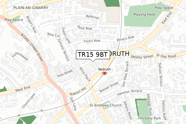
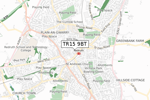
TR15 9BT is located in the Redruth North electoral ward, within the unitary authority of Cornwall and the English Parliamentary constituency of Camborne and Redruth. The Sub Integrated Care Board (ICB) Location is NHS Cornwall and the Isles of Scilly ICB - 11N and the police force is Devon & Cornwall. This postcode has been in use since June 2018.


GetTheData
Source: OS Open Zoomstack (Ordnance Survey)
Licence: Open Government Licence (requires attribution)
Attribution: Contains OS data © Crown copyright and database right 2024
Source: Open Postcode Geo
Licence: Open Government Licence (requires attribution)
Attribution: Contains OS data © Crown copyright and database right 2024; Contains Royal Mail data © Royal Mail copyright and database right 2024; Source: Office for National Statistics licensed under the Open Government Licence v.3.0
| Easting | 169989 |
| Northing | 42066 |
| Latitude | 50.233733 |
| Longitude | -5.226712 |
GetTheData
Source: Open Postcode Geo
Licence: Open Government Licence
| Country | England |
| Postcode District | TR15 |
| ➜ TR15 open data dashboard ➜ See where TR15 is on a map ➜ Where is Redruth? | |
GetTheData
Source: Land Registry Price Paid Data
Licence: Open Government Licence
| Ward | Redruth North |
| Constituency | Camborne And Redruth |
GetTheData
Source: ONS Postcode Database
Licence: Open Government Licence
| September 2022 | Violence and sexual offences | On or near Sea View Terrace | 189m |
| August 2022 | Violence and sexual offences | On or near Sea View Terrace | 189m |
| August 2022 | Violence and sexual offences | On or near Sea View Terrace | 189m |
| ➜ Get more crime data in our Crime section | |||
GetTheData
Source: data.police.uk
Licence: Open Government Licence
| Railway Station | Redruth | 67m |
| Railway Station (Station Road) | Redruth | 68m |
| Alma Place | Redruth | 84m |
| Railway Station | Redruth | 97m |
| Higher Fore Street | Redruth | 191m |
| Redruth Station | 0.1km |
GetTheData
Source: NaPTAN
Licence: Open Government Licence
GetTheData
Source: ONS Postcode Database
Licence: Open Government Licence


➜ Get more ratings from the Food Standards Agency
GetTheData
Source: Food Standards Agency
Licence: FSA terms & conditions
| Last Collection | |||
|---|---|---|---|
| Location | Mon-Fri | Sat | Distance |
| Redruth Post Office | 18:30 | 12:15 | 13m |
| Albany Road | 17:00 | 10:00 | 469m |
| West Trewirgie | 17:45 | 09:00 | 679m |
GetTheData
Source: Dracos
Licence: Creative Commons Attribution-ShareAlike
| Facility | Distance |
|---|---|
| Penventon Health & Leisure Spa West End, Redruth Health and Fitness Gym, Swimming Pool | 584m |
| Redruth Recreation Ground Lower Cardrew Lane, Redruth Grass Pitches | 617m |
| Raymond Road Football Pitch (Closed) Raymond Road, Redruth Grass Pitches | 622m |
GetTheData
Source: Active Places
Licence: Open Government Licence
| School | Phase of Education | Distance |
|---|---|---|
| Pennoweth Primary School Drump Road, Redruth, TR15 1NA | Primary | 383m |
| Trewirgie Junior School Falmouth Road, Wyndhan, Redruth, TR15 2QN | Primary | 411m |
| Curnow School Drump Road, Redruth, TR15 1LU | Not applicable | 475m |
GetTheData
Source: Edubase
Licence: Open Government Licence
The below table lists the International Territorial Level (ITL) codes (formerly Nomenclature of Territorial Units for Statistics (NUTS) codes) and Local Administrative Units (LAU) codes for TR15 9BT:
| ITL 1 Code | Name |
|---|---|
| TLK | South West (England) |
| ITL 2 Code | Name |
| TLK3 | Cornwall and Isles of Scilly |
| ITL 3 Code | Name |
| TLK30 | Cornwall and Isles of Scilly |
| LAU 1 Code | Name |
| E06000052 | Cornwall |
GetTheData
Source: ONS Postcode Directory
Licence: Open Government Licence
The below table lists the Census Output Area (OA), Lower Layer Super Output Area (LSOA), and Middle Layer Super Output Area (MSOA) for TR15 9BT:
| Code | Name | |
|---|---|---|
| OA | E00095503 | |
| LSOA | E01018913 | Cornwall 049B |
| MSOA | E02003920 | Cornwall 049 |
GetTheData
Source: ONS Postcode Directory
Licence: Open Government Licence
| TR15 2AF | Fore Street | 25m |
| TR15 2AE | Fore Street | 45m |
| TR15 2AT | Alma Place | 69m |
| TR15 2FE | Station Road | 70m |
| TR15 2BQ | Fore Street | 80m |
| TR15 2BJ | Fore Street | 85m |
| TR15 1JT | Green Lane | 102m |
| TR15 2AN | Higher Fore Street | 119m |
| TR15 2BL | Fore Street | 123m |
| TR15 1JS | Fords Row | 123m |
GetTheData
Source: Open Postcode Geo; Land Registry Price Paid Data
Licence: Open Government Licence