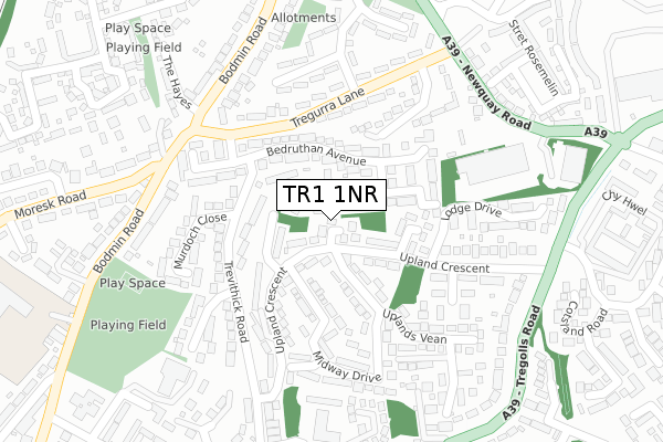
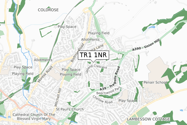
TR1 1NR is located in the Truro Moresk & Trehaverne electoral ward, within the unitary authority of Cornwall and the English Parliamentary constituency of Truro and Falmouth. The Sub Integrated Care Board (ICB) Location is NHS Cornwall and the Isles of Scilly ICB - 11N and the police force is Devon & Cornwall. This postcode has been in use since March 2018.


GetTheData
Source: OS Open Zoomstack (Ordnance Survey)
Licence: Open Government Licence (requires attribution)
Attribution: Contains OS data © Crown copyright and database right 2024
Source: Open Postcode Geo
Licence: Open Government Licence (requires attribution)
Attribution: Contains OS data © Crown copyright and database right 2024; Contains Royal Mail data © Royal Mail copyright and database right 2024; Source: Office for National Statistics licensed under the Open Government Licence v.3.0
| Easting | 183192 |
| Northing | 45212 |
| Latitude | 50.266976 |
| Longitude | -5.043659 |
GetTheData
Source: Open Postcode Geo
Licence: Open Government Licence
| Country | England |
| Postcode District | TR1 |
| ➜ TR1 open data dashboard ➜ See where TR1 is on a map ➜ Where is Truro? | |
GetTheData
Source: Land Registry Price Paid Data
Licence: Open Government Licence
| Ward | Truro Moresk & Trehaverne |
| Constituency | Truro And Falmouth |
GetTheData
Source: ONS Postcode Database
Licence: Open Government Licence
| October 2022 | Violence and sexual offences | On or near Trelander Barton | 239m |
| September 2022 | Criminal damage and arson | On or near Trelander Barton | 239m |
| September 2022 | Violence and sexual offences | On or near Trelander Barton | 239m |
| ➜ Get more crime data in our Crime section | |||
GetTheData
Source: data.police.uk
Licence: Open Government Licence
| Tregolls Road Dual Carriageway (Tregolls Road) | Truro | 143m |
| Penhaligon Court (Trevithick Road) | Truro | 150m |
| Penhaligon Court (Trevithick Road) | Truro | 159m |
| Tregolls Road Dual Carriageway (Tregolls Road) | Truro | 160m |
| Rising Sun (Mitchell Hill) | Truro | 231m |
| Truro Station | 1.6km |
GetTheData
Source: NaPTAN
Licence: Open Government Licence
Estimated total energy consumption in TR1 1NR by fuel type, 2015.
| Consumption (kWh) | 66,105 |
|---|---|
| Meter count | 10 |
| Mean (kWh/meter) | 6,611 |
| Median (kWh/meter) | 6,628 |
GetTheData
Source: Postcode level gas estimates: 2015 (experimental)
Source: Postcode level electricity estimates: 2015 (experimental)
Licence: Open Government Licence
GetTheData
Source: ONS Postcode Database
Licence: Open Government Licence


➜ Get more ratings from the Food Standards Agency
GetTheData
Source: Food Standards Agency
Licence: FSA terms & conditions
| Last Collection | |||
|---|---|---|---|
| Location | Mon-Fri | Sat | Distance |
| The Avenue | 16:30 | 12:15 | 277m |
| Higher Moresk | 16:30 | 12:10 | 523m |
| Princes Street | 18:00 | 12:45 | 585m |
GetTheData
Source: Dracos
Licence: Creative Commons Attribution-ShareAlike
| Facility | Distance |
|---|---|
| Tremorvah Park Playing Field Monterey Gardens, Truro Grass Pitches | 292m |
| Archbishop Benson Ce Primary School Bodmin Road, Truro Grass Pitches | 410m |
| Tregolls Primary School Chellew Road, Truro Grass Pitches, Artificial Grass Pitch | 608m |
GetTheData
Source: Active Places
Licence: Open Government Licence
| School | Phase of Education | Distance |
|---|---|---|
| Archbishop Benson CofE Primary School Bodmin Road, Truro, TR1 1BN | Primary | 407m |
| Tregolls Academy Chellew Road, Truro, TR1 1LH | Primary | 608m |
| Truro School Trennick Lane, Truro, Cornwall, TR1 1TH | Not applicable | 690m |
GetTheData
Source: Edubase
Licence: Open Government Licence
The below table lists the International Territorial Level (ITL) codes (formerly Nomenclature of Territorial Units for Statistics (NUTS) codes) and Local Administrative Units (LAU) codes for TR1 1NR:
| ITL 1 Code | Name |
|---|---|
| TLK | South West (England) |
| ITL 2 Code | Name |
| TLK3 | Cornwall and Isles of Scilly |
| ITL 3 Code | Name |
| TLK30 | Cornwall and Isles of Scilly |
| LAU 1 Code | Name |
| E06000052 | Cornwall |
GetTheData
Source: ONS Postcode Directory
Licence: Open Government Licence
The below table lists the Census Output Area (OA), Lower Layer Super Output Area (LSOA), and Middle Layer Super Output Area (MSOA) for TR1 1NR:
| Code | Name | |
|---|---|---|
| OA | E00095028 | |
| LSOA | E01018823 | Cornwall 042A |
| MSOA | E02003908 | Cornwall 042 |
GetTheData
Source: ONS Postcode Directory
Licence: Open Government Licence
| TR1 1ZQ | Tregolls Road | 79m |
| TR1 1JG | Manor Gardens | 87m |
| TR1 1NN | Tremorvah Barton | 104m |
| TR1 1XT | Woodland Court | 115m |
| TR1 1JB | Alverton Court | 129m |
| TR1 1NL | Tremorvah Crescent | 145m |
| TR1 1JP | Monterey Gardens | 160m |
| TR1 1LA | Tregolls Road | 160m |
| TR1 1JJ | Alverton Lane | 172m |
| TR1 1GR | Tregolls Road | 176m |
GetTheData
Source: Open Postcode Geo; Land Registry Price Paid Data
Licence: Open Government Licence