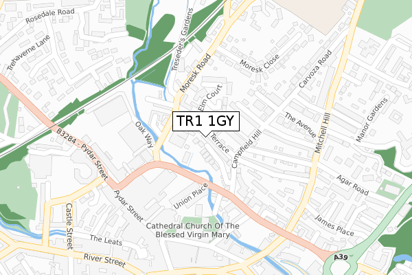
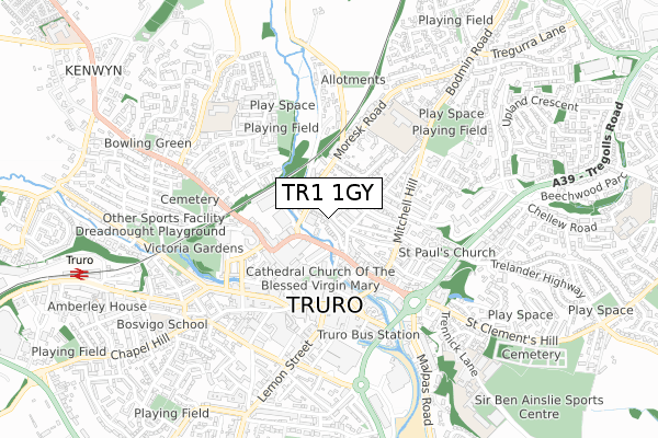
TR1 1GY is located in the Truro Moresk & Trehaverne electoral ward, within the unitary authority of Cornwall and the English Parliamentary constituency of Truro and Falmouth. The Sub Integrated Care Board (ICB) Location is NHS Cornwall and the Isles of Scilly ICB - 11N and the police force is Devon & Cornwall. This postcode has been in use since April 2019.


GetTheData
Source: OS Open Zoomstack (Ordnance Survey)
Licence: Open Government Licence (requires attribution)
Attribution: Contains OS data © Crown copyright and database right 2024
Source: Open Postcode Geo
Licence: Open Government Licence (requires attribution)
Attribution: Contains OS data © Crown copyright and database right 2024; Contains Royal Mail data © Royal Mail copyright and database right 2024; Source: Office for National Statistics licensed under the Open Government Licence v.3.0
| Easting | 182663 |
| Northing | 45152 |
| Latitude | 50.266243 |
| Longitude | -5.051036 |
GetTheData
Source: Open Postcode Geo
Licence: Open Government Licence
| Country | England |
| Postcode District | TR1 |
| ➜ TR1 open data dashboard ➜ See where TR1 is on a map ➜ Where is Truro? | |
GetTheData
Source: Land Registry Price Paid Data
Licence: Open Government Licence
| Ward | Truro Moresk & Trehaverne |
| Constituency | Truro And Falmouth |
GetTheData
Source: ONS Postcode Database
Licence: Open Government Licence
| August 2022 | Criminal damage and arson | On or near Moresk Road | 371m |
| June 2022 | Anti-social behaviour | On or near Union Place | 147m |
| June 2022 | Anti-social behaviour | On or near Union Place | 147m |
| ➜ Get more crime data in our Crime section | |||
GetTheData
Source: data.police.uk
Licence: Open Government Licence
| Methodist Church | Truro | 94m |
| Methodist Church (St Clement Street) | Truro | 107m |
| Car Park (St Clement Street) | Truro | 249m |
| Carrick House | Truro | 266m |
| Rising Sun (Mitchell Hill) | Truro | 284m |
| Truro Station | 1km |
GetTheData
Source: NaPTAN
Licence: Open Government Licence
| Percentage of properties with Next Generation Access | 0.0% |
| Percentage of properties with Superfast Broadband | 0.0% |
| Percentage of properties with Ultrafast Broadband | 0.0% |
| Percentage of properties with Full Fibre Broadband | 0.0% |
Superfast Broadband is between 30Mbps and 300Mbps
Ultrafast Broadband is > 300Mbps
| Percentage of properties unable to receive 2Mbps | 0.0% |
| Percentage of properties unable to receive 5Mbps | 0.0% |
| Percentage of properties unable to receive 10Mbps | 0.0% |
| Percentage of properties unable to receive 30Mbps | 0.0% |
GetTheData
Source: Ofcom
Licence: Ofcom Terms of Use (requires attribution)
GetTheData
Source: ONS Postcode Database
Licence: Open Government Licence


➜ Get more ratings from the Food Standards Agency
GetTheData
Source: Food Standards Agency
Licence: FSA terms & conditions
| Last Collection | |||
|---|---|---|---|
| Location | Mon-Fri | Sat | Distance |
| Lemon Street | 18:00 | 12:25 | 243m |
| The Avenue | 16:30 | 12:15 | 261m |
| Higher Moresk | 16:30 | 12:10 | 287m |
GetTheData
Source: Dracos
Licence: Creative Commons Attribution-ShareAlike
| Facility | Distance |
|---|---|
| The Peoples Palace Pydar Street, Truro Sports Hall | 302m |
| Tr1 Fitness (Closed) Calenick Street, Truro Health and Fitness Gym, Studio | 470m |
| Archbishop Benson Ce Primary School Bodmin Road, Truro Grass Pitches | 471m |
GetTheData
Source: Active Places
Licence: Open Government Licence
| School | Phase of Education | Distance |
|---|---|---|
| Archbishop Benson CofE Primary School Bodmin Road, Truro, TR1 1BN | Primary | 469m |
| Truro Nursery School Higher Trehaverne, Truro, TR1 3RJ | Nursery | 570m |
| St Mary's CofE School, Truro Higher Trehaverne, Truro, TR1 3RJ | Primary | 591m |
GetTheData
Source: Edubase
Licence: Open Government Licence
The below table lists the International Territorial Level (ITL) codes (formerly Nomenclature of Territorial Units for Statistics (NUTS) codes) and Local Administrative Units (LAU) codes for TR1 1GY:
| ITL 1 Code | Name |
|---|---|
| TLK | South West (England) |
| ITL 2 Code | Name |
| TLK3 | Cornwall and Isles of Scilly |
| ITL 3 Code | Name |
| TLK30 | Cornwall and Isles of Scilly |
| LAU 1 Code | Name |
| E06000052 | Cornwall |
GetTheData
Source: ONS Postcode Directory
Licence: Open Government Licence
The below table lists the Census Output Area (OA), Lower Layer Super Output Area (LSOA), and Middle Layer Super Output Area (MSOA) for TR1 1GY:
| Code | Name | |
|---|---|---|
| OA | E00094942 | |
| LSOA | E01018809 | Cornwall 044C |
| MSOA | E02003910 | Cornwall 044 |
GetTheData
Source: ONS Postcode Directory
Licence: Open Government Licence
| TR1 1HD | Pauls Terrace | 68m |
| TR1 1HA | Truro Vean Terrace | 69m |
| TR1 1DS | Elm Court Gardens | 85m |
| TR1 1DR | Benson Gardens | 93m |
| TR1 1HN | St Clements Terrace | 109m |
| TR1 1HB | Campfield Hill | 110m |
| TR1 1HL | Compton Terrace | 111m |
| TR1 1DY | Moresk Road | 112m |
| TR1 1HJ | Campfield Hill | 114m |
| TR1 1DE | Moresk Road | 125m |
GetTheData
Source: Open Postcode Geo; Land Registry Price Paid Data
Licence: Open Government Licence