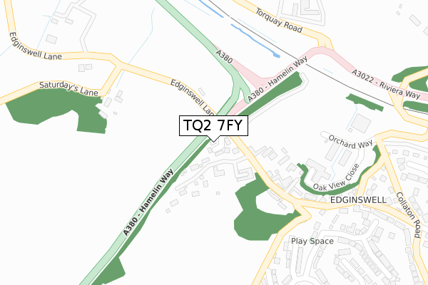
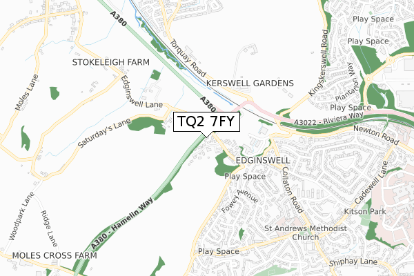
TQ2 7FY is located in the Shiphay electoral ward, within the unitary authority of Torbay and the English Parliamentary constituency of Torbay. The Sub Integrated Care Board (ICB) Location is NHS Devon ICB - 15N and the police force is Devon & Cornwall. This postcode has been in use since September 2019.


GetTheData
Source: OS Open Zoomstack (Ordnance Survey)
Licence: Open Government Licence (requires attribution)
Attribution: Contains OS data © Crown copyright and database right 2024
Source: Open Postcode Geo
Licence: Open Government Licence (requires attribution)
Attribution: Contains OS data © Crown copyright and database right 2024; Contains Royal Mail data © Royal Mail copyright and database right 2024; Source: Office for National Statistics licensed under the Open Government Licence v.3.0
| Easting | 288578 |
| Northing | 66229 |
| Latitude | 50.485233 |
| Longitude | -3.571945 |
GetTheData
Source: Open Postcode Geo
Licence: Open Government Licence
| Country | England |
| Postcode District | TQ2 |
| ➜ TQ2 open data dashboard ➜ See where TQ2 is on a map ➜ Where is Paignton? | |
GetTheData
Source: Land Registry Price Paid Data
Licence: Open Government Licence
| Ward | Shiphay |
| Constituency | Torbay |
GetTheData
Source: ONS Postcode Database
Licence: Open Government Licence
THE BARN, THE PADDOCK, EDGINSWELL LANE, TORQUAY, TQ2 7FY 2021 6 APR £512,500 |
1, THE PADDOCK, EDGINSWELL LANE, TORQUAY, TQ2 7FY 2019 18 DEC £425,000 |
THE BARN, THE PADDOCK, EDGINSWELL LANE, TORQUAY, TQ2 7FY 2019 29 NOV £460,000 |
2, THE PADDOCK, EDGINSWELL LANE, TORQUAY, TQ2 7FY 2019 13 SEP £350,000 |
GetTheData
Source: HM Land Registry Price Paid Data
Licence: Contains HM Land Registry data © Crown copyright and database right 2024. This data is licensed under the Open Government Licence v3.0.
| June 2022 | Violence and sexual offences | On or near Huntacott Way | 344m |
| June 2022 | Violence and sexual offences | On or near Fowey Avenue | 439m |
| June 2022 | Violence and sexual offences | On or near Edginswell Close | 490m |
| ➜ Get more crime data in our Crime section | |||
GetTheData
Source: data.police.uk
Licence: Open Government Licence
| Huntacott Way | Shiphay | 391m |
| Coventry Farm (Torquay Road) | Kingskerswell | 438m |
| Fowey Avenue 50 (Fowey Avenue) | Shiphay | 455m |
| Coventry Farm (Torquay Road) | Kingskerswell | 473m |
| Fowey Aveunue Opp 30 (Fowey Avenue) | Shiphay | 526m |
| Torre Station | 2.3km |
| Torquay Station | 3.4km |
| Newton Abbot Station | 5.3km |
GetTheData
Source: NaPTAN
Licence: Open Government Licence
GetTheData
Source: ONS Postcode Database
Licence: Open Government Licence


➜ Get more ratings from the Food Standards Agency
GetTheData
Source: Food Standards Agency
Licence: FSA terms & conditions
| Last Collection | |||
|---|---|---|---|
| Location | Mon-Fri | Sat | Distance |
| Edginswell | 17:30 | 12:30 | 368m |
| Fowey Avenue | 18:00 | 11:45 | 625m |
| Fowey Avenue/Falmouth Close | 18:00 | 11:45 | 625m |
GetTheData
Source: Dracos
Licence: Creative Commons Attribution-ShareAlike
| Facility | Distance |
|---|---|
| Shiphay Learning Academy Exe Hill, Torquay Grass Pitches | 743m |
| Sherwell Valley Primary School Hawkins Avenue, Torquay Grass Pitches, Sports Hall | 1.4km |
| Kingskerswell Playing Field Manor Drive, Kingskerswell, Newton Abbot Grass Pitches | 1.4km |
GetTheData
Source: Active Places
Licence: Open Government Licence
| School | Phase of Education | Distance |
|---|---|---|
| Shiphay Learning Academy Exe Hill, Shiphay, Torquay, TQ2 7NF | Primary | 743m |
| Sherwell Valley Primary School Hawkins Avenue, Torquay, TQ2 6ES | Primary | 1.4km |
| Torquay Boys' Grammar School Shiphay Manor Drive, Torquay, TQ2 7EL | Secondary | 1.5km |
GetTheData
Source: Edubase
Licence: Open Government Licence
The below table lists the International Territorial Level (ITL) codes (formerly Nomenclature of Territorial Units for Statistics (NUTS) codes) and Local Administrative Units (LAU) codes for TQ2 7FY:
| ITL 1 Code | Name |
|---|---|
| TLK | South West (England) |
| ITL 2 Code | Name |
| TLK4 | Devon |
| ITL 3 Code | Name |
| TLK42 | Torbay |
| LAU 1 Code | Name |
| E06000027 | Torbay |
GetTheData
Source: ONS Postcode Directory
Licence: Open Government Licence
The below table lists the Census Output Area (OA), Lower Layer Super Output Area (LSOA), and Middle Layer Super Output Area (MSOA) for TQ2 7FY:
| Code | Name | |
|---|---|---|
| OA | E00077064 | |
| LSOA | E01015250 | Torbay 003B |
| MSOA | E02003156 | Torbay 003 |
GetTheData
Source: ONS Postcode Directory
Licence: Open Government Licence
| TQ2 7JF | Edginswell Lane | 49m |
| TQ2 7JG | Higher Edginswell Lane | 278m |
| TQ2 7RN | Walkham Rise | 313m |
| TQ2 7RX | Chinkwell Rise | 346m |
| TQ2 7RL | Huntacott Way | 353m |
| TQ2 7RY | Brim Brook Court | 389m |
| TQ2 7RW | Fowey Avenue | 398m |
| TQ2 7JE | Edginswell Lane | 406m |
| TQ2 7SA | Helmdon Rise | 415m |
| TQ2 7JD | Higher Cadewell Lane | 429m |
GetTheData
Source: Open Postcode Geo; Land Registry Price Paid Data
Licence: Open Government Licence