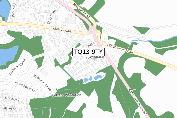
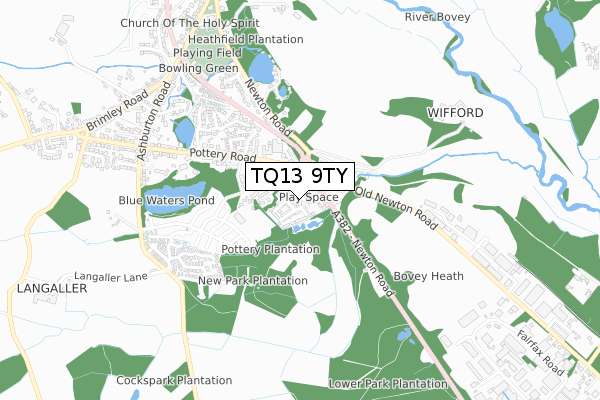
TQ13 9TY is located in the Bovey electoral ward, within the local authority district of Teignbridge and the English Parliamentary constituency of Central Devon. The Sub Integrated Care Board (ICB) Location is NHS Devon ICB - 15N and the police force is Devon & Cornwall. This postcode has been in use since August 2017.


GetTheData
Source: OS Open Zoomstack (Ordnance Survey)
Licence: Open Government Licence (requires attribution)
Attribution: Contains OS data © Crown copyright and database right 2025
Source: Open Postcode Geo
Licence: Open Government Licence (requires attribution)
Attribution: Contains OS data © Crown copyright and database right 2025; Contains Royal Mail data © Royal Mail copyright and database right 2025; Source: Office for National Statistics licensed under the Open Government Licence v.3.0
| Easting | 281683 |
| Northing | 76976 |
| Latitude | 50.580490 |
| Longitude | -3.672506 |
GetTheData
Source: Open Postcode Geo
Licence: Open Government Licence
| Country | England |
| Postcode District | TQ13 |
➜ See where TQ13 is on a map ➜ Where is Bovey Tracey? | |
GetTheData
Source: Land Registry Price Paid Data
Licence: Open Government Licence
| Ward | Bovey |
| Constituency | Central Devon |
GetTheData
Source: ONS Postcode Database
Licence: Open Government Licence
| Glenlyn (Old Newton Road) | Bovey Tracey | 121m |
| Glenlyn (Old Newton Road) | Bovey Tracey | 142m |
| House Of Marbles (Pottery Road) | Bovey Tracey | 175m |
| House Of Marbles (Pottery Road) | Bovey Tracey | 185m |
| Fairview Park (Pottery Road) | Bovey Tracey | 360m |
GetTheData
Source: NaPTAN
Licence: Open Government Licence
| Percentage of properties with Next Generation Access | 100.0% |
| Percentage of properties with Superfast Broadband | 100.0% |
| Percentage of properties with Ultrafast Broadband | 0.0% |
| Percentage of properties with Full Fibre Broadband | 0.0% |
Superfast Broadband is between 30Mbps and 300Mbps
Ultrafast Broadband is > 300Mbps
| Median download speed | 24.4Mbps |
| Average download speed | 33.2Mbps |
| Maximum download speed | 78.12Mbps |
| Median upload speed | 5.5Mbps |
| Average upload speed | 7.1Mbps |
| Maximum upload speed | 20.00Mbps |
| Percentage of properties unable to receive 2Mbps | 0.0% |
| Percentage of properties unable to receive 5Mbps | 0.0% |
| Percentage of properties unable to receive 10Mbps | 0.0% |
| Percentage of properties unable to receive 30Mbps | 0.0% |
GetTheData
Source: Ofcom
Licence: Ofcom Terms of Use (requires attribution)
GetTheData
Source: ONS Postcode Database
Licence: Open Government Licence


➜ Get more ratings from the Food Standards Agency
GetTheData
Source: Food Standards Agency
Licence: FSA terms & conditions
| Last Collection | |||
|---|---|---|---|
| Location | Mon-Fri | Sat | Distance |
| Coombe Cross | 16:00 | 08:30 | 1,528m |
| East Street | 16:00 | 08:15 | 1,642m |
| Shewte Cross | 16:15 | 08:00 | 2,875m |
GetTheData
Source: Dracos
Licence: Creative Commons Attribution-ShareAlike
| Risk of TQ13 9TY flooding from rivers and sea | High |
| ➜ TQ13 9TY flood map | |
GetTheData
Source: Open Flood Risk by Postcode
Licence: Open Government Licence
The below table lists the International Territorial Level (ITL) codes (formerly Nomenclature of Territorial Units for Statistics (NUTS) codes) and Local Administrative Units (LAU) codes for TQ13 9TY:
| ITL 1 Code | Name |
|---|---|
| TLK | South West (England) |
| ITL 2 Code | Name |
| TLK4 | Devon |
| ITL 3 Code | Name |
| TLK43 | Devon CC |
| LAU 1 Code | Name |
| E07000045 | Teignbridge |
GetTheData
Source: ONS Postcode Directory
Licence: Open Government Licence
The below table lists the Census Output Area (OA), Lower Layer Super Output Area (LSOA), and Middle Layer Super Output Area (MSOA) for TQ13 9TY:
| Code | Name | |
|---|---|---|
| OA | E00102353 | |
| LSOA | E01020202 | Teignbridge 007A |
| MSOA | E02004207 | Teignbridge 007 |
GetTheData
Source: ONS Postcode Directory
Licence: Open Government Licence
| TQ13 9GN | Templer Place | 36m |
| TQ13 9GR | Templer Place | 69m |
| TQ13 9DX | Newton Road | 77m |
| TQ13 9DT | Old Newton Road | 128m |
| TQ13 9JJ | Pottery Road | 166m |
| TQ13 9DR | Pottery Road | 191m |
| TQ13 9YF | Blue Waters Industrial Estate | 236m |
| TQ13 9DS | Pottery Road | 411m |
| TQ13 9YL | Kiln Close | 444m |
| TQ13 9YH | Pottery Close | 461m |
GetTheData
Source: Open Postcode Geo; Land Registry Price Paid Data
Licence: Open Government Licence