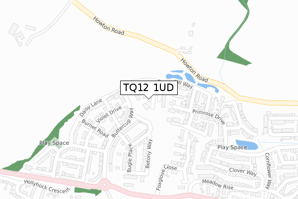
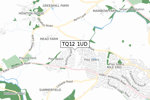
TQ12 1UD is located in the Bradley electoral ward, within the local authority district of Teignbridge and the English Parliamentary constituency of Newton Abbot. The Sub Integrated Care Board (ICB) Location is NHS Devon ICB - 15N and the police force is Devon & Cornwall. This postcode has been in use since December 2019.


GetTheData
Source: OS Open Zoomstack (Ordnance Survey)
Licence: Open Government Licence (requires attribution)
Attribution: Contains OS data © Crown copyright and database right 2024
Source: Open Postcode Geo
Licence: Open Government Licence (requires attribution)
Attribution: Contains OS data © Crown copyright and database right 2024; Contains Royal Mail data © Royal Mail copyright and database right 2024; Source: Office for National Statistics licensed under the Open Government Licence v.3.0
| Easting | 283499 |
| Northing | 72366 |
| Latitude | 50.539414 |
| Longitude | -3.645423 |
GetTheData
Source: Open Postcode Geo
Licence: Open Government Licence
| Country | England |
| Postcode District | TQ12 |
| ➜ TQ12 open data dashboard ➜ See where TQ12 is on a map ➜ Where is Newton Abbot? | |
GetTheData
Source: Land Registry Price Paid Data
Licence: Open Government Licence
| Ward | Bradley |
| Constituency | Newton Abbot |
GetTheData
Source: ONS Postcode Database
Licence: Open Government Licence
12, CHICORY CLOSE, NEWTON ABBOT, TQ12 1UD 2019 29 NOV £340,000 |
4, CHICORY CLOSE, NEWTON ABBOT, TQ12 1UD 2019 29 NOV £340,000 |
2, CHICORY CLOSE, NEWTON ABBOT, TQ12 1UD 2019 29 NOV £298,000 |
14, CHICORY CLOSE, NEWTON ABBOT, TQ12 1UD 2019 20 NOV £292,000 |
GetTheData
Source: HM Land Registry Price Paid Data
Licence: Contains HM Land Registry data © Crown copyright and database right 2024. This data is licensed under the Open Government Licence v3.0.
| Mile End Road (Ashburton Road) | Mile End | 612m |
| Mile End Road (Ashburton Road) | Mile End | 646m |
| Larkspur Drive (Mile End Road) | Mile End | 648m |
| Moorsend (Chercombe Valley Road) | Mile End | 742m |
| Moorsend (Chercombe Valley Road) | Mile End | 748m |
| Newton Abbot Station | 3.5km |
GetTheData
Source: NaPTAN
Licence: Open Government Licence
| Percentage of properties with Next Generation Access | 42.9% |
| Percentage of properties with Superfast Broadband | 42.9% |
| Percentage of properties with Ultrafast Broadband | 42.9% |
| Percentage of properties with Full Fibre Broadband | 0.0% |
Superfast Broadband is between 30Mbps and 300Mbps
Ultrafast Broadband is > 300Mbps
| Percentage of properties unable to receive 2Mbps | 0.0% |
| Percentage of properties unable to receive 5Mbps | 57.1% |
| Percentage of properties unable to receive 10Mbps | 57.1% |
| Percentage of properties unable to receive 30Mbps | 57.1% |
GetTheData
Source: Ofcom
Licence: Ofcom Terms of Use (requires attribution)
GetTheData
Source: ONS Postcode Database
Licence: Open Government Licence


➜ Get more ratings from the Food Standards Agency
GetTheData
Source: Food Standards Agency
Licence: FSA terms & conditions
| Last Collection | |||
|---|---|---|---|
| Location | Mon-Fri | Sat | Distance |
| Old Highweek Post Office | 17:15 | 12:00 | 1,360m |
| Knowles Hill Road | 17:30 | 12:15 | 1,970m |
| East Ogwell Old Post Office | 17:15 | 11:50 | 2,330m |
GetTheData
Source: Dracos
Licence: Creative Commons Attribution-ShareAlike
| Facility | Distance |
|---|---|
| Hele Park Golf Centre (Closed) Ashburton Road, Newton Abbot Golf | 292m |
| Seale Hayne Howton Road, Newton Abbot Health and Fitness Gym, Sports Hall, Squash Courts | 1km |
| Coombeshead Academy (Forches Cross) Bovey Road, Newton Abbot Grass Pitches | 1.2km |
GetTheData
Source: Active Places
Licence: Open Government Licence
| School | Phase of Education | Distance |
|---|---|---|
| Bradley Barton Primary School and Nursery Unit Ogwell Mill Road, Bradley Barton, Newton Abbot, TQ12 1PR | Primary | 1.4km |
| St Joseph's Catholic Primary School Coombeshead Road, Highweek, Newton Abbot, TQ12 1PT | Primary | 1.8km |
| School for Inspiring Talents College House, Ashburton Road, Newton Abbot, Devon, TQ12 1NH | Not applicable | 1.8km |
GetTheData
Source: Edubase
Licence: Open Government Licence
The below table lists the International Territorial Level (ITL) codes (formerly Nomenclature of Territorial Units for Statistics (NUTS) codes) and Local Administrative Units (LAU) codes for TQ12 1UD:
| ITL 1 Code | Name |
|---|---|
| TLK | South West (England) |
| ITL 2 Code | Name |
| TLK4 | Devon |
| ITL 3 Code | Name |
| TLK43 | Devon CC |
| LAU 1 Code | Name |
| E07000045 | Teignbridge |
GetTheData
Source: ONS Postcode Directory
Licence: Open Government Licence
The below table lists the Census Output Area (OA), Lower Layer Super Output Area (LSOA), and Middle Layer Super Output Area (MSOA) for TQ12 1UD:
| Code | Name | |
|---|---|---|
| OA | E00102370 | |
| LSOA | E01020207 | Teignbridge 013C |
| MSOA | E02004213 | Teignbridge 013 |
GetTheData
Source: ONS Postcode Directory
Licence: Open Government Licence
| TQ12 6NB | Howton Road | 223m |
| TQ12 1GF | Primrose Drive | 269m |
| TQ12 1US | Camomile Way | 295m |
| TQ12 1GR | Cowslip Crescent | 358m |
| TQ12 1GE | Clover Way | 365m |
| TQ12 1GD | Meadow Rise | 393m |
| TQ12 1GP | Nettle Close | 394m |
| TQ12 6JN | Ashburton Road | 420m |
| TQ12 1GN | Speedwell Close | 466m |
| TQ12 1SX | Cornflower Way | 481m |
GetTheData
Source: Open Postcode Geo; Land Registry Price Paid Data
Licence: Open Government Licence