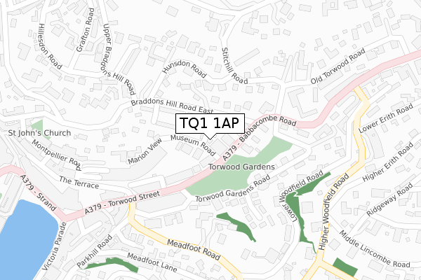
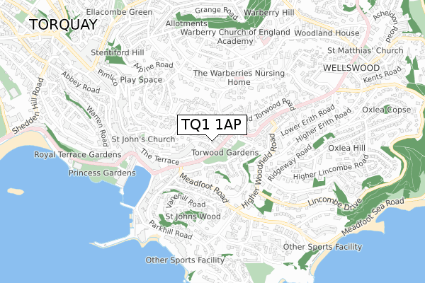
TQ1 1AP is located in the Wellswood electoral ward, within the unitary authority of Torbay and the English Parliamentary constituency of Torbay. The Sub Integrated Care Board (ICB) Location is NHS Devon ICB - 15N and the police force is Devon & Cornwall. This postcode has been in use since August 2017.


GetTheData
Source: OS Open Zoomstack (Ordnance Survey)
Licence: Open Government Licence (requires attribution)
Attribution: Contains OS data © Crown copyright and database right 2025
Source: Open Postcode Geo
Licence: Open Government Licence (requires attribution)
Attribution: Contains OS data © Crown copyright and database right 2025; Contains Royal Mail data © Royal Mail copyright and database right 2025; Source: Office for National Statistics licensed under the Open Government Licence v.3.0
| Easting | 292293 |
| Northing | 63646 |
| Latitude | 50.462708 |
| Longitude | -3.518854 |
GetTheData
Source: Open Postcode Geo
Licence: Open Government Licence
| Country | England |
| Postcode District | TQ1 |
➜ See where TQ1 is on a map ➜ Where is Torquay? | |
GetTheData
Source: Land Registry Price Paid Data
Licence: Open Government Licence
| Ward | Wellswood |
| Constituency | Torbay |
GetTheData
Source: ONS Postcode Database
Licence: Open Government Licence
5, MUSEUM WAY, TORQUAY, TQ1 1AP 2020 13 NOV £305,000 |
4, MUSEUM WAY, TORQUAY, TQ1 1AP 2020 12 NOV £287,500 |
3, MUSEUM WAY, TORQUAY, TQ1 1AP 2019 17 JUN £272,500 |
GetTheData
Source: HM Land Registry Price Paid Data
Licence: Contains HM Land Registry data © Crown copyright and database right 2025. This data is licensed under the Open Government Licence v3.0.
| Museum (Babbacombe Road) | Torquay | 51m |
| Museum (Babbacombe Road) | Torquay | 72m |
| Ten Pin Bowling Alley (Babbacombe Road) | Torquay | 129m |
| Ten Pin Bowling Alley (Torwood Street) | Torquay | 155m |
| Meadfoot Road | Torquay | 263m |
| Torquay Station | 1.7km |
| Torre Station | 2.3km |
| Paignton Station | 4.5km |
GetTheData
Source: NaPTAN
Licence: Open Government Licence
| Percentage of properties with Next Generation Access | 0.0% |
| Percentage of properties with Superfast Broadband | 0.0% |
| Percentage of properties with Ultrafast Broadband | 0.0% |
| Percentage of properties with Full Fibre Broadband | 0.0% |
Superfast Broadband is between 30Mbps and 300Mbps
Ultrafast Broadband is > 300Mbps
| Percentage of properties unable to receive 2Mbps | 0.0% |
| Percentage of properties unable to receive 5Mbps | 0.0% |
| Percentage of properties unable to receive 10Mbps | 0.0% |
| Percentage of properties unable to receive 30Mbps | 100.0% |
GetTheData
Source: Ofcom
Licence: Ofcom Terms of Use (requires attribution)
GetTheData
Source: ONS Postcode Database
Licence: Open Government Licence


➜ Get more ratings from the Food Standards Agency
GetTheData
Source: Food Standards Agency
Licence: FSA terms & conditions
| Last Collection | |||
|---|---|---|---|
| Location | Mon-Fri | Sat | Distance |
| Torwood Gardens | 17:45 | 12:15 | 169m |
| Strand | 17:30 | 12:00 | 418m |
| Strand | 17:30 | 12:00 | 418m |
GetTheData
Source: Dracos
Licence: Creative Commons Attribution-ShareAlike
The below table lists the International Territorial Level (ITL) codes (formerly Nomenclature of Territorial Units for Statistics (NUTS) codes) and Local Administrative Units (LAU) codes for TQ1 1AP:
| ITL 1 Code | Name |
|---|---|
| TLK | South West (England) |
| ITL 2 Code | Name |
| TLK4 | Devon |
| ITL 3 Code | Name |
| TLK42 | Torbay |
| LAU 1 Code | Name |
| E06000027 | Torbay |
GetTheData
Source: ONS Postcode Directory
Licence: Open Government Licence
The below table lists the Census Output Area (OA), Lower Layer Super Output Area (LSOA), and Middle Layer Super Output Area (MSOA) for TQ1 1AP:
| Code | Name | |
|---|---|---|
| OA | E00077167 | |
| LSOA | E01015267 | Torbay 010A |
| MSOA | E02003163 | Torbay 010 |
GetTheData
Source: ONS Postcode Directory
Licence: Open Government Licence
| TQ1 1HF | Braddons Hill Road East | 66m |
| TQ1 1HG | Babbacombe Road | 67m |
| TQ1 1HQ | Babbacombe Road | 93m |
| TQ1 1HH | Babbacombe Road | 110m |
| TQ1 1DW | Museum Road | 125m |
| TQ1 1EG | Torwood Gardens Road | 141m |
| TQ1 1AH | Torwood Gardens Road | 153m |
| TQ1 1HJ | Babbacombe Road | 157m |
| TQ1 1QB | Hunsdon Road | 172m |
| TQ1 1DS | South Hill Road | 178m |
GetTheData
Source: Open Postcode Geo; Land Registry Price Paid Data
Licence: Open Government Licence