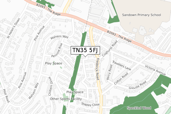
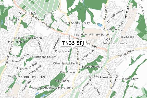
TN35 5FJ is located in the Tressell electoral ward, within the local authority district of Hastings and the English Parliamentary constituency of Hastings and Rye. The Sub Integrated Care Board (ICB) Location is NHS Sussex ICB - 97R and the police force is Sussex. This postcode has been in use since November 2018.


GetTheData
Source: OS Open Zoomstack (Ordnance Survey)
Licence: Open Government Licence (requires attribution)
Attribution: Contains OS data © Crown copyright and database right 2024
Source: Open Postcode Geo
Licence: Open Government Licence (requires attribution)
Attribution: Contains OS data © Crown copyright and database right 2024; Contains Royal Mail data © Royal Mail copyright and database right 2024; Source: Office for National Statistics licensed under the Open Government Licence v.3.0
| Easting | 583098 |
| Northing | 111569 |
| Latitude | 50.874610 |
| Longitude | 0.601120 |
GetTheData
Source: Open Postcode Geo
Licence: Open Government Licence
| Country | England |
| Postcode District | TN35 |
| ➜ TN35 open data dashboard ➜ See where TN35 is on a map ➜ Where is Hastings? | |
GetTheData
Source: Land Registry Price Paid Data
Licence: Open Government Licence
| Ward | Tressell |
| Constituency | Hastings And Rye |
GetTheData
Source: ONS Postcode Database
Licence: Open Government Licence
| June 2023 | Violence and sexual offences | On or near Cookson Gardens | 168m |
| July 2022 | Anti-social behaviour | On or near Cookson Gardens | 168m |
| June 2022 | Anti-social behaviour | On or near Tuppenney Close | 90m |
| ➜ Get more crime data in our Crime section | |||
GetTheData
Source: data.police.uk
Licence: Open Government Licence
| Pennine Rise (Malvern Way) | St Helens | 182m |
| Victoria Avenue End (The Ridge) | Ore | 188m |
| Victoria Avenue End (The Ridge) | Ore | 201m |
| Cotswold Close (Pennine Rise) | St Helens | 213m |
| Church Street (Clifton Road) | Ore | 226m |
| Ore Station | 1.1km |
| Hastings Station | 2.5km |
| Three Oaks Station | 3.1km |
GetTheData
Source: NaPTAN
Licence: Open Government Licence
| Percentage of properties with Next Generation Access | 100.0% |
| Percentage of properties with Superfast Broadband | 100.0% |
| Percentage of properties with Ultrafast Broadband | 100.0% |
| Percentage of properties with Full Fibre Broadband | 100.0% |
Superfast Broadband is between 30Mbps and 300Mbps
Ultrafast Broadband is > 300Mbps
| Percentage of properties unable to receive 2Mbps | 0.0% |
| Percentage of properties unable to receive 5Mbps | 0.0% |
| Percentage of properties unable to receive 10Mbps | 0.0% |
| Percentage of properties unable to receive 30Mbps | 0.0% |
GetTheData
Source: Ofcom
Licence: Ofcom Terms of Use (requires attribution)
GetTheData
Source: ONS Postcode Database
Licence: Open Government Licence


➜ Get more ratings from the Food Standards Agency
GetTheData
Source: Food Standards Agency
Licence: FSA terms & conditions
| Last Collection | |||
|---|---|---|---|
| Location | Mon-Fri | Sat | Distance |
| Ore Post Office | 17:30 | 12:15 | 573m |
| Elphinstone Road (Upper) | 17:45 | 12:00 | 1,111m |
| Peter James Lane | 16:30 | 09:30 | 1,410m |
GetTheData
Source: Dracos
Licence: Creative Commons Attribution-ShareAlike
| Facility | Distance |
|---|---|
| Sandown Primary School The Ridge, Hastings Grass Pitches, Swimming Pool | 363m |
| Trojan Training Systems Ivyhouse Lane, Hastings Health and Fitness Gym | 512m |
| Ore Village Primary Academy Rye Road, Hastings Grass Pitches | 862m |
GetTheData
Source: Active Places
Licence: Open Government Licence
| School | Phase of Education | Distance |
|---|---|---|
| Sandown Primary School and Nursery The Ridge, Hastings, TN34 2AA | Primary | 360m |
| Ore Village Primary Academy Rye Road, Hastings, TN35 5DB | Primary | 715m |
| All Saints CofE Junior Academy Githa Road, Hastings, TN35 5JU | Primary | 1.1km |
GetTheData
Source: Edubase
Licence: Open Government Licence
The below table lists the International Territorial Level (ITL) codes (formerly Nomenclature of Territorial Units for Statistics (NUTS) codes) and Local Administrative Units (LAU) codes for TN35 5FJ:
| ITL 1 Code | Name |
|---|---|
| TLJ | South East (England) |
| ITL 2 Code | Name |
| TLJ2 | Surrey, East and West Sussex |
| ITL 3 Code | Name |
| TLJ22 | East Sussex CC |
| LAU 1 Code | Name |
| E07000062 | Hastings |
GetTheData
Source: ONS Postcode Directory
Licence: Open Government Licence
The below table lists the Census Output Area (OA), Lower Layer Super Output Area (LSOA), and Middle Layer Super Output Area (MSOA) for TN35 5FJ:
| Code | Name | |
|---|---|---|
| OA | E00106723 | |
| LSOA | E01021013 | Hastings 004D |
| MSOA | E02004371 | Hastings 004 |
GetTheData
Source: ONS Postcode Directory
Licence: Open Government Licence
| TN35 5QJ | Tuppenney Close | 89m |
| TN34 3FR | Bannister Close | 94m |
| TN35 5AT | Coghurst Road | 97m |
| TN35 5AU | Frederick Road | 103m |
| TN34 3QN | The Cheviots | 111m |
| TN35 5BS | Victoria Avenue | 131m |
| TN35 5AR | Percy Road | 147m |
| TN34 3QG | Malvern Way | 151m |
| TN35 5QH | Cookson Gardens | 153m |
| TN35 5AS | Coghurst Road | 172m |
GetTheData
Source: Open Postcode Geo; Land Registry Price Paid Data
Licence: Open Government Licence