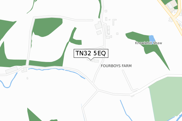
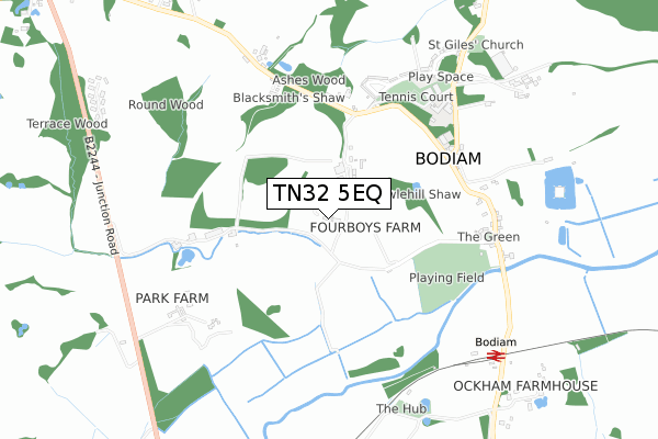
TN32 5EQ is located in the Northern Rother electoral ward, within the local authority district of Rother and the English Parliamentary constituency of Bexhill and Battle. The Sub Integrated Care Board (ICB) Location is NHS Sussex ICB - 97R and the police force is Sussex. This postcode has been in use since October 2017.


GetTheData
Source: OS Open Zoomstack (Ordnance Survey)
Licence: Open Government Licence (requires attribution)
Attribution: Contains OS data © Crown copyright and database right 2024
Source: Open Postcode Geo
Licence: Open Government Licence (requires attribution)
Attribution: Contains OS data © Crown copyright and database right 2024; Contains Royal Mail data © Royal Mail copyright and database right 2024; Source: Office for National Statistics licensed under the Open Government Licence v.3.0
| Easting | 577682 |
| Northing | 125517 |
| Latitude | 51.001603 |
| Longitude | 0.531018 |
GetTheData
Source: Open Postcode Geo
Licence: Open Government Licence
| Country | England |
| Postcode District | TN32 |
| ➜ TN32 open data dashboard ➜ See where TN32 is on a map | |
GetTheData
Source: Land Registry Price Paid Data
Licence: Open Government Licence
| Ward | Northern Rother |
| Constituency | Bexhill And Battle |
GetTheData
Source: ONS Postcode Database
Licence: Open Government Licence
| June 2022 | Violence and sexual offences | On or near Sports/Recreation Area | 442m |
| June 2022 | Criminal damage and arson | On or near Sports/Recreation Area | 442m |
| June 2022 | Burglary | On or near Sports/Recreation Area | 442m |
| ➜ Get more crime data in our Crime section | |||
GetTheData
Source: data.police.uk
Licence: Open Government Licence
| Castle Inn (Bodiam Road) | Bodiam | 625m |
| Castle Inn (Bodiam Road) | Bodiam | 656m |
| Levetts Lane (Bodiam Road) | Bodiam | 709m |
| Levetts Lane (Bodiam Road) | Bodiam | 728m |
| K&esr Station (Bodiam Road) | Bodiam | 812m |
| Bodiam (Kent & East Sussex Railway) | Bodiam | 817m |
| Robertsbridge Station | 4.7km |
GetTheData
Source: NaPTAN
Licence: Open Government Licence
| Percentage of properties with Next Generation Access | 100.0% |
| Percentage of properties with Superfast Broadband | 0.0% |
| Percentage of properties with Ultrafast Broadband | 0.0% |
| Percentage of properties with Full Fibre Broadband | 0.0% |
Superfast Broadband is between 30Mbps and 300Mbps
Ultrafast Broadband is > 300Mbps
| Percentage of properties unable to receive 2Mbps | 0.0% |
| Percentage of properties unable to receive 5Mbps | 0.0% |
| Percentage of properties unable to receive 10Mbps | 0.0% |
| Percentage of properties unable to receive 30Mbps | 100.0% |
GetTheData
Source: Ofcom
Licence: Ofcom Terms of Use (requires attribution)
GetTheData
Source: ONS Postcode Database
Licence: Open Government Licence


➜ Get more ratings from the Food Standards Agency
GetTheData
Source: Food Standards Agency
Licence: FSA terms & conditions
| Last Collection | |||
|---|---|---|---|
| Location | Mon-Fri | Sat | Distance |
| Bodiam | 16:30 | 09:30 | 649m |
| Junction Inn | 16:15 | 09:30 | 1,436m |
| Brasses | 16:45 | 09:15 | 1,917m |
GetTheData
Source: Dracos
Licence: Creative Commons Attribution-ShareAlike
| Facility | Distance |
|---|---|
| Claremont School (Senior) Bodiam, Robertsbridge Sports Hall | 585m |
| Bodiam Recreation Ground Green Lane, Bodiam Grass Pitches | 594m |
| Arthur Herdman Pavilion And Recreation Ground Village Street, Village Street, Ewhurst Grass Pitches | 1.8km |
GetTheData
Source: Active Places
Licence: Open Government Licence
| School | Phase of Education | Distance |
|---|---|---|
| Bodiam Church of England Primary School Castle Road, Bodiam, Robertsbridge, TN32 5UH | Primary | 531m |
| Staplecross Methodist Primary School Bodiam Road, Staplecross, Bodiam Road, Robertsbridge, TN32 5QD | Primary | 2.9km |
| Sandhurst Primary School Rye Road, Sandhurst, Sandhurst Primary School, Cranbrook, TN18 5JE | Primary | 3.7km |
GetTheData
Source: Edubase
Licence: Open Government Licence
The below table lists the International Territorial Level (ITL) codes (formerly Nomenclature of Territorial Units for Statistics (NUTS) codes) and Local Administrative Units (LAU) codes for TN32 5EQ:
| ITL 1 Code | Name |
|---|---|
| TLJ | South East (England) |
| ITL 2 Code | Name |
| TLJ2 | Surrey, East and West Sussex |
| ITL 3 Code | Name |
| TLJ22 | East Sussex CC |
| LAU 1 Code | Name |
| E07000064 | Rother |
GetTheData
Source: ONS Postcode Directory
Licence: Open Government Licence
The below table lists the Census Output Area (OA), Lower Layer Super Output Area (LSOA), and Middle Layer Super Output Area (MSOA) for TN32 5EQ:
| Code | Name | |
|---|---|---|
| OA | E00107351 | |
| LSOA | E01021133 | Rother 001B |
| MSOA | E02004392 | Rother 001 |
GetTheData
Source: ONS Postcode Directory
Licence: Open Government Licence
| TN32 5UP | Knowle Hill Cottages | 446m |
| TN32 5UH | Knowle Cottages | 492m |
| TN32 5UG | 519m | |
| TN32 5UR | Blacksmiths Field | 526m |
| TN32 5UB | The Green | 579m |
| TN32 5UE | 591m | |
| TN32 5UT | The Elms | 639m |
| TN32 5UL | Levetts Lane | 642m |
| TN32 5UD | 652m | |
| TN32 5UU | 691m |
GetTheData
Source: Open Postcode Geo; Land Registry Price Paid Data
Licence: Open Government Licence