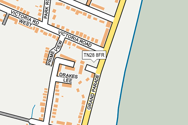
TN28 8FR is located in the New Romney electoral ward, within the local authority district of Folkestone and Hythe and the English Parliamentary constituency of Folkestone and Hythe. The Sub Integrated Care Board (ICB) Location is NHS Kent and Medway ICB - 91Q and the police force is Kent. This postcode has been in use since June 2018.


GetTheData
Source: OS OpenMap – Local (Ordnance Survey)
Source: OS VectorMap District (Ordnance Survey)
Licence: Open Government Licence (requires attribution)
| Easting | 608331 |
| Northing | 124143 |
| Latitude | 50.978996 |
| Longitude | 0.966473 |
GetTheData
Source: Open Postcode Geo
Licence: Open Government Licence
| Country | England |
| Postcode District | TN28 |
➜ See where TN28 is on a map ➜ Where is Littlestone-on-Sea? | |
GetTheData
Source: Land Registry Price Paid Data
Licence: Open Government Licence
| Ward | New Romney |
| Constituency | Folkestone And Hythe |
GetTheData
Source: ONS Postcode Database
Licence: Open Government Licence
| Clark Road (Grand Parade) | Littlestone-on-sea | 198m |
| Queen's Road (Coast Drive) | Littlestone-on-sea | 203m |
| Queen's Road (Coast Drive) | Littlestone-on-sea | 204m |
| Clark Road (Grand Parade) | Littlestone-on-sea | 208m |
| Madeira Road (Littlestone Road) | Littlestone-on-sea | 315m |
| New Romney Station (Rhdr) | New Romney | 1,148m |
GetTheData
Source: NaPTAN
Licence: Open Government Licence
| Percentage of properties with Next Generation Access | 0.0% |
| Percentage of properties with Superfast Broadband | 0.0% |
| Percentage of properties with Ultrafast Broadband | 0.0% |
| Percentage of properties with Full Fibre Broadband | 0.0% |
Superfast Broadband is between 30Mbps and 300Mbps
Ultrafast Broadband is > 300Mbps
| Median download speed | 8.9Mbps |
| Average download speed | 10.1Mbps |
| Maximum download speed | 13.80Mbps |
| Median upload speed | 1.1Mbps |
| Average upload speed | 1.0Mbps |
| Maximum upload speed | 1.22Mbps |
| Percentage of properties unable to receive 2Mbps | 0.0% |
| Percentage of properties unable to receive 5Mbps | 0.0% |
| Percentage of properties unable to receive 10Mbps | 0.0% |
| Percentage of properties unable to receive 30Mbps | 100.0% |
GetTheData
Source: Ofcom
Licence: Ofcom Terms of Use (requires attribution)
GetTheData
Source: ONS Postcode Database
Licence: Open Government Licence


➜ Get more ratings from the Food Standards Agency
GetTheData
Source: Food Standards Agency
Licence: FSA terms & conditions
| Last Collection | |||
|---|---|---|---|
| Location | Mon-Fri | Sat | Distance |
| Littlestone Golf Club | 16:15 | 09:00 | 720m |
| Dunes Road | 16:45 | 09:00 | 1,042m |
| Greatstone Post Office | 17:00 | 09:00 | 1,307m |
GetTheData
Source: Dracos
Licence: Creative Commons Attribution-ShareAlike
| Risk of TN28 8FR flooding from rivers and sea | Low |
| ➜ TN28 8FR flood map | |
GetTheData
Source: Open Flood Risk by Postcode
Licence: Open Government Licence
The below table lists the International Territorial Level (ITL) codes (formerly Nomenclature of Territorial Units for Statistics (NUTS) codes) and Local Administrative Units (LAU) codes for TN28 8FR:
| ITL 1 Code | Name |
|---|---|
| TLJ | South East (England) |
| ITL 2 Code | Name |
| TLJ4 | Kent |
| ITL 3 Code | Name |
| TLJ44 | East Kent |
| LAU 1 Code | Name |
| E07000112 | Folkestone and Hythe |
GetTheData
Source: ONS Postcode Directory
Licence: Open Government Licence
The below table lists the Census Output Area (OA), Lower Layer Super Output Area (LSOA), and Middle Layer Super Output Area (MSOA) for TN28 8FR:
| Code | Name | |
|---|---|---|
| OA | E00124546 | |
| LSOA | E01024537 | Shepway 012A |
| MSOA | E02005113 | Shepway 012 |
GetTheData
Source: ONS Postcode Directory
Licence: Open Government Licence
| TN28 8NN | Grand Parade | 29m |
| TN28 8NG | Victory Terrace | 38m |
| TN28 8NE | Nelson Mews | 43m |
| TN28 8XA | Armada Close | 77m |
| TN28 8NU | Hamilton Close | 83m |
| TN28 8LZ | Grand Parade | 85m |
| TN28 8NL | Victoria Road | 92m |
| TN28 8RW | Drakes Lee | 112m |
| TN28 8NQ | Grand Parade | 129m |
| TN28 8NF | Grand Parade | 134m |
GetTheData
Source: Open Postcode Geo; Land Registry Price Paid Data
Licence: Open Government Licence