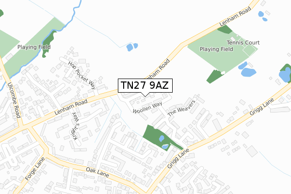
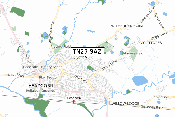
TN27 9AZ is located in the Headcorn electoral ward, within the local authority district of Maidstone and the English Parliamentary constituency of Faversham and Mid Kent. The Sub Integrated Care Board (ICB) Location is NHS Kent and Medway ICB - 91Q and the police force is Kent. This postcode has been in use since July 2018.


GetTheData
Source: OS Open Zoomstack (Ordnance Survey)
Licence: Open Government Licence (requires attribution)
Attribution: Contains OS data © Crown copyright and database right 2024
Source: Open Postcode Geo
Licence: Open Government Licence (requires attribution)
Attribution: Contains OS data © Crown copyright and database right 2024; Contains Royal Mail data © Royal Mail copyright and database right 2024; Source: Office for National Statistics licensed under the Open Government Licence v.3.0
| Easting | 583951 |
| Northing | 144605 |
| Latitude | 51.171097 |
| Longitude | 0.629979 |
GetTheData
Source: Open Postcode Geo
Licence: Open Government Licence
| Country | England |
| Postcode District | TN27 |
| ➜ TN27 open data dashboard ➜ See where TN27 is on a map ➜ Where is Headcorn? | |
GetTheData
Source: Land Registry Price Paid Data
Licence: Open Government Licence
| Ward | Headcorn |
| Constituency | Faversham And Mid Kent |
GetTheData
Source: ONS Postcode Database
Licence: Open Government Licence
2022 13 SEP £670,000 |
3, ARTISAN ROAD, HEADCORN, ASHFORD, TN27 9AZ 2020 17 AUG £550,000 |
2020 19 JUN £520,000 |
12, ARTISAN ROAD, HEADCORN, ASHFORD, TN27 9AZ 2020 28 FEB £620,000 |
8, ARTISAN ROAD, HEADCORN, ASHFORD, TN27 9AZ 2019 24 OCT £499,000 |
5, ARTISAN ROAD, HEADCORN, ASHFORD, TN27 9AZ 2019 18 SEP £600,000 |
10, ARTISAN ROAD, HEADCORN, ASHFORD, TN27 9AZ 2019 23 AUG £489,500 |
13, ARTISAN ROAD, HEADCORN, ASHFORD, TN27 9AZ 2019 28 JUN £499,500 |
9, ARTISAN ROAD, HEADCORN, ASHFORD, TN27 9AZ 2019 31 MAY £499,500 |
11, ARTISAN ROAD, HEADCORN, ASHFORD, TN27 9AZ 2019 18 APR £499,500 |
GetTheData
Source: HM Land Registry Price Paid Data
Licence: Contains HM Land Registry data © Crown copyright and database right 2024. This data is licensed under the Open Government Licence v3.0.
| June 2022 | Criminal damage and arson | On or near Knaves Acre | 179m |
| June 2022 | Other crime | On or near Knaves Acre | 179m |
| June 2022 | Violence and sexual offences | On or near Knaves Acre | 179m |
| ➜ Get more crime data in our Crime section | |||
GetTheData
Source: data.police.uk
Licence: Open Government Licence
| Gibbs Hill (Wheeler Street) | Headcorn | 470m |
| Gibbs Hill (Wheeler Street) | Headcorn | 476m |
| Railway Station (Station Road) | Headcorn | 504m |
| Railway Station (Station Road) | Headcorn | 505m |
| Railway Station Forecourt (Station Approach) | Headcorn | 585m |
| Headcorn Station | 0.6km |
GetTheData
Source: NaPTAN
Licence: Open Government Licence
➜ Broadband speed and availability dashboard for TN27 9AZ
| Percentage of properties with Next Generation Access | 100.0% |
| Percentage of properties with Superfast Broadband | 100.0% |
| Percentage of properties with Ultrafast Broadband | 0.0% |
| Percentage of properties with Full Fibre Broadband | 0.0% |
Superfast Broadband is between 30Mbps and 300Mbps
Ultrafast Broadband is > 300Mbps
| Median download speed | 46.5Mbps |
| Average download speed | 47.5Mbps |
| Maximum download speed | 78.12Mbps |
| Median upload speed | 7.4Mbps |
| Average upload speed | 9.2Mbps |
| Maximum upload speed | 19.53Mbps |
| Percentage of properties unable to receive 2Mbps | 0.0% |
| Percentage of properties unable to receive 5Mbps | 0.0% |
| Percentage of properties unable to receive 10Mbps | 0.0% |
| Percentage of properties unable to receive 30Mbps | 0.0% |
➜ Broadband speed and availability dashboard for TN27 9AZ
GetTheData
Source: Ofcom
Licence: Ofcom Terms of Use (requires attribution)
GetTheData
Source: ONS Postcode Database
Licence: Open Government Licence


➜ Get more ratings from the Food Standards Agency
GetTheData
Source: Food Standards Agency
Licence: FSA terms & conditions
| Last Collection | |||
|---|---|---|---|
| Location | Mon-Fri | Sat | Distance |
| Smarden Road | 16:00 | 09:00 | 1,068m |
| Southernden | 16:15 | 09:15 | 3,099m |
| Swifts Green | 16:45 | 09:00 | 3,186m |
GetTheData
Source: Dracos
Licence: Creative Commons Attribution-ShareAlike
| Facility | Distance |
|---|---|
| Headcorn Cricket And Tennis Club Lenham Road, Headcorn Grass Pitches, Outdoor Tennis Courts | 382m |
| Headcorn Primary School Kings Road, Headcorn, Ashford Grass Pitches | 621m |
| Headcorn Football Club Grigg Lane, Headcorn Grass Pitches | 694m |
GetTheData
Source: Active Places
Licence: Open Government Licence
| School | Phase of Education | Distance |
|---|---|---|
| Headcorn Primary School Kings Road, Headcorn, TN27 9QT | Primary | 621m |
| Frittenden Church of England Primary School Frittenden Primary School, Frittenden, Cranbrook, TN17 2DD | Primary | 4.5km |
| Ulcombe Church of England Primary School The Street, Ulcombe, Maidstone, ME17 1DU | Primary | 4.5km |
GetTheData
Source: Edubase
Licence: Open Government Licence
The below table lists the International Territorial Level (ITL) codes (formerly Nomenclature of Territorial Units for Statistics (NUTS) codes) and Local Administrative Units (LAU) codes for TN27 9AZ:
| ITL 1 Code | Name |
|---|---|
| TLJ | South East (England) |
| ITL 2 Code | Name |
| TLJ4 | Kent |
| ITL 3 Code | Name |
| TLJ45 | Mid Kent |
| LAU 1 Code | Name |
| E07000110 | Maidstone |
GetTheData
Source: ONS Postcode Directory
Licence: Open Government Licence
The below table lists the Census Output Area (OA), Lower Layer Super Output Area (LSOA), and Middle Layer Super Output Area (MSOA) for TN27 9AZ:
| Code | Name | |
|---|---|---|
| OA | E00123688 | |
| LSOA | E01024365 | Maidstone 017B |
| MSOA | E02005084 | Maidstone 017 |
GetTheData
Source: ONS Postcode Directory
Licence: Open Government Licence
| TN27 9UB | Thatch Barn Road | 146m |
| TN27 9UA | Thatch Barn Road | 183m |
| TN27 9TJ | Knaves Acre | 192m |
| TN27 9TY | Knights Way | 234m |
| TN27 9TU | Lenham Road | 250m |
| TN27 9TD | Grigg Lane | 250m |
| TN27 9TX | Knights Way | 264m |
| TN27 9TG | Oak Lane | 278m |
| TN27 9UE | Hydes Orchard | 287m |
| TN27 9TT | Lenham Road | 292m |
GetTheData
Source: Open Postcode Geo; Land Registry Price Paid Data
Licence: Open Government Licence