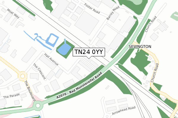
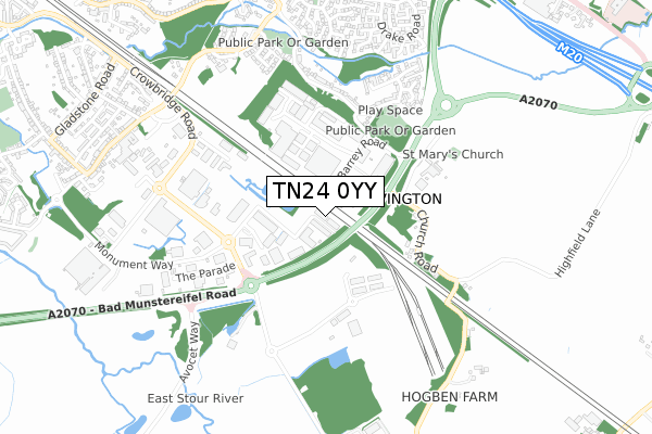
TN24 0YY is located in the Aylesford & East Stour electoral ward, within the local authority district of Ashford and the English Parliamentary constituency of Ashford. The Sub Integrated Care Board (ICB) Location is NHS Kent and Medway ICB - 91Q and the police force is Kent. This postcode has been in use since December 2018.


GetTheData
Source: OS Open Zoomstack (Ordnance Survey)
Licence: Open Government Licence (requires attribution)
Attribution: Contains OS data © Crown copyright and database right 2024
Source: Open Postcode Geo
Licence: Open Government Licence (requires attribution)
Attribution: Contains OS data © Crown copyright and database right 2024; Contains Royal Mail data © Royal Mail copyright and database right 2024; Source: Office for National Statistics licensed under the Open Government Licence v.3.0
| Easting | 603214 |
| Northing | 140629 |
| Latitude | 51.128878 |
| Longitude | 0.902924 |
GetTheData
Source: Open Postcode Geo
Licence: Open Government Licence
| Country | England |
| Postcode District | TN24 |
| ➜ TN24 open data dashboard ➜ See where TN24 is on a map ➜ Where is Ashford? | |
GetTheData
Source: Land Registry Price Paid Data
Licence: Open Government Licence
| Ward | Aylesford & East Stour |
| Constituency | Ashford |
GetTheData
Source: ONS Postcode Database
Licence: Open Government Licence
| June 2022 | Public order | On or near Shopping Area | 203m |
| June 2022 | Public order | On or near Shopping Area | 203m |
| June 2022 | Anti-social behaviour | On or near Shopping Area | 203m |
| ➜ Get more crime data in our Crime section | |||
GetTheData
Source: data.police.uk
Licence: Open Government Licence
| Caffyns (Monument Way) | Orbital Business Park | 450m |
| Bp Travel (The Boulevard) | Orbital Business Park | 538m |
| Pirtek (The Long Barrow) | Orbital Business Park | 720m |
| Ashford Market (Monument Way) | Orbital Business Park | 768m |
| Canterbury Road | South Willesborough | 869m |
| Ashford International Station | 2.5km |
GetTheData
Source: NaPTAN
Licence: Open Government Licence
GetTheData
Source: ONS Postcode Database
Licence: Open Government Licence


➜ Get more ratings from the Food Standards Agency
GetTheData
Source: Food Standards Agency
Licence: FSA terms & conditions
| Last Collection | |||
|---|---|---|---|
| Location | Mon-Fri | Sat | Distance |
| Church Road | 17:00 | 10:30 | 440m |
| Evans Road | 17:15 | 12:15 | 873m |
| South Willesborough P.o. | 17:15 | 12:15 | 998m |
GetTheData
Source: Dracos
Licence: Creative Commons Attribution-ShareAlike
| Facility | Distance |
|---|---|
| Willesborough Junior School Highfield Road, Willesborough, Ashford Grass Pitches | 1.1km |
| Women's Institute Hall Church Road, Willesborough, Ashford Sports Hall | 1.3km |
| Hythe Road (Closed) Hythe Road, Ashford Grass Pitches | 1.3km |
GetTheData
Source: Active Places
Licence: Open Government Licence
| School | Phase of Education | Distance |
|---|---|---|
| Willesborough Junior School Highfield Road, Willesborough, Ashford, TN24 0JU | Primary | 1.1km |
| Willesborough Infant School Church Road, Willesborough, Ashford, TN24 0JZ | Primary | 1.2km |
| East Stour Primary School Earlsworth Road, South Willesborough, Ashford, TN24 0DW | Primary | 1.4km |
GetTheData
Source: Edubase
Licence: Open Government Licence
The below table lists the International Territorial Level (ITL) codes (formerly Nomenclature of Territorial Units for Statistics (NUTS) codes) and Local Administrative Units (LAU) codes for TN24 0YY:
| ITL 1 Code | Name |
|---|---|
| TLJ | South East (England) |
| ITL 2 Code | Name |
| TLJ4 | Kent |
| ITL 3 Code | Name |
| TLJ45 | Mid Kent |
| LAU 1 Code | Name |
| E07000105 | Ashford |
GetTheData
Source: ONS Postcode Directory
Licence: Open Government Licence
The below table lists the Census Output Area (OA), Lower Layer Super Output Area (LSOA), and Middle Layer Super Output Area (MSOA) for TN24 0YY:
| Code | Name | |
|---|---|---|
| OA | E00121830 | |
| LSOA | E01023996 | Ashford 006C |
| MSOA | E02005001 | Ashford 006 |
GetTheData
Source: ONS Postcode Directory
Licence: Open Government Licence
| TN24 0SG | Barrey Road | 208m |
| TN24 0FE | Foster Road | 301m |
| TN24 0SJ | St Johns Court | 341m |
| TN24 0LD | Church Road | 368m |
| TN24 0SH | Foster Road | 406m |
| TN24 0LF | Church Road | 459m |
| TN24 0TL | The Glenmore Centre | 519m |
| TN24 0LE | Church Road | 532m |
| TN24 0TP | Nightingale Close | 593m |
| TN24 0FN | Highfield Lane | 597m |
GetTheData
Source: Open Postcode Geo; Land Registry Price Paid Data
Licence: Open Government Licence