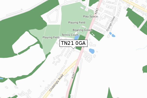
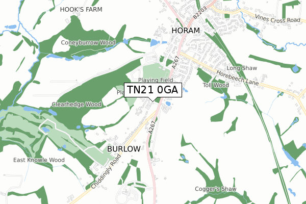
TN21 0GA is located in the Horam & Punnetts Town electoral ward, within the local authority district of Wealden and the English Parliamentary constituency of Wealden. The Sub Integrated Care Board (ICB) Location is NHS Sussex ICB - 97R and the police force is Sussex. This postcode has been in use since August 2019.


GetTheData
Source: OS Open Zoomstack (Ordnance Survey)
Licence: Open Government Licence (requires attribution)
Attribution: Contains OS data © Crown copyright and database right 2024
Source: Open Postcode Geo
Licence: Open Government Licence (requires attribution)
Attribution: Contains OS data © Crown copyright and database right 2024; Contains Royal Mail data © Royal Mail copyright and database right 2024; Source: Office for National Statistics licensed under the Open Government Licence v.3.0
| Easting | 557401 |
| Northing | 116811 |
| Latitude | 50.929276 |
| Longitude | 0.238455 |
GetTheData
Source: Open Postcode Geo
Licence: Open Government Licence
| Country | England |
| Postcode District | TN21 |
| ➜ TN21 open data dashboard ➜ See where TN21 is on a map ➜ Where is Horam? | |
GetTheData
Source: Land Registry Price Paid Data
Licence: Open Government Licence
| Ward | Horam & Punnetts Town |
| Constituency | Wealden |
GetTheData
Source: ONS Postcode Database
Licence: Open Government Licence
1, AUTUMN DRIVE, HORAM, HEATHFIELD, TN21 0GA 2021 8 JAN £570,000 |
5, AUTUMN DRIVE, HORAM, HEATHFIELD, TN21 0GA 2021 7 JAN £390,000 |
3, AUTUMN DRIVE, HORAM, HEATHFIELD, TN21 0GA 2020 23 OCT £395,000 |
11, AUTUMN DRIVE, HORAM, HEATHFIELD, TN21 0GA 2020 9 OCT £395,000 |
GetTheData
Source: HM Land Registry Price Paid Data
Licence: Contains HM Land Registry data © Crown copyright and database right 2024. This data is licensed under the Open Government Licence v3.0.
| June 2022 | Other crime | On or near Sports/Recreation Area | 136m |
| June 2022 | Public order | On or near Sports/Recreation Area | 136m |
| June 2022 | Vehicle crime | On or near Sports/Recreation Area | 136m |
| ➜ Get more crime data in our Crime section | |||
GetTheData
Source: data.police.uk
Licence: Open Government Licence
| May Garland Ph (North Street) | Burlow | 162m |
| May Garland Ph (North Street) | Burlow | 220m |
| Former Merrydown Winery (High Street) | Horam | 524m |
| Former Merrydown Winery (High Street) | Horam | 556m |
| Cherry Tree Court (High Street) | Horam | 767m |
GetTheData
Source: NaPTAN
Licence: Open Government Licence
GetTheData
Source: ONS Postcode Database
Licence: Open Government Licence


➜ Get more ratings from the Food Standards Agency
GetTheData
Source: Food Standards Agency
Licence: FSA terms & conditions
| Last Collection | |||
|---|---|---|---|
| Location | Mon-Fri | Sat | Distance |
| Horam Post Office | 17:00 | 11:30 | 713m |
| Marle Green | 16:15 | 09:30 | 1,563m |
| Beestons | 16:30 | 09:00 | 2,876m |
GetTheData
Source: Dracos
Licence: Creative Commons Attribution-ShareAlike
| Facility | Distance |
|---|---|
| Horam Recreation Ground Horam, Heathfield Grass Pitches, Outdoor Tennis Courts | 200m |
| Horam Park Golf Club Chiddingly Road, Horam, Heathfield Golf | 600m |
| St Mary's School Maynards Green, Heathfield Grass Pitches | 1.5km |
GetTheData
Source: Active Places
Licence: Open Government Licence
| School | Phase of Education | Distance |
|---|---|---|
| St Mary's School Horam, Heathfield, TN21 0BT | Not applicable | 1.5km |
| Maynards Green Community Primary School Maynards Green, Heathfield, TN21 0DD | Primary | 1.9km |
| Parkside Community Primary School Beechwood Lane, Heathfield, TN21 8QQ | Primary | 3.9km |
GetTheData
Source: Edubase
Licence: Open Government Licence
The below table lists the International Territorial Level (ITL) codes (formerly Nomenclature of Territorial Units for Statistics (NUTS) codes) and Local Administrative Units (LAU) codes for TN21 0GA:
| ITL 1 Code | Name |
|---|---|
| TLJ | South East (England) |
| ITL 2 Code | Name |
| TLJ2 | Surrey, East and West Sussex |
| ITL 3 Code | Name |
| TLJ22 | East Sussex CC |
| LAU 1 Code | Name |
| E07000065 | Wealden |
GetTheData
Source: ONS Postcode Directory
Licence: Open Government Licence
The below table lists the Census Output Area (OA), Lower Layer Super Output Area (LSOA), and Middle Layer Super Output Area (MSOA) for TN21 0GA:
| Code | Name | |
|---|---|---|
| OA | E00107693 | |
| LSOA | E01021200 | Wealden 011D |
| MSOA | E02004413 | Wealden 011 |
GetTheData
Source: ONS Postcode Directory
Licence: Open Government Licence
| TN21 0JH | Chiddingly Road | 191m |
| TN21 0JG | 273m | |
| TN21 0EF | Grange Close | 278m |
| TN21 0EE | Grange Close | 357m |
| TN21 0LJ | 361m | |
| TN21 0JF | Old Vicarage Close | 383m |
| TN21 0EG | Grange Close | 385m |
| TN21 0JE | 408m | |
| TN21 0DU | Horebeech Lane | 450m |
| TN21 0JJ | Chiddingly Road | 464m |
GetTheData
Source: Open Postcode Geo; Land Registry Price Paid Data
Licence: Open Government Licence