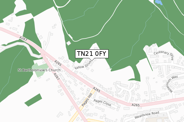
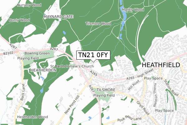
TN21 0FY is located in the Heathfield North electoral ward, within the local authority district of Wealden and the English Parliamentary constituency of Bexhill and Battle. The Sub Integrated Care Board (ICB) Location is NHS Sussex ICB - 97R and the police force is Sussex. This postcode has been in use since September 2019.


GetTheData
Source: OS Open Zoomstack (Ordnance Survey)
Licence: Open Government Licence (requires attribution)
Attribution: Contains OS data © Crown copyright and database right 2024
Source: Open Postcode Geo
Licence: Open Government Licence (requires attribution)
Attribution: Contains OS data © Crown copyright and database right 2024; Contains Royal Mail data © Royal Mail copyright and database right 2024; Source: Office for National Statistics licensed under the Open Government Licence v.3.0
| Easting | 557223 |
| Northing | 121548 |
| Latitude | 50.971889 |
| Longitude | 0.237968 |
GetTheData
Source: Open Postcode Geo
Licence: Open Government Licence
| Country | England |
| Postcode District | TN21 |
| ➜ TN21 open data dashboard ➜ See where TN21 is on a map ➜ Where is Heathfield? | |
GetTheData
Source: Land Registry Price Paid Data
Licence: Open Government Licence
| Ward | Heathfield North |
| Constituency | Bexhill And Battle |
GetTheData
Source: ONS Postcode Database
Licence: Open Government Licence
14, FALLOW DRIVE, HEATHFIELD, TN21 0FY 2021 28 APR £835,000 |
12, FALLOW DRIVE, HEATHFIELD, TN21 0FY 2021 19 MAR £840,000 |
6, FALLOW DRIVE, HEATHFIELD, TN21 0FY 2020 24 NOV £770,000 |
1, FALLOW DRIVE, HEATHFIELD, TN21 0FY 2020 21 AUG £600,000 |
9, FALLOW DRIVE, HEATHFIELD, TN21 0FY 2020 21 AUG £659,950 |
7, FALLOW DRIVE, HEATHFIELD, TN21 0FY 2020 22 JUL £660,000 |
8, FALLOW DRIVE, HEATHFIELD, TN21 0FY 2020 17 JUL £835,000 |
15, FALLOW DRIVE, HEATHFIELD, TN21 0FY 2020 31 MAR £660,000 |
16, FALLOW DRIVE, HEATHFIELD, TN21 0FY 2020 28 FEB £570,000 |
GetTheData
Source: HM Land Registry Price Paid Data
Licence: Contains HM Land Registry data © Crown copyright and database right 2024. This data is licensed under the Open Government Licence v3.0.
| June 2022 | Violence and sexual offences | On or near Park/Open Space | 275m |
| June 2022 | Criminal damage and arson | On or near Park/Open Space | 275m |
| June 2022 | Violence and sexual offences | On or near Nursery Way | 278m |
| ➜ Get more crime data in our Crime section | |||
GetTheData
Source: data.police.uk
Licence: Open Government Licence
| Little London Road (Cross In Hand Road) | Heathfield | 121m |
| Little London Road (Cross In Hand Road) | Heathfield | 134m |
| Pages Hill (Cross In Hand Road) | Heathfield | 150m |
| Pages Hill (Cross In Hand Road) | Heathfield | 171m |
| Fire Station (High Street) | Heathfield | 554m |
GetTheData
Source: NaPTAN
Licence: Open Government Licence
GetTheData
Source: ONS Postcode Database
Licence: Open Government Licence


➜ Get more ratings from the Food Standards Agency
GetTheData
Source: Food Standards Agency
Licence: FSA terms & conditions
| Last Collection | |||
|---|---|---|---|
| Location | Mon-Fri | Sat | Distance |
| Tilsmore Corner | 17:00 | 09:00 | 702m |
| Station House | 16:45 | 09:00 | 882m |
| Heathfield Post Office | 17:30 | 11:30 | 911m |
GetTheData
Source: Dracos
Licence: Creative Commons Attribution-ShareAlike
| Facility | Distance |
|---|---|
| Sheepsetting Lane Recreation Ground Sheepsetting Lane, Cross In Hand, Heathfield Grass Pitches | 426m |
| Isenhurst Health Club (Cross In Hand) Mayfield Road, Cross In Hand, Heathfield Swimming Pool, Health and Fitness Gym, Studio | 924m |
| Hardy Roberts Playing Field Cross In Hand, Heathfield Grass Pitches, Outdoor Tennis Courts | 937m |
GetTheData
Source: Active Places
Licence: Open Government Licence
| School | Phase of Education | Distance |
|---|---|---|
| Cross-in-Hand Church of England Primary School Sheepsetting Lane, Cross in Hand, Heathfield, TN21 0XG | Primary | 495m |
| Virtue Therapeutic School Sussex VTSS Oak View, Mayfield Flat, Cross-in-Hand, Heathfield, TN21 0TU | Not applicable | 2.1km |
| Parkside Community Primary School Beechwood Lane, Heathfield, TN21 8QQ | Primary | 2.2km |
GetTheData
Source: Edubase
Licence: Open Government Licence
The below table lists the International Territorial Level (ITL) codes (formerly Nomenclature of Territorial Units for Statistics (NUTS) codes) and Local Administrative Units (LAU) codes for TN21 0FY:
| ITL 1 Code | Name |
|---|---|
| TLJ | South East (England) |
| ITL 2 Code | Name |
| TLJ2 | Surrey, East and West Sussex |
| ITL 3 Code | Name |
| TLJ22 | East Sussex CC |
| LAU 1 Code | Name |
| E07000065 | Wealden |
GetTheData
Source: ONS Postcode Directory
Licence: Open Government Licence
The below table lists the Census Output Area (OA), Lower Layer Super Output Area (LSOA), and Middle Layer Super Output Area (MSOA) for TN21 0FY:
| Code | Name | |
|---|---|---|
| OA | E00107434 | |
| LSOA | E01021150 | Wealden 010A |
| MSOA | E02004412 | Wealden 010 |
GetTheData
Source: ONS Postcode Directory
Licence: Open Government Licence
| TN21 0LS | 147m | |
| TN21 0UT | Cross In Hand Road | 157m |
| TN21 0UU | Pages Hill | 178m |
| TN21 0LT | 189m | |
| TN21 0UZ | Pages Close | 247m |
| TN21 0UW | Nursery Way | 257m |
| TN21 0UY | Sheepsetting Lane | 307m |
| TN21 0UR | Cross In Hand Road | 352m |
| TN21 0XA | Wealdview Road | 416m |
| TN21 0SH | 501m |
GetTheData
Source: Open Postcode Geo; Land Registry Price Paid Data
Licence: Open Government Licence