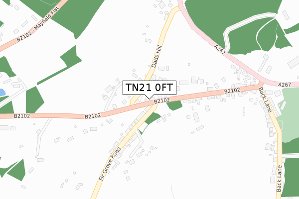
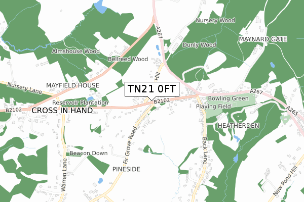
TN21 0FT is located in the Framfield & Cross-in-Hand electoral ward, within the local authority district of Wealden and the English Parliamentary constituency of Bexhill and Battle. The Sub Integrated Care Board (ICB) Location is NHS Sussex ICB - 97R and the police force is Sussex. This postcode has been in use since November 2017.


GetTheData
Source: OS Open Zoomstack (Ordnance Survey)
Licence: Open Government Licence (requires attribution)
Attribution: Contains OS data © Crown copyright and database right 2024
Source: Open Postcode Geo
Licence: Open Government Licence (requires attribution)
Attribution: Contains OS data © Crown copyright and database right 2024; Contains Royal Mail data © Royal Mail copyright and database right 2024; Source: Office for National Statistics licensed under the Open Government Licence v.3.0
| Easting | 555840 |
| Northing | 121652 |
| Latitude | 50.973199 |
| Longitude | 0.218330 |
GetTheData
Source: Open Postcode Geo
Licence: Open Government Licence
| Country | England |
| Postcode District | TN21 |
| ➜ TN21 open data dashboard ➜ See where TN21 is on a map ➜ Where is Cross in Hand? | |
GetTheData
Source: Land Registry Price Paid Data
Licence: Open Government Licence
| Ward | Framfield & Cross-in-hand |
| Constituency | Bexhill And Battle |
GetTheData
Source: ONS Postcode Database
Licence: Open Government Licence
| June 2022 | Anti-social behaviour | On or near Dads Hill | 138m |
| June 2022 | Criminal damage and arson | On or near Petrol Station | 424m |
| June 2022 | Other theft | On or near Petrol Station | 424m |
| ➜ Get more crime data in our Crime section | |||
GetTheData
Source: data.police.uk
Licence: Open Government Licence
| Fir Grove Road (B2102) | Cross-in-hand | 43m |
| Fir Grove Road (B2102) | Cross-in-hand | 55m |
| Uplye (B2102) | Cross-in-hand | 259m |
| Uplye (B2102) | Cross-in-hand | 260m |
| Cross In Hand Inn (Mayfield Road) | Cross-in-hand | 416m |
GetTheData
Source: NaPTAN
Licence: Open Government Licence
| Percentage of properties with Next Generation Access | 100.0% |
| Percentage of properties with Superfast Broadband | 100.0% |
| Percentage of properties with Ultrafast Broadband | 0.0% |
| Percentage of properties with Full Fibre Broadband | 0.0% |
Superfast Broadband is between 30Mbps and 300Mbps
Ultrafast Broadband is > 300Mbps
| Percentage of properties unable to receive 2Mbps | 0.0% |
| Percentage of properties unable to receive 5Mbps | 0.0% |
| Percentage of properties unable to receive 10Mbps | 0.0% |
| Percentage of properties unable to receive 30Mbps | 0.0% |
GetTheData
Source: Ofcom
Licence: Ofcom Terms of Use (requires attribution)
GetTheData
Source: ONS Postcode Database
Licence: Open Government Licence


➜ Get more ratings from the Food Standards Agency
GetTheData
Source: Food Standards Agency
Licence: FSA terms & conditions
| Last Collection | |||
|---|---|---|---|
| Location | Mon-Fri | Sat | Distance |
| Gorse Cottage | 16:00 | 09:00 | 1,994m |
| Tilsmore Corner | 17:00 | 09:00 | 2,082m |
| Station House | 16:45 | 09:00 | 2,261m |
GetTheData
Source: Dracos
Licence: Creative Commons Attribution-ShareAlike
| Facility | Distance |
|---|---|
| Hardy Roberts Playing Field Cross In Hand, Heathfield Grass Pitches, Outdoor Tennis Courts | 450m |
| Isenhurst Health Club (Cross In Hand) Mayfield Road, Cross In Hand, Heathfield Swimming Pool, Health and Fitness Gym, Studio | 502m |
| Sheepsetting Lane Recreation Ground Sheepsetting Lane, Cross In Hand, Heathfield Grass Pitches | 1.6km |
GetTheData
Source: Active Places
Licence: Open Government Licence
| School | Phase of Education | Distance |
|---|---|---|
| Virtue Therapeutic School Sussex VTSS Oak View, Mayfield Flat, Cross-in-Hand, Heathfield, TN21 0TU | Not applicable | 718m |
| Cross-in-Hand Church of England Primary School Sheepsetting Lane, Cross in Hand, Heathfield, TN21 0XG | Primary | 1.8km |
| Five Ashes CofE Primary School Five Ashes, Mayfield, TN20 6HY | Primary | 3.3km |
GetTheData
Source: Edubase
Licence: Open Government Licence
The below table lists the International Territorial Level (ITL) codes (formerly Nomenclature of Territorial Units for Statistics (NUTS) codes) and Local Administrative Units (LAU) codes for TN21 0FT:
| ITL 1 Code | Name |
|---|---|
| TLJ | South East (England) |
| ITL 2 Code | Name |
| TLJ2 | Surrey, East and West Sussex |
| ITL 3 Code | Name |
| TLJ22 | East Sussex CC |
| LAU 1 Code | Name |
| E07000065 | Wealden |
GetTheData
Source: ONS Postcode Directory
Licence: Open Government Licence
The below table lists the Census Output Area (OA), Lower Layer Super Output Area (LSOA), and Middle Layer Super Output Area (MSOA) for TN21 0FT:
| Code | Name | |
|---|---|---|
| OA | E00107431 | |
| LSOA | E01021149 | Wealden 011A |
| MSOA | E02004413 | Wealden 011 |
GetTheData
Source: ONS Postcode Directory
Licence: Open Government Licence
| TN21 0SS | Beaconsfield Terrace | 82m |
| TN21 0SY | Dads Hill | 110m |
| TN21 0ST | Salisbury Terrace | 125m |
| TN21 0SU | Firgrove Road | 236m |
| TN21 0SR | 241m | |
| TN21 0TA | 341m | |
| TN21 0SX | Firgrove Road | 376m |
| TN21 0QA | Back Lane | 402m |
| TN21 0UE | Mayfield Road | 413m |
| TN21 0UB | 428m |
GetTheData
Source: Open Postcode Geo; Land Registry Price Paid Data
Licence: Open Government Licence