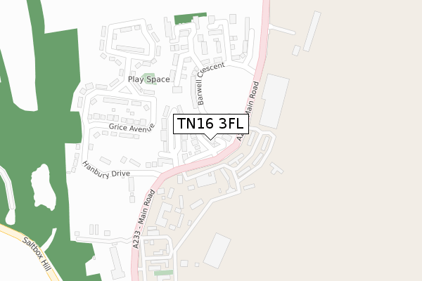
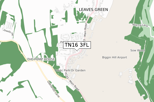
TN16 3FL is located in the Darwin electoral ward, within the London borough of Bromley and the English Parliamentary constituency of Orpington. The Sub Integrated Care Board (ICB) Location is NHS South East London ICB - 72Q and the police force is Metropolitan Police. This postcode has been in use since December 2018.


GetTheData
Source: OS Open Zoomstack (Ordnance Survey)
Licence: Open Government Licence (requires attribution)
Attribution: Contains OS data © Crown copyright and database right 2024
Source: Open Postcode Geo
Licence: Open Government Licence (requires attribution)
Attribution: Contains OS data © Crown copyright and database right 2024; Contains Royal Mail data © Royal Mail copyright and database right 2024; Source: Office for National Statistics licensed under the Open Government Licence v.3.0
| Easting | 541210 |
| Northing | 160906 |
| Latitude | 51.329727 |
| Longitude | 0.025485 |
GetTheData
Source: Open Postcode Geo
Licence: Open Government Licence
| Country | England |
| Postcode District | TN16 |
| ➜ TN16 open data dashboard ➜ See where TN16 is on a map ➜ Where is Biggin Hill? | |
GetTheData
Source: Land Registry Price Paid Data
Licence: Open Government Licence
| Ward | Darwin |
| Constituency | Orpington |
GetTheData
Source: ONS Postcode Database
Licence: Open Government Licence
6, VULCAN CLOSE, BIGGIN HILL, WESTERHAM, TN16 3FL 2020 25 JAN £549,950 |
5, VULCAN CLOSE, BIGGIN HILL, WESTERHAM, TN16 3FL 2019 3 MAY £586,950 |
11, VULCAN CLOSE, BIGGIN HILL, WESTERHAM, TN16 3FL 2019 15 FEB £574,950 |
9, VULCAN CLOSE, BIGGIN HILL, WESTERHAM, TN16 3FL 2019 28 JAN £599,950 |
1, VULCAN CLOSE, BIGGIN HILL, WESTERHAM, TN16 3FL 2019 3 JAN £574,950 |
8, VULCAN CLOSE, BIGGIN HILL, WESTERHAM, TN16 3FL 2018 21 DEC £549,950 |
7, VULCAN CLOSE, BIGGIN HILL, WESTERHAM, TN16 3FL 2018 21 DEC £600,000 |
10, VULCAN CLOSE, BIGGIN HILL, WESTERHAM, TN16 3FL 2018 19 DEC £599,950 |
4, VULCAN CLOSE, BIGGIN HILL, WESTERHAM, TN16 3FL 2018 17 DEC £574,950 |
2, VULCAN CLOSE, BIGGIN HILL, WESTERHAM, TN16 3FL 2018 14 DEC £574,950 |
GetTheData
Source: HM Land Registry Price Paid Data
Licence: Contains HM Land Registry data © Crown copyright and database right 2024. This data is licensed under the Open Government Licence v3.0.
| September 2022 | Anti-social behaviour | On or near Mouchotte Close | 277m |
| June 2022 | Violence and sexual offences | On or near Moxley Close | 52m |
| June 2022 | Anti-social behaviour | On or near Churchin Close | 187m |
| ➜ Get more crime data in our Crime section | |||
GetTheData
Source: data.police.uk
Licence: Open Government Licence
| Hanbury Drive (Main Road) | Leaves Green | 88m |
| Biggin Hill Airport Pass Term | Leaves Green | 150m |
| Hanbury Drive (Main Road) | Leaves Green | 193m |
| Biggin Hill Airport Pass Term | Leaves Green | 328m |
| Main Road Salt Box Hill | Leaves Green | 497m |
| Orpington Station | 6.6km |
GetTheData
Source: NaPTAN
Licence: Open Government Licence
| Percentage of properties with Next Generation Access | 100.0% |
| Percentage of properties with Superfast Broadband | 100.0% |
| Percentage of properties with Ultrafast Broadband | 100.0% |
| Percentage of properties with Full Fibre Broadband | 100.0% |
Superfast Broadband is between 30Mbps and 300Mbps
Ultrafast Broadband is > 300Mbps
| Percentage of properties unable to receive 2Mbps | 0.0% |
| Percentage of properties unable to receive 5Mbps | 0.0% |
| Percentage of properties unable to receive 10Mbps | 0.0% |
| Percentage of properties unable to receive 30Mbps | 0.0% |
GetTheData
Source: Ofcom
Licence: Ofcom Terms of Use (requires attribution)
GetTheData
Source: ONS Postcode Database
Licence: Open Government Licence


➜ Get more ratings from the Food Standards Agency
GetTheData
Source: Food Standards Agency
Licence: FSA terms & conditions
| Last Collection | |||
|---|---|---|---|
| Location | Mon-Fri | Sat | Distance |
| Leaves Green Tso | 17:00 | 12:00 | 706m |
| Christy Road | 17:15 | 11:15 | 1,317m |
| Biggin Hill Green | 17:45 | 09:45 | 1,550m |
GetTheData
Source: Dracos
Licence: Creative Commons Attribution-ShareAlike
| Facility | Distance |
|---|---|
| West Kent Golf Club Milking Lane, Downe, Orpington Golf | 1.2km |
| Oaklands Primary Academy Oaklands Lane, Biggin Hill Grass Pitches | 1.6km |
| Addington Sports Ground Layhams Road, Keston Grass Pitches | 1.6km |
GetTheData
Source: Active Places
Licence: Open Government Licence
| School | Phase of Education | Distance |
|---|---|---|
| Oaklands Primary Academy Oaklands Lane, Biggin Hill, Westerham, TN16 3DN | Primary | 1.6km |
| Meridian High School Fairchildes Avenue, New Addington, Croydon, CR0 0AH | Secondary | 1.9km |
| Biggin Hill Primary School Old Tye Avenue, Biggin Hill, Westerham, TN16 3LY | Primary | 2km |
GetTheData
Source: Edubase
Licence: Open Government Licence
The below table lists the International Territorial Level (ITL) codes (formerly Nomenclature of Territorial Units for Statistics (NUTS) codes) and Local Administrative Units (LAU) codes for TN16 3FL:
| ITL 1 Code | Name |
|---|---|
| TLI | London |
| ITL 2 Code | Name |
| TLI6 | Outer London - South |
| ITL 3 Code | Name |
| TLI61 | Bromley |
| LAU 1 Code | Name |
| E09000006 | Bromley |
GetTheData
Source: ONS Postcode Directory
Licence: Open Government Licence
The below table lists the Census Output Area (OA), Lower Layer Super Output Area (LSOA), and Middle Layer Super Output Area (MSOA) for TN16 3FL:
| Code | Name | |
|---|---|---|
| OA | E00166118 | |
| LSOA | E01000747 | Bromley 042B |
| MSOA | E02006789 | Bromley 042 |
GetTheData
Source: ONS Postcode Directory
Licence: Open Government Licence
| TN16 3GJ | Moxey Close | 64m |
| TN16 3EL | Vincent Square | 111m |
| TN16 3GD | Barwell Crescent | 121m |
| TN16 3EH | Main Road | 135m |
| TN16 3GF | Curchin Close | 184m |
| TN16 3EW | Grice Avenue | 231m |
| TN16 3GL | Turner Avenue | 242m |
| TN16 3ER | Keith Park Crescent | 251m |
| TN16 3EN | Hanbury Drive | 255m |
| TN16 3GG | Henderson Grove | 257m |
GetTheData
Source: Open Postcode Geo; Land Registry Price Paid Data
Licence: Open Government Licence