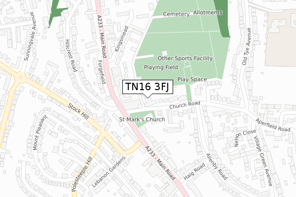
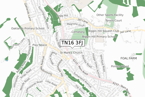
TN16 3FJ is located in the Biggin Hill electoral ward, within the London borough of Bromley and the English Parliamentary constituency of Orpington. The Sub Integrated Care Board (ICB) Location is NHS South East London ICB - 72Q and the police force is Metropolitan Police. This postcode has been in use since December 2017.


GetTheData
Source: OS Open Zoomstack (Ordnance Survey)
Licence: Open Government Licence (requires attribution)
Attribution: Contains OS data © Crown copyright and database right 2024
Source: Open Postcode Geo
Licence: Open Government Licence (requires attribution)
Attribution: Contains OS data © Crown copyright and database right 2024; Contains Royal Mail data © Royal Mail copyright and database right 2024; Source: Office for National Statistics licensed under the Open Government Licence v.3.0
| Easting | 541961 |
| Northing | 159002 |
| Latitude | 51.312429 |
| Longitude | 0.035499 |
GetTheData
Source: Open Postcode Geo
Licence: Open Government Licence
| Country | England |
| Postcode District | TN16 |
| ➜ TN16 open data dashboard ➜ See where TN16 is on a map ➜ Where is Biggin Hill? | |
GetTheData
Source: Land Registry Price Paid Data
Licence: Open Government Licence
| Ward | Biggin Hill |
| Constituency | Orpington |
GetTheData
Source: ONS Postcode Database
Licence: Open Government Licence
| January 2024 | Anti-social behaviour | On or near The Ridings | 100m |
| January 2024 | Anti-social behaviour | On or near The Ridings | 100m |
| January 2024 | Anti-social behaviour | On or near The Ridings | 100m |
| ➜ Get more crime data in our Crime section | |||
GetTheData
Source: data.police.uk
Licence: Open Government Licence
| Biggin Hill Library & Pool | Biggin Hill | 40m |
| Lebanon Gardens (Main Road) | Biggin Hill | 105m |
| Maple Leaf Close (Main Road) | Biggin Hill | 124m |
| Lebanon Gardens | Biggin Hill | 171m |
| Lebanon Gardens (Main Road) | Biggin Hill | 200m |
GetTheData
Source: NaPTAN
Licence: Open Government Licence
| Percentage of properties with Next Generation Access | 100.0% |
| Percentage of properties with Superfast Broadband | 100.0% |
| Percentage of properties with Ultrafast Broadband | 100.0% |
| Percentage of properties with Full Fibre Broadband | 100.0% |
Superfast Broadband is between 30Mbps and 300Mbps
Ultrafast Broadband is > 300Mbps
| Percentage of properties unable to receive 2Mbps | 0.0% |
| Percentage of properties unable to receive 5Mbps | 0.0% |
| Percentage of properties unable to receive 10Mbps | 0.0% |
| Percentage of properties unable to receive 30Mbps | 0.0% |
GetTheData
Source: Ofcom
Licence: Ofcom Terms of Use (requires attribution)
GetTheData
Source: ONS Postcode Database
Licence: Open Government Licence


➜ Get more ratings from the Food Standards Agency
GetTheData
Source: Food Standards Agency
Licence: FSA terms & conditions
| Last Collection | |||
|---|---|---|---|
| Location | Mon-Fri | Sat | Distance |
| Biggin Hill Post Office | 17:15 | 11:45 | 172m |
| Biggin Hill Sorting Office | 18:15 | 09:30 | 235m |
| Biggin Hill Sorting Office | 18:15 | 09:30 | 236m |
GetTheData
Source: Dracos
Licence: Creative Commons Attribution-ShareAlike
| Facility | Distance |
|---|---|
| Biggin Hill Pool Church Road, Biggin Hill, Westerham Swimming Pool, Studio | 58m |
| Biggin Hill Recreation Ground Church Road, Biggin Hill, Westerham Grass Pitches | 140m |
| Biggin Hill Primary School Old Tye Avenue, Biggin Hill, Westerham Grass Pitches | 493m |
GetTheData
Source: Active Places
Licence: Open Government Licence
| School | Phase of Education | Distance |
|---|---|---|
| Biggin Hill Primary School Old Tye Avenue, Biggin Hill, Westerham, TN16 3LY | Primary | 412m |
| Charles Darwin School Jail Lane, Biggin Hill, Westerham, TN16 3AU | Secondary | 766m |
| Oaklands Primary Academy Oaklands Lane, Biggin Hill, Westerham, TN16 3DN | Primary | 816m |
GetTheData
Source: Edubase
Licence: Open Government Licence
The below table lists the International Territorial Level (ITL) codes (formerly Nomenclature of Territorial Units for Statistics (NUTS) codes) and Local Administrative Units (LAU) codes for TN16 3FJ:
| ITL 1 Code | Name |
|---|---|
| TLI | London |
| ITL 2 Code | Name |
| TLI6 | Outer London - South |
| ITL 3 Code | Name |
| TLI61 | Bromley |
| LAU 1 Code | Name |
| E09000006 | Bromley |
GetTheData
Source: ONS Postcode Directory
Licence: Open Government Licence
The below table lists the Census Output Area (OA), Lower Layer Super Output Area (LSOA), and Middle Layer Super Output Area (MSOA) for TN16 3FJ:
| Code | Name | |
|---|---|---|
| OA | E00003168 | |
| LSOA | E01032570 | Bromley 042D |
| MSOA | E02006789 | Bromley 042 |
GetTheData
Source: ONS Postcode Directory
Licence: Open Government Licence
| TN16 3JW | Maple Leaf Close | 67m |
| TN16 3LB | Church Road | 74m |
| TN16 3JR | Main Road | 108m |
| TN16 3LE | The Ridings | 111m |
| TN16 3AY | Main Road | 133m |
| TN16 3UH | Temple Road | 165m |
| TN16 3JU | Main Road | 175m |
| TN16 3DS | Forgefield | 196m |
| TN16 3UB | Kingsmead | 207m |
| TN16 3JP | Main Road | 218m |
GetTheData
Source: Open Postcode Geo; Land Registry Price Paid Data
Licence: Open Government Licence