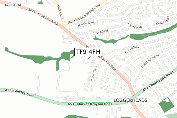
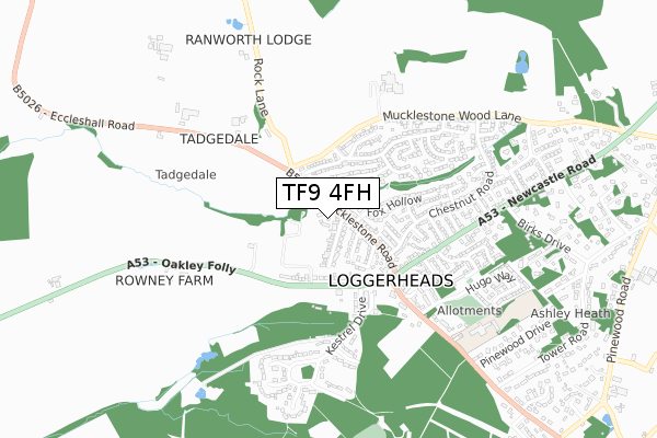
TF9 4FH is located in the Loggerheads electoral ward, within the local authority district of Newcastle-under-Lyme and the English Parliamentary constituency of Stone. The Sub Integrated Care Board (ICB) Location is NHS Staffordshire and Stoke-on-Trent ICB - 05G and the police force is Staffordshire. This postcode has been in use since November 2019.


GetTheData
Source: OS Open Zoomstack (Ordnance Survey)
Licence: Open Government Licence (requires attribution)
Attribution: Contains OS data © Crown copyright and database right 2024
Source: Open Postcode Geo
Licence: Open Government Licence (requires attribution)
Attribution: Contains OS data © Crown copyright and database right 2024; Contains Royal Mail data © Royal Mail copyright and database right 2024; Source: Office for National Statistics licensed under the Open Government Licence v.3.0
| Easting | 373552 |
| Northing | 336032 |
| Latitude | 52.921061 |
| Longitude | -2.394815 |
GetTheData
Source: Open Postcode Geo
Licence: Open Government Licence
| Country | England |
| Postcode District | TF9 |
| ➜ TF9 open data dashboard ➜ See where TF9 is on a map ➜ Where is Loggerheads? | |
GetTheData
Source: Land Registry Price Paid Data
Licence: Open Government Licence
| Ward | Loggerheads |
| Constituency | Stone |
GetTheData
Source: ONS Postcode Database
Licence: Open Government Licence
14, LEIGHTON VIEW, LOGGERHEADS, MARKET DRAYTON, TF9 4FH 2023 20 JAN £355,000 |
72, LEIGHTON VIEW, LOGGERHEADS, MARKET DRAYTON, TF9 4FH 2022 11 NOV £304,995 |
26, LEIGHTON VIEW, LOGGERHEADS, MARKET DRAYTON, TF9 4FH 2022 11 NOV £275,000 |
71, LEIGHTON VIEW, LOGGERHEADS, MARKET DRAYTON, TF9 4FH 2022 30 SEP £264,995 |
73, LEIGHTON VIEW, LOGGERHEADS, MARKET DRAYTON, TF9 4FH 2022 29 SEP £299,995 |
74, LEIGHTON VIEW, LOGGERHEADS, MARKET DRAYTON, TF9 4FH 2022 29 SEP £349,995 |
2, LEIGHTON VIEW, LOGGERHEADS, MARKET DRAYTON, TF9 4FH 2022 26 AUG £399,995 |
1, LEIGHTON VIEW, LOGGERHEADS, MARKET DRAYTON, TF9 4FH 2022 19 AUG £369,995 |
61, LEIGHTON VIEW, LOGGERHEADS, MARKET DRAYTON, TF9 4FH 2022 27 JUN £344,995 |
57, LEIGHTON VIEW, LOGGERHEADS, MARKET DRAYTON, TF9 4FH 2022 10 JUN £319,995 |
GetTheData
Source: HM Land Registry Price Paid Data
Licence: Contains HM Land Registry data © Crown copyright and database right 2024. This data is licensed under the Open Government Licence v3.0.
| May 2023 | Violence and sexual offences | On or near Mucklestone Road | 171m |
| June 2022 | Violence and sexual offences | On or near Tadgedale Avenue | 172m |
| June 2022 | Criminal damage and arson | On or near Tadgedale Avenue | 172m |
| ➜ Get more crime data in our Crime section | |||
GetTheData
Source: data.police.uk
Licence: Open Government Licence
| Loggerheads Hotel (Market Drayton Rd) | Loggerheads | 301m |
| Loggerheads Hotel (Market Drayton Rd) | Loggerheads | 326m |
| The Paddock (Newcastle Rd) | Loggerheads | 599m |
| Hugo Meynell School (Eccleshall Road) | Loggerheads | 668m |
| The Paddock (Newcastle Rd) | Loggerheads | 702m |
GetTheData
Source: NaPTAN
Licence: Open Government Licence
GetTheData
Source: ONS Postcode Database
Licence: Open Government Licence


➜ Get more ratings from the Food Standards Agency
GetTheData
Source: Food Standards Agency
Licence: FSA terms & conditions
| Last Collection | |||
|---|---|---|---|
| Location | Mon-Fri | Sat | Distance |
| Norton Post Office | 16:00 | 09:00 | 4,135m |
| Betton | 16:00 | 11:15 | 4,491m |
| Bellaport Road | 10:30 | 10:30 | 4,780m |
GetTheData
Source: Dracos
Licence: Creative Commons Attribution-ShareAlike
| Facility | Distance |
|---|---|
| The Burntwood Eccleshall Road, Loggerheads, Newcastle Under Lyme Grass Pitches | 804m |
| Norton In Hales Community Sports Club Bearstone Road, Norton In Hales Grass Pitches, Outdoor Tennis Courts | 4.2km |
GetTheData
Source: Active Places
Licence: Open Government Licence
| School | Phase of Education | Distance |
|---|---|---|
| Hugo Meynell CofE (VC) Primary School Eccleshall Road, Loggerheads, Market Drayton, TF9 4NU | Primary | 739m |
| St Mary's CofE (A) Primary School Mucklestone, Market Drayton, TF9 4DN | Primary | 1.7km |
| Norton-in-Hales CofE Primary School Main Road, Norton-in-Hales, Market Drayton, TF9 4AT | Primary | 4.2km |
GetTheData
Source: Edubase
Licence: Open Government Licence
The below table lists the International Territorial Level (ITL) codes (formerly Nomenclature of Territorial Units for Statistics (NUTS) codes) and Local Administrative Units (LAU) codes for TF9 4FH:
| ITL 1 Code | Name |
|---|---|
| TLG | West Midlands (England) |
| ITL 2 Code | Name |
| TLG2 | Shropshire and Staffordshire |
| ITL 3 Code | Name |
| TLG24 | Staffordshire CC |
| LAU 1 Code | Name |
| E07000195 | Newcastle-under-Lyme |
GetTheData
Source: ONS Postcode Directory
Licence: Open Government Licence
The below table lists the Census Output Area (OA), Lower Layer Super Output Area (LSOA), and Middle Layer Super Output Area (MSOA) for TF9 4FH:
| Code | Name | |
|---|---|---|
| OA | E00150674 | |
| LSOA | E01029569 | Newcastle-under-Lyme 016A |
| MSOA | E02006173 | Newcastle-under-Lyme 016 |
GetTheData
Source: ONS Postcode Directory
Licence: Open Government Licence
| TF9 4DF | Price Close | 81m |
| TF9 4BS | Market Drayton Road | 147m |
| TF9 4EY | Hemp Mill Walk | 183m |
| TF9 4DD | Tadgedale Avenue | 183m |
| TF9 4BT | Market Drayton Road | 190m |
| TF9 4ES | Mucklestone Road | 190m |
| TF9 4DB | Rowney Close | 227m |
| TF9 4ER | Mucklestone Road | 229m |
| TF9 4DX | Folly View | 234m |
| TF9 4DG | Tadgedale | 247m |
GetTheData
Source: Open Postcode Geo; Land Registry Price Paid Data
Licence: Open Government Licence