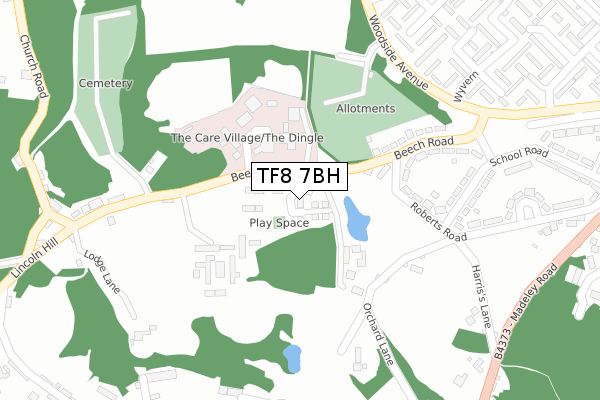
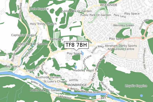
TF8 7BH is located in the Ironbridge Gorge electoral ward, within the unitary authority of Telford and Wrekin and the English Parliamentary constituency of Telford. The Sub Integrated Care Board (ICB) Location is NHS Shropshire, Telford and Wrekin ICB - M2L0M and the police force is West Mercia. This postcode has been in use since July 2019.


GetTheData
Source: OS Open Zoomstack (Ordnance Survey)
Licence: Open Government Licence (requires attribution)
Attribution: Contains OS data © Crown copyright and database right 2024
Source: Open Postcode Geo
Licence: Open Government Licence (requires attribution)
Attribution: Contains OS data © Crown copyright and database right 2024; Contains Royal Mail data © Royal Mail copyright and database right 2024; Source: Office for National Statistics licensed under the Open Government Licence v.3.0
| Easting | 367566 |
| Northing | 304026 |
| Latitude | 52.633024 |
| Longitude | -2.480660 |
GetTheData
Source: Open Postcode Geo
Licence: Open Government Licence
| Country | England |
| Postcode District | TF8 |
| ➜ TF8 open data dashboard ➜ See where TF8 is on a map ➜ Where is Telford? | |
GetTheData
Source: Land Registry Price Paid Data
Licence: Open Government Licence
| Ward | Ironbridge Gorge |
| Constituency | Telford |
GetTheData
Source: ONS Postcode Database
Licence: Open Government Licence
2022 26 SEP £410,000 |
47, MOLLETT DRIVE, IRONBRIDGE, TELFORD, TF8 7BH 2022 23 APR £299,950 |
49, MOLLETT DRIVE, IRONBRIDGE, TELFORD, TF8 7BH 2021 21 APR £299,950 |
2, MOLLETT DRIVE, IRONBRIDGE, TELFORD, TF8 7BH 2021 16 APR £329,950 |
53, MOLLETT DRIVE, IRONBRIDGE, TELFORD, TF8 7BH 2021 6 APR £299,950 |
59, MOLLETT DRIVE, IRONBRIDGE, TELFORD, TF8 7BH 2021 19 MAR £329,950 |
55, MOLLETT DRIVE, IRONBRIDGE, TELFORD, TF8 7BH 2021 19 MAR £299,950 |
57, MOLLETT DRIVE, IRONBRIDGE, TELFORD, TF8 7BH 2021 5 MAR £339,950 |
4, MOLLETT DRIVE, IRONBRIDGE, TELFORD, TF8 7BH 2021 19 FEB £329,000 |
51, MOLLETT DRIVE, IRONBRIDGE, TELFORD, TF8 7BH 2021 5 FEB £334,950 |
GetTheData
Source: HM Land Registry Price Paid Data
Licence: Contains HM Land Registry data © Crown copyright and database right 2024. This data is licensed under the Open Government Licence v3.0.
| August 2023 | Public order | On or near Roberts Road | 409m |
| August 2023 | Violence and sexual offences | On or near Roberts Road | 409m |
| August 2023 | Violence and sexual offences | On or near Roberts Road | 409m |
| ➜ Get more crime data in our Crime section | |||
GetTheData
Source: data.police.uk
Licence: Open Government Licence
| Wyvern (Woodside Avenue) | Woodside | 295m |
| Wyvern (Woodside Avenue) | Woodside | 306m |
| Warrensway (Woodside Avenue) | Woodside | 413m |
| Warrensway (Woodside Avenue) | Woodside | 423m |
| Belmont Road (Madeley Road) | Madeley | 564m |
GetTheData
Source: NaPTAN
Licence: Open Government Licence
GetTheData
Source: ONS Postcode Database
Licence: Open Government Licence


➜ Get more ratings from the Food Standards Agency
GetTheData
Source: Food Standards Agency
Licence: FSA terms & conditions
| Last Collection | |||
|---|---|---|---|
| Location | Mon-Fri | Sat | Distance |
| Belmont Road | 16:30 | 11:00 | 513m |
| Ironbridge Post Office | 17:00 | 11:00 | 615m |
| Coalbrookdale | 15:45 | 10:45 | 842m |
GetTheData
Source: Dracos
Licence: Creative Commons Attribution-ShareAlike
| Facility | Distance |
|---|---|
| Abraham Darby Academy (Closed) Ironbridge Road, Madeley, Telford Grass Pitches, Sports Hall, Studio | 808m |
| Abraham Darby Sports And Leisure Centre Ironbridge Road, Madeley, Telford Health and Fitness Gym, Swimming Pool, Sports Hall, Studio, Grass Pitches | 836m |
| Broseley Cricket Club Woodlands Road, Broseley Wood, Broseley Grass Pitches | 1.4km |
GetTheData
Source: Active Places
Licence: Open Government Licence
| School | Phase of Education | Distance |
|---|---|---|
| Aspris Telford School Dale Road, Telford, TF8 7DT | Not applicable | 660m |
| Haberdashers' Abraham Darby Ironbridge Road, Madeley, Telford, TF7 5HX | Secondary | 727m |
| Woodlands Primary School Ironbridge Road, Madeley, Telford, TF7 5HX | Primary | 729m |
GetTheData
Source: Edubase
Licence: Open Government Licence
The below table lists the International Territorial Level (ITL) codes (formerly Nomenclature of Territorial Units for Statistics (NUTS) codes) and Local Administrative Units (LAU) codes for TF8 7BH:
| ITL 1 Code | Name |
|---|---|
| TLG | West Midlands (England) |
| ITL 2 Code | Name |
| TLG2 | Shropshire and Staffordshire |
| ITL 3 Code | Name |
| TLG21 | Telford and Wrekin |
| LAU 1 Code | Name |
| E06000020 | Telford and Wrekin |
GetTheData
Source: ONS Postcode Directory
Licence: Open Government Licence
The below table lists the Census Output Area (OA), Lower Layer Super Output Area (LSOA), and Middle Layer Super Output Area (MSOA) for TF8 7BH:
| Code | Name | |
|---|---|---|
| OA | E00071454 | |
| LSOA | E01014148 | Telford and Wrekin 010B |
| MSOA | E02002937 | Telford and Wrekin 010 |
GetTheData
Source: ONS Postcode Directory
Licence: Open Government Licence
| TF7 5JN | Beech Road | 180m |
| TF8 7PA | Woodlands | 220m |
| TF7 5JW | Beech Road | 231m |
| TF7 5JL | Roberts Road | 240m |
| TF8 7NY | Lincoln Hill | 277m |
| TF7 5JP | Beech Road | 295m |
| TF7 5UB | Newcomen Way | 339m |
| TF7 5JQ | School Road | 339m |
| TF7 5QH | Wyvern | 364m |
| TF8 7QQ | Hodge Bower | 371m |
GetTheData
Source: Open Postcode Geo; Land Registry Price Paid Data
Licence: Open Government Licence