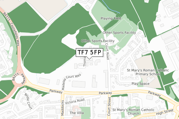
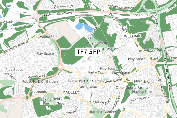
TF7 5FP is located in the Madeley & Sutton Hill electoral ward, within the unitary authority of Telford and Wrekin and the English Parliamentary constituency of Telford. The Sub Integrated Care Board (ICB) Location is NHS Shropshire, Telford and Wrekin ICB - M2L0M and the police force is West Mercia. This postcode has been in use since December 2017.


GetTheData
Source: OS Open Zoomstack (Ordnance Survey)
Licence: Open Government Licence (requires attribution)
Attribution: Contains OS data © Crown copyright and database right 2025
Source: Open Postcode Geo
Licence: Open Government Licence (requires attribution)
Attribution: Contains OS data © Crown copyright and database right 2025; Contains Royal Mail data © Royal Mail copyright and database right 2025; Source: Office for National Statistics licensed under the Open Government Licence v.3.0
| Easting | 369563 |
| Northing | 304773 |
| Latitude | 52.639855 |
| Longitude | -2.451224 |
GetTheData
Source: Open Postcode Geo
Licence: Open Government Licence
| Country | England |
| Postcode District | TF7 |
➜ See where TF7 is on a map ➜ Where is Telford? | |
GetTheData
Source: Land Registry Price Paid Data
Licence: Open Government Licence
| Ward | Madeley & Sutton Hill |
| Constituency | Telford |
GetTheData
Source: ONS Postcode Database
Licence: Open Government Licence
| Court Centre (Parkway) | Madeley | 181m |
| Court Centre (Parkway) | Madeley | 204m |
| Madeley Centre (Court Street) | Madeley | 329m |
| Madeley Centre (Park Avenue) | Madeley | 384m |
| Parkway (Castlefields Way) | Woodside | 388m |
| Telford Central Station | 4.6km |
GetTheData
Source: NaPTAN
Licence: Open Government Licence
| Percentage of properties with Next Generation Access | 100.0% |
| Percentage of properties with Superfast Broadband | 100.0% |
| Percentage of properties with Ultrafast Broadband | 100.0% |
| Percentage of properties with Full Fibre Broadband | 100.0% |
Superfast Broadband is between 30Mbps and 300Mbps
Ultrafast Broadband is > 300Mbps
| Median download speed | 100.0Mbps |
| Average download speed | 108.8Mbps |
| Maximum download speed | 200.00Mbps |
Ofcom does not currently provide upload speed data for TF7 5FP. This is because there are less than four broadband connections in this postcode.
| Percentage of properties unable to receive 2Mbps | 0.0% |
| Percentage of properties unable to receive 5Mbps | 0.0% |
| Percentage of properties unable to receive 10Mbps | 0.0% |
| Percentage of properties unable to receive 30Mbps | 0.0% |
GetTheData
Source: Ofcom
Licence: Ofcom Terms of Use (requires attribution)
GetTheData
Source: ONS Postcode Database
Licence: Open Government Licence


➜ Get more ratings from the Food Standards Agency
GetTheData
Source: Food Standards Agency
Licence: FSA terms & conditions
| Last Collection | |||
|---|---|---|---|
| Location | Mon-Fri | Sat | Distance |
| Madeley Post Office | 17:15 | 11:15 | 388m |
| High Street | 16:45 | 11:00 | 486m |
| Tweedale Industrial Estate | 18:15 | 12:00 | 625m |
GetTheData
Source: Dracos
Licence: Creative Commons Attribution-ShareAlike
The below table lists the International Territorial Level (ITL) codes (formerly Nomenclature of Territorial Units for Statistics (NUTS) codes) and Local Administrative Units (LAU) codes for TF7 5FP:
| ITL 1 Code | Name |
|---|---|
| TLG | West Midlands (England) |
| ITL 2 Code | Name |
| TLG2 | Shropshire and Staffordshire |
| ITL 3 Code | Name |
| TLG21 | Telford and Wrekin |
| LAU 1 Code | Name |
| E06000020 | Telford and Wrekin |
GetTheData
Source: ONS Postcode Directory
Licence: Open Government Licence
The below table lists the Census Output Area (OA), Lower Layer Super Output Area (LSOA), and Middle Layer Super Output Area (MSOA) for TF7 5FP:
| Code | Name | |
|---|---|---|
| OA | E00071503 | |
| LSOA | E01014162 | Telford and Wrekin 022D |
| MSOA | E02002949 | Telford and Wrekin 022 |
GetTheData
Source: ONS Postcode Directory
Licence: Open Government Licence
| TF7 5EE | Court Street | 114m |
| TF7 5EG | Court Street | 114m |
| TF7 5ED | Court Street | 152m |
| TF7 5EL | Coronation Crescent | 201m |
| TF7 5EW | Coronation Crescent | 207m |
| TF7 5EQ | Coronation Crescent | 211m |
| TF7 5EN | Coronation Crescent | 231m |
| TF7 5EJ | Coronation Crescent | 241m |
| TF7 5FF | Russell Court | 242m |
| TF7 5LL | Shelsy Court | 249m |
GetTheData
Source: Open Postcode Geo; Land Registry Price Paid Data
Licence: Open Government Licence