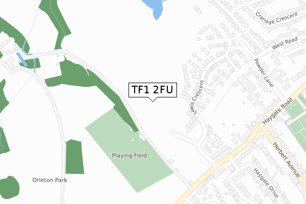
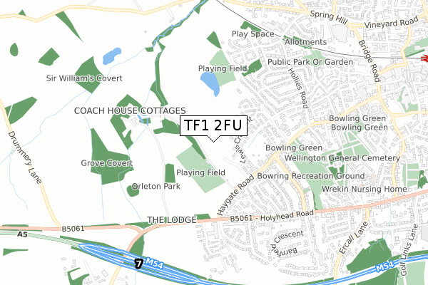
TF1 2FU is located in the Haygate & Park electoral ward, within the unitary authority of Telford and Wrekin and the English Parliamentary constituency of The Wrekin. The Sub Integrated Care Board (ICB) Location is NHS Shropshire, Telford and Wrekin ICB - M2L0M and the police force is West Mercia. This postcode has been in use since September 2019.


GetTheData
Source: OS Open Zoomstack (Ordnance Survey)
Licence: Open Government Licence (requires attribution)
Attribution: Contains OS data © Crown copyright and database right 2025
Source: Open Postcode Geo
Licence: Open Government Licence (requires attribution)
Attribution: Contains OS data © Crown copyright and database right 2025; Contains Royal Mail data © Royal Mail copyright and database right 2025; Source: Office for National Statistics licensed under the Open Government Licence v.3.0
| Easting | 363924 |
| Northing | 311161 |
| Latitude | 52.697148 |
| Longitude | -2.535388 |
GetTheData
Source: Open Postcode Geo
Licence: Open Government Licence
| Country | England |
| Postcode District | TF1 |
➜ See where TF1 is on a map ➜ Where is Telford? | |
GetTheData
Source: Land Registry Price Paid Data
Licence: Open Government Licence
| Ward | Haygate & Park |
| Constituency | The Wrekin |
GetTheData
Source: ONS Postcode Database
Licence: Open Government Licence
2024 9 FEB £280,000 |
9, LOFTED DRIVE, WELLINGTON, TELFORD, TF1 2FU 2022 29 JUL £354,995 |
2022 30 JUN £266,646 |
3, LOFTED DRIVE, WELLINGTON, TELFORD, TF1 2FU 2022 24 JUN £359,995 |
12, LOFTED DRIVE, WELLINGTON, TELFORD, TF1 2FU 2022 17 JUN £479,995 |
10, LOFTED DRIVE, WELLINGTON, TELFORD, TF1 2FU 2022 31 MAY £359,995 |
GetTheData
Source: HM Land Registry Price Paid Data
Licence: Contains HM Land Registry data © Crown copyright and database right 2025. This data is licensed under the Open Government Licence v3.0.
| Falcon Hotel (Haygate Road) | Wellington | 397m |
| Falcon Hotel (Holyhead Road) | Wellington | 446m |
| Bowing (Herbert Avenue) | Wellington | 458m |
| Falcon Hotel (Holyhead Road) | Wellington | 459m |
| Powder Lane (Haygate Road) | Wellington | 459m |
| Wellington (Shropshire) Station | 1.3km |
GetTheData
Source: NaPTAN
Licence: Open Government Licence
GetTheData
Source: ONS Postcode Database
Licence: Open Government Licence


➜ Get more ratings from the Food Standards Agency
GetTheData
Source: Food Standards Agency
Licence: FSA terms & conditions
| Last Collection | |||
|---|---|---|---|
| Location | Mon-Fri | Sat | Distance |
| Haygate Road | 16:15 | 10:45 | 435m |
| Holyhead Road | 16:15 | 10:30 | 455m |
| Lawrence Road | 16:15 | 10:45 | 530m |
GetTheData
Source: Dracos
Licence: Creative Commons Attribution-ShareAlike
The below table lists the International Territorial Level (ITL) codes (formerly Nomenclature of Territorial Units for Statistics (NUTS) codes) and Local Administrative Units (LAU) codes for TF1 2FU:
| ITL 1 Code | Name |
|---|---|
| TLG | West Midlands (England) |
| ITL 2 Code | Name |
| TLG2 | Shropshire and Staffordshire |
| ITL 3 Code | Name |
| TLG21 | Telford and Wrekin |
| LAU 1 Code | Name |
| E06000020 | Telford and Wrekin |
GetTheData
Source: ONS Postcode Directory
Licence: Open Government Licence
The below table lists the Census Output Area (OA), Lower Layer Super Output Area (LSOA), and Middle Layer Super Output Area (MSOA) for TF1 2FU:
| Code | Name | |
|---|---|---|
| OA | E00071708 | |
| LSOA | E01014202 | Telford and Wrekin 010D |
| MSOA | E02002937 | Telford and Wrekin 010 |
GetTheData
Source: ONS Postcode Directory
Licence: Open Government Licence
| TF1 2BW | Haygate Road | 301m |
| TF1 2DA | Haygate Road | 325m |
| TF1 2BU | Haygate Road | 327m |
| TF1 2BL | Powder Lane | 395m |
| TF1 2BA | Addison Road | 406m |
| TF1 2BN | Haygate Road | 415m |
| TF1 2EJ | Farmstead Court | 431m |
| TF1 2PQ | Pendil Close | 435m |
| TF1 2HA | Holyhead Road | 440m |
| TF1 2DD | Holyhead Road | 460m |
GetTheData
Source: Open Postcode Geo; Land Registry Price Paid Data
Licence: Open Government Licence