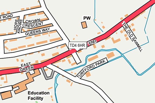
TD4 6HR is located in the Leaderdale and Melrose electoral ward, within the council area of Scottish Borders and the Scottish Parliamentary constituency of Berwickshire, Roxburgh and Selkirk. The Community Health Partnership is Scottish Borders Community Health & Care Partnership and the police force is Scotland. This postcode has been in use since January 1980.


GetTheData
Source: OS OpenMap – Local (Ordnance Survey)
Source: OS VectorMap District (Ordnance Survey)
Licence: Open Government Licence (requires attribution)
| Easting | 358033 |
| Northing | 638651 |
| Latitude | 55.639588 |
| Longitude | -2.668256 |
GetTheData
Source: Open Postcode Geo
Licence: Open Government Licence
| Country | Scotland |
| Postcode District | TD4 |
| ➜ TD4 open data dashboard ➜ See where TD4 is on a map ➜ Where is Earlston? | |
GetTheData
Source: Land Registry Price Paid Data
Licence: Open Government Licence
| Ward | Leaderdale And Melrose |
| Constituency | Berwickshire, Roxburgh And Selkirk |
GetTheData
Source: ONS Postcode Database
Licence: Open Government Licence
| Summerfield (Unnamed Rd) | Earlston | 129m |
| East Green Nursery (East Green) | Earlston | 144m |
| East Green Nursery (East Green) | Earlston | 148m |
| East End Church (Church Street) | Earlston | 188m |
| East End Church (Church Street) | Earlston | 214m |
GetTheData
Source: NaPTAN
Licence: Open Government Licence
GetTheData
Source: ONS Postcode Database
Licence: Open Government Licence


➜ Get more ratings from the Food Standards Agency
GetTheData
Source: Food Standards Agency
Licence: FSA terms & conditions
| Last Collection | |||
|---|---|---|---|
| Location | Mon-Fri | Sat | Distance |
| East End | 16:15 | 08:45 | 91m |
| Earlston Post Office | 16:00 | 12:00 | 615m |
| West End | 16:15 | 11:15 | 751m |
GetTheData
Source: Dracos
Licence: Creative Commons Attribution-ShareAlike
The below table lists the International Territorial Level (ITL) codes (formerly Nomenclature of Territorial Units for Statistics (NUTS) codes) and Local Administrative Units (LAU) codes for TD4 6HR:
| ITL 1 Code | Name |
|---|---|
| TLM | Scotland |
| ITL 2 Code | Name |
| TLM9 | Southern Scotland |
| ITL 3 Code | Name |
| TLM91 | Scottish Borders |
| LAU 1 Code | Name |
| S30000007 | Scottish Borders |
GetTheData
Source: ONS Postcode Directory
Licence: Open Government Licence
The below table lists the Census Output Area (OA), Lower Layer Super Output Area (LSOA), and Middle Layer Super Output Area (MSOA) for TD4 6HR:
| Code | Name | |
|---|---|---|
| OA | S00095434 | |
| LSOA | S01012270 | Earlston - East |
| MSOA | S02002296 | Earlston Stow and Clovernfords Area |
GetTheData
Source: ONS Postcode Directory
Licence: Open Government Licence