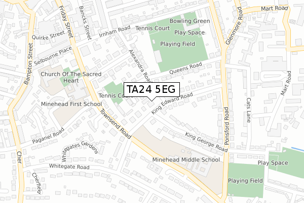
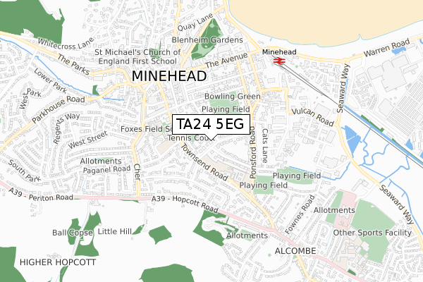
TA24 5EG is located in the Minehead electoral ward, within the unitary authority of Somerset and the English Parliamentary constituency of Bridgwater and West Somerset. The Sub Integrated Care Board (ICB) Location is NHS Somerset ICB - 11X and the police force is Avon and Somerset. This postcode has been in use since September 2018.


GetTheData
Source: OS Open Zoomstack (Ordnance Survey)
Licence: Open Government Licence (requires attribution)
Attribution: Contains OS data © Crown copyright and database right 2024
Source: Open Postcode Geo
Licence: Open Government Licence (requires attribution)
Attribution: Contains OS data © Crown copyright and database right 2024; Contains Royal Mail data © Royal Mail copyright and database right 2024; Source: Office for National Statistics licensed under the Open Government Licence v.3.0
| Easting | 297102 |
| Northing | 145828 |
| Latitude | 51.202365 |
| Longitude | -3.474222 |
GetTheData
Source: Open Postcode Geo
Licence: Open Government Licence
| Country | England |
| Postcode District | TA24 |
| ➜ TA24 open data dashboard ➜ See where TA24 is on a map ➜ Where is Minehead? | |
GetTheData
Source: Land Registry Price Paid Data
Licence: Open Government Licence
| Ward | Minehead |
| Constituency | Bridgwater And West Somerset |
GetTheData
Source: ONS Postcode Database
Licence: Open Government Licence
| June 2022 | Public order | On or near Sports/Recreation Area | 165m |
| June 2022 | Burglary | On or near Sports/Recreation Area | 165m |
| June 2022 | Violence and sexual offences | On or near Selbourne Place | 362m |
| ➜ Get more crime data in our Crime section | |||
GetTheData
Source: data.police.uk
Licence: Open Government Licence
| King Edward Road (Townsend Road) | Minehead | 122m |
| Minehead Hospital (Paganel Road) | Minehead | 205m |
| Minehead Middle School | Minehead | 220m |
| Minehead Middle School | Minehead | 229m |
| Queens Road (Ponsford Road) | Minehead | 246m |
| Minehead (West Somerset Railway) | Minehead | 621m |
GetTheData
Source: NaPTAN
Licence: Open Government Licence
GetTheData
Source: ONS Postcode Database
Licence: Open Government Licence


➜ Get more ratings from the Food Standards Agency
GetTheData
Source: Food Standards Agency
Licence: FSA terms & conditions
| Last Collection | |||
|---|---|---|---|
| Location | Mon-Fri | Sat | Distance |
| The Avenue Post Office | 17:00 | 12:30 | 435m |
| Staunton Road | 16:30 | 12:15 | 630m |
| Church Street | 16:30 | 12:30 | 982m |
GetTheData
Source: Dracos
Licence: Creative Commons Attribution-ShareAlike
| Facility | Distance |
|---|---|
| The Lawns Community Hall Townsend Road, Minehead Sports Hall | 103m |
| Minehead Lawn Tennis Club Townsend Road, Minehead Outdoor Tennis Courts | 135m |
| Irnham Road Recreation Ground Irnham Road, Minehead Grass Pitches, Outdoor Tennis Courts | 166m |
GetTheData
Source: Active Places
Licence: Open Government Licence
| School | Phase of Education | Distance |
|---|---|---|
| Minehead First School Townsend Road, Minehead, TA24 5RG | Primary | 235m |
| Minehead Middle School Ponsford Road, Minehead, TA24 5RH | Middle deemed secondary | 270m |
| Aurora Foxes Selbourne Place, Minehead, TA24 5TY | Not applicable | 343m |
GetTheData
Source: Edubase
Licence: Open Government Licence
The below table lists the International Territorial Level (ITL) codes (formerly Nomenclature of Territorial Units for Statistics (NUTS) codes) and Local Administrative Units (LAU) codes for TA24 5EG:
| ITL 1 Code | Name |
|---|---|
| TLK | South West (England) |
| ITL 2 Code | Name |
| TLK2 | Dorset and Somerset |
| ITL 3 Code | Name |
| TLK23 | Somerset CC |
| LAU 1 Code | Name |
| E07000246 | Somerset West and Taunton |
GetTheData
Source: ONS Postcode Directory
Licence: Open Government Licence
The below table lists the Census Output Area (OA), Lower Layer Super Output Area (LSOA), and Middle Layer Super Output Area (MSOA) for TA24 5EG:
| Code | Name | |
|---|---|---|
| OA | E00149452 | |
| LSOA | E01029329 | West Somerset 001C |
| MSOA | E02006113 | West Somerset 001 |
GetTheData
Source: ONS Postcode Directory
Licence: Open Government Licence
| TA24 5JB | King Edward Road | 39m |
| TA24 5LD | Alexandra Gardens | 61m |
| TA24 5DR | Alexandra Road | 96m |
| TA24 5RQ | Townsend Road | 139m |
| TA24 5EA | King Edward Road | 143m |
| TA24 5DS | Warden Road | 156m |
| TA24 5DZ | Queens Road | 164m |
| TA24 5JD | King George Road | 178m |
| TA24 5DP | Alexandra Road | 184m |
| TA24 5RN | Kildare Gardens | 215m |
GetTheData
Source: Open Postcode Geo; Land Registry Price Paid Data
Licence: Open Government Licence