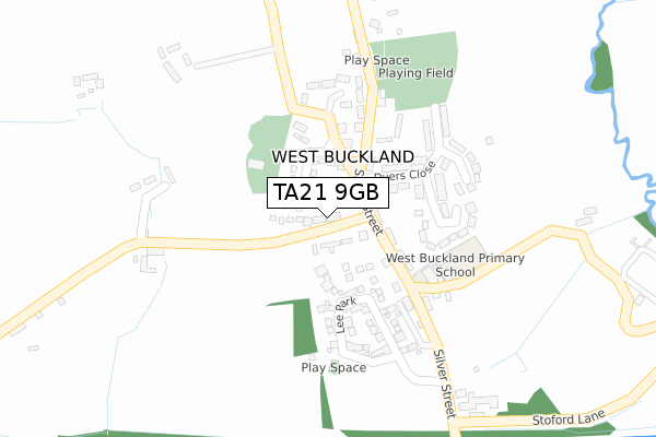
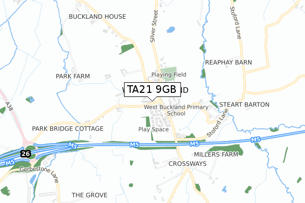
TA21 9GB is located in the Wellington electoral ward, within the unitary authority of Somerset and the English Parliamentary constituency of Taunton Deane. The Sub Integrated Care Board (ICB) Location is NHS Somerset ICB - 11X and the police force is Avon and Somerset. This postcode has been in use since June 2019.


GetTheData
Source: OS Open Zoomstack (Ordnance Survey)
Licence: Open Government Licence (requires attribution)
Attribution: Contains OS data © Crown copyright and database right 2024
Source: Open Postcode Geo
Licence: Open Government Licence (requires attribution)
Attribution: Contains OS data © Crown copyright and database right 2024; Contains Royal Mail data © Royal Mail copyright and database right 2024; Source: Office for National Statistics licensed under the Open Government Licence v.3.0
| Easting | 314816 |
| Northing | 120066 |
| Latitude | 50.973678 |
| Longitude | -3.214654 |
GetTheData
Source: Open Postcode Geo
Licence: Open Government Licence
| Country | England |
| Postcode District | TA21 |
| ➜ TA21 open data dashboard ➜ See where TA21 is on a map ➜ Where is Wellington? | |
GetTheData
Source: Land Registry Price Paid Data
Licence: Open Government Licence
| Ward | Wellington |
| Constituency | Taunton Deane |
GetTheData
Source: ONS Postcode Database
Licence: Open Government Licence
10, JURSTON WALK, WELLINGTON, TA21 9GB 2020 24 JUL £405,000 |
5, JURSTON WALK, WELLINGTON, TA21 9GB 2020 12 JUN £304,950 |
4, JURSTON WALK, WELLINGTON, TA21 9GB 2020 13 MAR £384,950 |
3, JURSTON WALK, WELLINGTON, TA21 9GB 2019 19 DEC £379,950 |
2, JURSTON WALK, WELLINGTON, TA21 9GB 2019 5 DEC £369,950 |
GetTheData
Source: HM Land Registry Price Paid Data
Licence: Contains HM Land Registry data © Crown copyright and database right 2024. This data is licensed under the Open Government Licence v3.0.
| January 2024 | Violence and sexual offences | On or near Jurston Lane | 255m |
| December 2023 | Public order | On or near Jurston Lane | 255m |
| November 2023 | Violence and sexual offences | On or near Jurston Lane | 255m |
| ➜ Get more crime data in our Crime section | |||
GetTheData
Source: data.police.uk
Licence: Open Government Licence
| Beech Hill | Wellington | 262m |
| Pyles Thorne (Pyles Thorne Road) | Middle Green | 355m |
| Pyles Thorne (Pyles Thorne Road) | Middle Green | 367m |
| Pyles Thorne Close | Wellington | 449m |
| Beech Hill Stores (Beech Hill) | Wellington | 460m |
GetTheData
Source: NaPTAN
Licence: Open Government Licence
GetTheData
Source: ONS Postcode Database
Licence: Open Government Licence


➜ Get more ratings from the Food Standards Agency
GetTheData
Source: Food Standards Agency
Licence: FSA terms & conditions
| Last Collection | |||
|---|---|---|---|
| Location | Mon-Fri | Sat | Distance |
| Longforth Road | 16:30 | 12:30 | 1,496m |
| Ford Steet | 11:00 | 11:00 | 1,711m |
| Rockwell Green Post Office | 17:00 | 11:30 | 2,016m |
GetTheData
Source: Dracos
Licence: Creative Commons Attribution-ShareAlike
| Facility | Distance |
|---|---|
| The Princess Royal Sports Complex South Street, Wellington Sports Hall, Swimming Pool, Health and Fitness Gym, Artificial Grass Pitch, Grass Pitches, Studio, Squash Courts | 785m |
| Anytime Fitness (Wellington) Westpark, Westpark, Chelston, Wellington Health and Fitness Gym | 992m |
| Wellington Playing Field North Street, Wellington Grass Pitches, Outdoor Tennis Courts | 1.3km |
GetTheData
Source: Active Places
Licence: Open Government Licence
| School | Phase of Education | Distance |
|---|---|---|
| Wellesley Park Primary School Homefield, Wellington, TA21 9AJ | Primary | 725m |
| Wellington School South Street, Wellington, TA21 8NT | Not applicable | 785m |
| St John's Church of England Primary School Priory, Wellington, TA21 9EJ | Primary | 987m |
GetTheData
Source: Edubase
Licence: Open Government Licence
The below table lists the International Territorial Level (ITL) codes (formerly Nomenclature of Territorial Units for Statistics (NUTS) codes) and Local Administrative Units (LAU) codes for TA21 9GB:
| ITL 1 Code | Name |
|---|---|
| TLK | South West (England) |
| ITL 2 Code | Name |
| TLK2 | Dorset and Somerset |
| ITL 3 Code | Name |
| TLK23 | Somerset CC |
| LAU 1 Code | Name |
| E07000246 | Somerset West and Taunton |
GetTheData
Source: ONS Postcode Directory
Licence: Open Government Licence
The below table lists the Census Output Area (OA), Lower Layer Super Output Area (LSOA), and Middle Layer Super Output Area (MSOA) for TA21 9GB:
| Code | Name | |
|---|---|---|
| OA | E00149336 | |
| LSOA | E01029310 | Taunton Deane 013C |
| MSOA | E02006111 | Taunton Deane 013 |
GetTheData
Source: ONS Postcode Directory
Licence: Open Government Licence
| TA21 8EB | Oldway Park | 230m |
| TA21 8ED | Blackmoor Road | 254m |
| TA21 8EE | Elms Road | 292m |
| TA21 8ES | Beech Hill | 303m |
| TA21 8EA | 307m | |
| TA21 8EU | Hawthorne Road | 343m |
| TA21 8ET | Chestnut Close | 344m |
| TA21 8DX | Pyles Thorne Road | 371m |
| TA21 8DZ | Wayside Cottages | 392m |
| TA21 8DY | 407m |
GetTheData
Source: Open Postcode Geo; Land Registry Price Paid Data
Licence: Open Government Licence