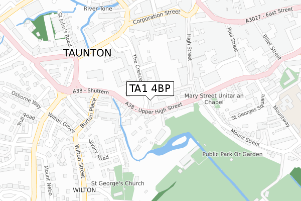
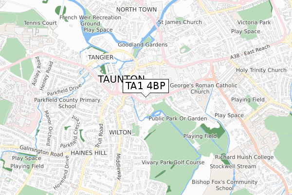
TA1 4BP is located in the Bishop's Hull & Taunton West electoral ward, within the unitary authority of Somerset and the English Parliamentary constituency of Taunton Deane. The Sub Integrated Care Board (ICB) Location is NHS Somerset ICB - 11X and the police force is Avon and Somerset. This postcode has been in use since July 2018.


GetTheData
Source: OS Open Zoomstack (Ordnance Survey)
Licence: Open Government Licence (requires attribution)
Attribution: Contains OS data © Crown copyright and database right 2024
Source: Open Postcode Geo
Licence: Open Government Licence (requires attribution)
Attribution: Contains OS data © Crown copyright and database right 2024; Contains Royal Mail data © Royal Mail copyright and database right 2024; Source: Office for National Statistics licensed under the Open Government Licence v.3.0
| Easting | 322567 |
| Northing | 124207 |
| Latitude | 51.012005 |
| Longitude | -3.105162 |
GetTheData
Source: Open Postcode Geo
Licence: Open Government Licence
| Country | England |
| Postcode District | TA1 |
| ➜ TA1 open data dashboard ➜ See where TA1 is on a map ➜ Where is Taunton? | |
GetTheData
Source: Land Registry Price Paid Data
Licence: Open Government Licence
| Ward | Bishop's Hull & Taunton West |
| Constituency | Taunton Deane |
GetTheData
Source: ONS Postcode Database
Licence: Open Government Licence
| January 2024 | Anti-social behaviour | On or near Corporation Street | 284m |
| January 2024 | Anti-social behaviour | On or near Corporation Street | 284m |
| January 2024 | Violence and sexual offences | On or near Corporation Street | 284m |
| ➜ Get more crime data in our Crime section | |||
GetTheData
Source: data.police.uk
Licence: Open Government Licence
| County Hall (Park Street) | Taunton | 242m |
| County Hall (Park Street) | Taunton | 261m |
| Corporation Street | Taunton | 314m |
| Castle Way | Taunton | 319m |
| The Parade (Fore Street) | Taunton | 333m |
| Taunton Station | 1.3km |
GetTheData
Source: NaPTAN
Licence: Open Government Licence
| Percentage of properties with Next Generation Access | 100.0% |
| Percentage of properties with Superfast Broadband | 100.0% |
| Percentage of properties with Ultrafast Broadband | 0.0% |
| Percentage of properties with Full Fibre Broadband | 0.0% |
Superfast Broadband is between 30Mbps and 300Mbps
Ultrafast Broadband is > 300Mbps
| Percentage of properties unable to receive 2Mbps | 0.0% |
| Percentage of properties unable to receive 5Mbps | 0.0% |
| Percentage of properties unable to receive 10Mbps | 0.0% |
| Percentage of properties unable to receive 30Mbps | 0.0% |
GetTheData
Source: Ofcom
Licence: Ofcom Terms of Use (requires attribution)
GetTheData
Source: ONS Postcode Database
Licence: Open Government Licence


➜ Get more ratings from the Food Standards Agency
GetTheData
Source: Food Standards Agency
Licence: FSA terms & conditions
| Last Collection | |||
|---|---|---|---|
| Location | Mon-Fri | Sat | Distance |
| The Crescent | 17:15 | 11:45 | 182m |
| Taunton Main Post Office | 17:30 | 12:30 | 489m |
| East Reach | 17:00 | 11:45 | 681m |
GetTheData
Source: Dracos
Licence: Creative Commons Attribution-ShareAlike
| Facility | Distance |
|---|---|
| Taunton Bowling Club Fons George, Taunton Indoor Bowls | 220m |
| Anytime Fitness (Taunton) Orchard Centre, Taunton Health and Fitness Gym, Studio | 280m |
| Vivary Golf Course Upper High Street, Taunton Golf | 355m |
GetTheData
Source: Active Places
Licence: Open Government Licence
| School | Phase of Education | Distance |
|---|---|---|
| St George's Catholic School The Mount, Taunton, TA1 3NR | Primary | 448m |
| Silver Bridge School 54 Silver Street, Taunton, Somerset, TA1 3DL | Not applicable | 632m |
| King's College Taunton South Road, Taunton, TA1 3LA | Not applicable | 646m |
GetTheData
Source: Edubase
Licence: Open Government Licence
The below table lists the International Territorial Level (ITL) codes (formerly Nomenclature of Territorial Units for Statistics (NUTS) codes) and Local Administrative Units (LAU) codes for TA1 4BP:
| ITL 1 Code | Name |
|---|---|
| TLK | South West (England) |
| ITL 2 Code | Name |
| TLK2 | Dorset and Somerset |
| ITL 3 Code | Name |
| TLK23 | Somerset CC |
| LAU 1 Code | Name |
| E07000246 | Somerset West and Taunton |
GetTheData
Source: ONS Postcode Directory
Licence: Open Government Licence
The below table lists the Census Output Area (OA), Lower Layer Super Output Area (LSOA), and Middle Layer Super Output Area (MSOA) for TA1 4BP:
| Code | Name | |
|---|---|---|
| OA | E00167314 | |
| LSOA | E01029284 | Taunton Deane 010B |
| MSOA | E02006108 | Taunton Deane 010 |
GetTheData
Source: ONS Postcode Directory
Licence: Open Government Licence
| TA1 4EB | The Crescent | 56m |
| TA1 3PZ | Upper High Street | 83m |
| TA1 4DP | Crescent Way | 89m |
| TA1 3PY | Upper High Street | 91m |
| TA1 3PX | Upper High Street | 103m |
| TA1 3PN | High Street | 120m |
| TA1 4EA | The Crescent | 171m |
| TA1 3PJ | High Street | 184m |
| TA1 4ES | Westbourne Terrace | 196m |
| TA1 3JW | Vivary Road | 203m |
GetTheData
Source: Open Postcode Geo; Land Registry Price Paid Data
Licence: Open Government Licence