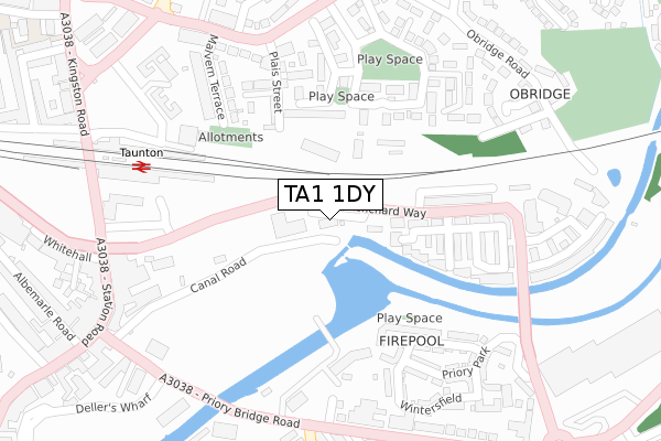
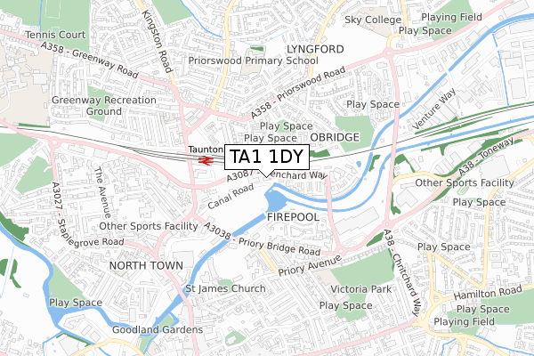
TA1 1DY is located in the Taunton East electoral ward, within the unitary authority of Somerset and the English Parliamentary constituency of Taunton Deane. The Sub Integrated Care Board (ICB) Location is NHS Somerset ICB - 11X and the police force is Avon and Somerset. This postcode has been in use since February 2018.


GetTheData
Source: OS Open Zoomstack (Ordnance Survey)
Licence: Open Government Licence (requires attribution)
Attribution: Contains OS data © Crown copyright and database right 2024
Source: Open Postcode Geo
Licence: Open Government Licence (requires attribution)
Attribution: Contains OS data © Crown copyright and database right 2024; Contains Royal Mail data © Royal Mail copyright and database right 2024; Source: Office for National Statistics licensed under the Open Government Licence v.3.0
| Easting | 323052 |
| Northing | 125370 |
| Latitude | 51.022526 |
| Longitude | -3.098497 |
GetTheData
Source: Open Postcode Geo
Licence: Open Government Licence
| Country | England |
| Postcode District | TA1 |
| ➜ TA1 open data dashboard ➜ See where TA1 is on a map ➜ Where is Taunton? | |
GetTheData
Source: Land Registry Price Paid Data
Licence: Open Government Licence
| Ward | Taunton East |
| Constituency | Taunton Deane |
GetTheData
Source: ONS Postcode Database
Licence: Open Government Licence
| January 2024 | Violence and sexual offences | On or near Wellesley Street | 455m |
| November 2023 | Anti-social behaviour | On or near Wintersfield | 320m |
| November 2023 | Anti-social behaviour | On or near Petrol Station | 368m |
| ➜ Get more crime data in our Crime section | |||
GetTheData
Source: data.police.uk
Licence: Open Government Licence
| Taunton Station South Side (Car Park) | Taunton | 254m |
| Gardeners Arms (Priorswood Road) | Taunton | 292m |
| Gardeners Arms (The Triangle) | Taunton | 310m |
| Royal Ashton | Taunton | 351m |
| Kilkenny Car Park | Taunton | 359m |
| Taunton Station | 0.3km |
GetTheData
Source: NaPTAN
Licence: Open Government Licence
➜ Broadband speed and availability dashboard for TA1 1DY
| Percentage of properties with Next Generation Access | 100.0% |
| Percentage of properties with Superfast Broadband | 100.0% |
| Percentage of properties with Ultrafast Broadband | 0.0% |
| Percentage of properties with Full Fibre Broadband | 0.0% |
Superfast Broadband is between 30Mbps and 300Mbps
Ultrafast Broadband is > 300Mbps
| Median download speed | 55.0Mbps |
| Average download speed | 49.3Mbps |
| Maximum download speed | 80.00Mbps |
| Median upload speed | 10.0Mbps |
| Average upload speed | 11.4Mbps |
| Maximum upload speed | 20.00Mbps |
| Percentage of properties unable to receive 2Mbps | 0.0% |
| Percentage of properties unable to receive 5Mbps | 0.0% |
| Percentage of properties unable to receive 10Mbps | 0.0% |
| Percentage of properties unable to receive 30Mbps | 0.0% |
➜ Broadband speed and availability dashboard for TA1 1DY
GetTheData
Source: Ofcom
Licence: Ofcom Terms of Use (requires attribution)
GetTheData
Source: ONS Postcode Database
Licence: Open Government Licence


➜ Get more ratings from the Food Standards Agency
GetTheData
Source: Food Standards Agency
Licence: FSA terms & conditions
| Last Collection | |||
|---|---|---|---|
| Location | Mon-Fri | Sat | Distance |
| Railway Station | 17:00 | 12:30 | 321m |
| Priorswood Road | 17:00 | 11:45 | 322m |
| St Augustine Street | 17:00 | 12:30 | 420m |
GetTheData
Source: Dracos
Licence: Creative Commons Attribution-ShareAlike
| Facility | Distance |
|---|---|
| Cooper Associates County Ground St. James Street, Taunton Grass Pitches | 407m |
| Academy Personal Fitness Centre (Closed) St. James Street, Taunton Health and Fitness Gym | 493m |
| Taunton Pool Station Road, Taunton Swimming Pool | 597m |
GetTheData
Source: Active Places
Licence: Open Government Licence
| School | Phase of Education | Distance |
|---|---|---|
| St Andrew's Church School Grove Terrace, Taunton, TA2 6HA | Primary | 501m |
| Priorswood Primary School Wedlands, Taunton, TA2 7AD | Primary | 563m |
| St James Church School Cranmer Road, Taunton, TA1 1XU | Primary | 650m |
GetTheData
Source: Edubase
Licence: Open Government Licence
The below table lists the International Territorial Level (ITL) codes (formerly Nomenclature of Territorial Units for Statistics (NUTS) codes) and Local Administrative Units (LAU) codes for TA1 1DY:
| ITL 1 Code | Name |
|---|---|
| TLK | South West (England) |
| ITL 2 Code | Name |
| TLK2 | Dorset and Somerset |
| ITL 3 Code | Name |
| TLK23 | Somerset CC |
| LAU 1 Code | Name |
| E07000246 | Somerset West and Taunton |
GetTheData
Source: ONS Postcode Directory
Licence: Open Government Licence
The below table lists the Census Output Area (OA), Lower Layer Super Output Area (LSOA), and Middle Layer Super Output Area (MSOA) for TA1 1DY:
| Code | Name | |
|---|---|---|
| OA | E00149278 | |
| LSOA | E01029299 | Taunton Deane 007E |
| MSOA | E02006105 | Taunton Deane 007 |
GetTheData
Source: ONS Postcode Directory
Licence: Open Government Licence
| TA1 1PS | Firepool View | 133m |
| TA1 1AR | Cunningham Court | 190m |
| TA2 7PR | Plais Street | 194m |
| TA1 1PU | Geoffrey Farrant Walk | 212m |
| TA2 7UD | Compton Close | 215m |
| TA2 7UG | Eaton Crescent | 221m |
| TA2 7UF | Eaton Crescent | 232m |
| TA1 1NY | Firepool View | 232m |
| TA2 7PP | Glenthorne Road | 235m |
| TA2 7DX | Plais Street | 242m |
GetTheData
Source: Open Postcode Geo; Land Registry Price Paid Data
Licence: Open Government Licence