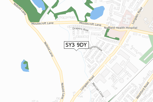
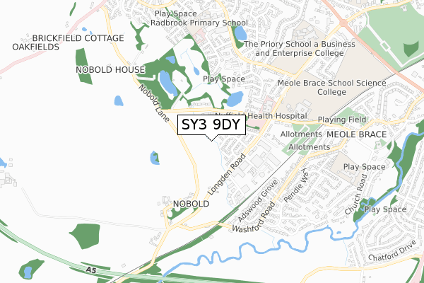
SY3 9DY is located in the Radbrook electoral ward, within the unitary authority of Shropshire and the English Parliamentary constituency of Shrewsbury and Atcham. The Sub Integrated Care Board (ICB) Location is NHS Shropshire, Telford and Wrekin ICB - M2L0M and the police force is West Mercia. This postcode has been in use since February 2019.


GetTheData
Source: OS Open Zoomstack (Ordnance Survey)
Licence: Open Government Licence (requires attribution)
Attribution: Contains OS data © Crown copyright and database right 2024
Source: Open Postcode Geo
Licence: Open Government Licence (requires attribution)
Attribution: Contains OS data © Crown copyright and database right 2024; Contains Royal Mail data © Royal Mail copyright and database right 2024; Source: Office for National Statistics licensed under the Open Government Licence v.3.0
| Easting | 347357 |
| Northing | 311740 |
| Latitude | 52.700776 |
| Longitude | -2.780467 |
GetTheData
Source: Open Postcode Geo
Licence: Open Government Licence
| Country | England |
| Postcode District | SY3 |
| ➜ SY3 open data dashboard ➜ See where SY3 is on a map ➜ Where is Shrewsbury? | |
GetTheData
Source: Land Registry Price Paid Data
Licence: Open Government Licence
| Ward | Radbrook |
| Constituency | Shrewsbury And Atcham |
GetTheData
Source: ONS Postcode Database
Licence: Open Government Licence
2023 9 NOV £580,000 |
2022 16 SEP £600,000 |
2021 28 OCT £585,000 |
6, LADY HERBERT WAY, SHREWSBURY, SY3 9DY 2021 29 JUN £485,000 |
10, LADY HERBERT WAY, SHREWSBURY, SY3 9DY 2021 28 JUN £485,000 |
24, LADY HERBERT WAY, SHREWSBURY, SY3 9DY 2021 20 MAY £484,000 |
28, LADY HERBERT WAY, SHREWSBURY, SY3 9DY 2021 15 FEB £470,000 |
26, LADY HERBERT WAY, SHREWSBURY, SY3 9DY 2021 5 FEB £475,000 |
5, LADY HERBERT WAY, SHREWSBURY, SY3 9DY 2020 27 AUG £462,000 |
34, LADY HERBERT WAY, SHREWSBURY, SY3 9DY 2020 5 JUN £490,000 |
GetTheData
Source: HM Land Registry Price Paid Data
Licence: Contains HM Land Registry data © Crown copyright and database right 2024. This data is licensed under the Open Government Licence v3.0.
| December 2023 | Other theft | On or near Ryelands | 191m |
| April 2023 | Bicycle theft | On or near Alan Gutridge Drive | 282m |
| November 2022 | Anti-social behaviour | On or near Lanesfield | 388m |
| ➜ Get more crime data in our Crime section | |||
GetTheData
Source: data.police.uk
Licence: Open Government Licence
| Radbrook College (Radbrook Road) | Radbrook | 140m |
| Radbrook College (Radbrook Road) | Radbrook | 146m |
| Radbrook Road Jct (Crowmeole Lane) | Radbrook | 192m |
| Radbrook Road Jct (Crowmeole Lane) | Radbrook | 205m |
| Crowmeole Lane Jct (Hanwood Road) | Radbrook | 208m |
| Shrewsbury Station | 2.4km |
GetTheData
Source: NaPTAN
Licence: Open Government Licence
GetTheData
Source: ONS Postcode Database
Licence: Open Government Licence


➜ Get more ratings from the Food Standards Agency
GetTheData
Source: Food Standards Agency
Licence: FSA terms & conditions
| Last Collection | |||
|---|---|---|---|
| Location | Mon-Fri | Sat | Distance |
| Worthington Drive | 19:00 | 11:45 | 334m |
| Crowmeole Lane | 19:15 | 11:45 | 387m |
| Radbrook Road | 19:15 | 11:45 | 396m |
GetTheData
Source: Dracos
Licence: Creative Commons Attribution-ShareAlike
| Facility | Distance |
|---|---|
| Radbrook Elite Health & Leisure Club (Closed) Radbrook Road, Shrewsbury Studio, Health and Fitness Gym, Swimming Pool, Squash Courts | 216m |
| Radbrook Recreation Ground Radbrook Road, Shrewsbury Grass Pitches | 521m |
| Shorncliffe Drive Recreation Ground Shorncliffe Way, Shrewsbury Grass Pitches | 982m |
GetTheData
Source: Active Places
Licence: Open Government Licence
| School | Phase of Education | Distance |
|---|---|---|
| Radbrook Primary School Calverton Way, Bank Farm Road, Shrewsbury, SY3 6DZ | Primary | 462m |
| The Keystone Academy Squinter Pip Way, Shrewsbury, SY5 8PY | Not applicable | 816m |
| St George's Junior School Woodfield Road, Shrewsbury, SY3 8LU | Primary | 977m |
GetTheData
Source: Edubase
Licence: Open Government Licence
The below table lists the International Territorial Level (ITL) codes (formerly Nomenclature of Territorial Units for Statistics (NUTS) codes) and Local Administrative Units (LAU) codes for SY3 9DY:
| ITL 1 Code | Name |
|---|---|
| TLG | West Midlands (England) |
| ITL 2 Code | Name |
| TLG2 | Shropshire and Staffordshire |
| ITL 3 Code | Name |
| TLG22 | Shropshire |
| LAU 1 Code | Name |
| E06000051 | Shropshire |
GetTheData
Source: ONS Postcode Directory
Licence: Open Government Licence
The below table lists the Census Output Area (OA), Lower Layer Super Output Area (LSOA), and Middle Layer Super Output Area (MSOA) for SY3 9DY:
| Code | Name | |
|---|---|---|
| OA | E00147438 | |
| LSOA | E01028951 | Shropshire 020D |
| MSOA | E02006034 | Shropshire 020 |
GetTheData
Source: ONS Postcode Directory
Licence: Open Government Licence
| SY3 9BJ | 116m | |
| SY3 9RD | Wildon Way | 120m |
| SY3 9RB | Aspen Grove | 121m |
| SY3 6BZ | Gransden Drive | 133m |
| SY3 9BF | College Gardens | 156m |
| SY3 9BQ | Radbrook Road | 194m |
| SY3 9BZ | Ryelands | 206m |
| SY3 6BX | Sparkham Close | 211m |
| SY3 6BT | Worthington Drive | 220m |
| SY3 9AF | Radbrook Hall Court | 231m |
GetTheData
Source: Open Postcode Geo; Land Registry Price Paid Data
Licence: Open Government Licence