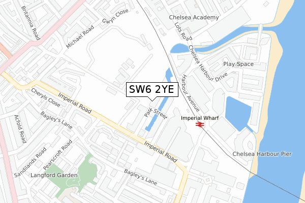
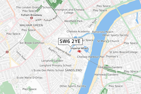
SW6 2YE is located in the Sands End electoral ward, within the London borough of Hammersmith and Fulham and the English Parliamentary constituency of Chelsea and Fulham. The Sub Integrated Care Board (ICB) Location is NHS North West London ICB - W2U3Z and the police force is Metropolitan Police. This postcode has been in use since November 2019.


GetTheData
Source: OS Open Zoomstack (Ordnance Survey)
Licence: Open Government Licence (requires attribution)
Attribution: Contains OS data © Crown copyright and database right 2025
Source: Open Postcode Geo
Licence: Open Government Licence (requires attribution)
Attribution: Contains OS data © Crown copyright and database right 2025; Contains Royal Mail data © Royal Mail copyright and database right 2025; Source: Office for National Statistics licensed under the Open Government Licence v.3.0
| Easting | 526139 |
| Northing | 176761 |
| Latitude | 51.475757 |
| Longitude | -0.185085 |
GetTheData
Source: Open Postcode Geo
Licence: Open Government Licence
| Country | England |
| Postcode District | SW6 |
➜ See where SW6 is on a map ➜ Where is London? | |
GetTheData
Source: Land Registry Price Paid Data
Licence: Open Government Licence
| Ward | Sands End |
| Constituency | Chelsea And Fulham |
GetTheData
Source: ONS Postcode Database
Licence: Open Government Licence
| Imperial Whf Stn Chelsea Hrbr | Sands End | 118m |
| Imperial Road Chelsea Harbour (Imperial Road) | Sands End | 138m |
| Imperial Whf Stn Chelsea Hrbr (Imperial Road) | Sands End | 142m |
| Imperial Wharf Station | Sands End | 142m |
| Harwood Terrace (Imperial Road) | Sands End | 229m |
| Fulham Broadway Underground Station | Fulham Broadway | 863m |
| Parsons Green Underground Station | Parsons Green | 1,117m |
| West Brompton Underground Station | West Brompton | 1,473m |
| Imperial Wharf Station | 0.2km |
| West Brompton Station | 1.5km |
| Clapham Junction Station | 1.6km |
GetTheData
Source: NaPTAN
Licence: Open Government Licence
| Percentage of properties with Next Generation Access | 100.0% |
| Percentage of properties with Superfast Broadband | 100.0% |
| Percentage of properties with Ultrafast Broadband | 100.0% |
| Percentage of properties with Full Fibre Broadband | 100.0% |
Superfast Broadband is between 30Mbps and 300Mbps
Ultrafast Broadband is > 300Mbps
| Percentage of properties unable to receive 2Mbps | 0.0% |
| Percentage of properties unable to receive 5Mbps | 0.0% |
| Percentage of properties unable to receive 10Mbps | 0.0% |
| Percentage of properties unable to receive 30Mbps | 0.0% |
GetTheData
Source: Ofcom
Licence: Ofcom Terms of Use (requires attribution)
GetTheData
Source: ONS Postcode Database
Licence: Open Government Licence


➜ Get more ratings from the Food Standards Agency
GetTheData
Source: Food Standards Agency
Licence: FSA terms & conditions
| Last Collection | |||
|---|---|---|---|
| Location | Mon-Fri | Sat | Distance |
| Chelsea Harbour | 17:30 | 12:00 | 136m |
| Townmead Road | 17:30 | 12:00 | 282m |
| Chelsea Harbour | 17:30 | 12:00 | 290m |
GetTheData
Source: Dracos
Licence: Creative Commons Attribution-ShareAlike
| Risk of SW6 2YE flooding from rivers and sea | Very Low |
| ➜ SW6 2YE flood map | |
GetTheData
Source: Open Flood Risk by Postcode
Licence: Open Government Licence
The below table lists the International Territorial Level (ITL) codes (formerly Nomenclature of Territorial Units for Statistics (NUTS) codes) and Local Administrative Units (LAU) codes for SW6 2YE:
| ITL 1 Code | Name |
|---|---|
| TLI | London |
| ITL 2 Code | Name |
| TLI3 | Inner London - West |
| ITL 3 Code | Name |
| TLI33 | Kensington & Chelsea and Hammersmith & Fulham |
| LAU 1 Code | Name |
| E09000013 | Hammersmith and Fulham |
GetTheData
Source: ONS Postcode Directory
Licence: Open Government Licence
The below table lists the Census Output Area (OA), Lower Layer Super Output Area (LSOA), and Middle Layer Super Output Area (MSOA) for SW6 2YE:
| Code | Name | |
|---|---|---|
| OA | E00167275 | |
| LSOA | E01001939 | Hammersmith and Fulham 023C |
| MSOA | E02000394 | Hammersmith and Fulham 023 |
GetTheData
Source: ONS Postcode Directory
Licence: Open Government Licence
| SW6 2GB | Thurstan Street | 41m |
| SW6 2FQ | Park Street | 66m |
| SW6 2FS | Park Street | 87m |
| SW6 2FT | Park Street | 87m |
| SW6 2FN | Park Street | 98m |
| SW6 2FB | Park Street | 98m |
| SW6 2GF | Thurstan Street | 107m |
| SW6 2FL | Park Street | 143m |
| SW6 2BW | Bagleys Lane | 176m |
| SW6 2BX | Maltings Place | 184m |
GetTheData
Source: Open Postcode Geo; Land Registry Price Paid Data
Licence: Open Government Licence