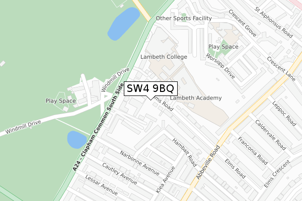
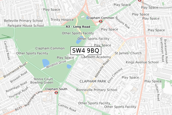
SW4 9BQ is located in the Clapham Common & Abbeville electoral ward, within the London borough of Lambeth and the English Parliamentary constituency of Streatham. The Sub Integrated Care Board (ICB) Location is NHS South East London ICB - 72Q and the police force is Metropolitan Police. This postcode has been in use since February 2020.


GetTheData
Source: OS Open Zoomstack (Ordnance Survey)
Licence: Open Government Licence (requires attribution)
Attribution: Contains OS data © Crown copyright and database right 2024
Source: Open Postcode Geo
Licence: Open Government Licence (requires attribution)
Attribution: Contains OS data © Crown copyright and database right 2024; Contains Royal Mail data © Royal Mail copyright and database right 2024; Source: Office for National Statistics licensed under the Open Government Licence v.3.0
| Easting | 529213 |
| Northing | 174768 |
| Latitude | 51.457153 |
| Longitude | -0.141573 |
GetTheData
Source: Open Postcode Geo
Licence: Open Government Licence
| Country | England |
| Postcode District | SW4 |
| ➜ SW4 open data dashboard ➜ See where SW4 is on a map ➜ Where is London? | |
GetTheData
Source: Land Registry Price Paid Data
Licence: Open Government Licence
| Ward | Clapham Common & Abbeville |
| Constituency | Streatham |
GetTheData
Source: ONS Postcode Database
Licence: Open Government Licence
APARTMENT 7, MYERS COURT, 6, ELMS ROAD, LONDON, SW4 9BQ 2015 19 MAY £4,500,000 |
GetTheData
Source: HM Land Registry Price Paid Data
Licence: Contains HM Land Registry data © Crown copyright and database right 2024. This data is licensed under the Open Government Licence v3.0.
| January 2024 | Anti-social behaviour | On or near Narbonne Avenue | 264m |
| January 2024 | Robbery | On or near Tableer Avenue | 328m |
| December 2023 | Anti-social behaviour | On or near Narbonne Avenue | 264m |
| ➜ Get more crime data in our Crime section | |||
GetTheData
Source: data.police.uk
Licence: Open Government Licence
| Elms Road Windmill On The Common (Clapham Common South Side) | Clapham Common | 137m |
| Elms Road Windmill On The Common (Clapham Common South Side) | Clapham Common | 169m |
| Lynette Avenue (Clapham Common South Side) | Clapham Park | 401m |
| Clapham Common (Clapham Common South Side) | Clapham Common | 414m |
| Lynette Avenue (Clapham Common South Side) | Clapham Park | 427m |
| Clapham Common Underground Station | Clapham | 559m |
| Clapham South Underground Station | Clapham South | 651m |
| Clapham North Underground Station | Clapham | 1,198m |
| Clapham High Street Station | 1.1km |
| Wandsworth Road Station | 1.5km |
| Balham Station | 1.7km |
GetTheData
Source: NaPTAN
Licence: Open Government Licence
GetTheData
Source: ONS Postcode Database
Licence: Open Government Licence


➜ Get more ratings from the Food Standards Agency
GetTheData
Source: Food Standards Agency
Licence: FSA terms & conditions
| Last Collection | |||
|---|---|---|---|
| Location | Mon-Fri | Sat | Distance |
| Elms Road | 17:30 | 12:00 | 89m |
| Lessar Avenue | 17:30 | 12:00 | 332m |
| Post Office | 17:30 | 12:00 | 342m |
GetTheData
Source: Dracos
Licence: Creative Commons Attribution-ShareAlike
| Facility | Distance |
|---|---|
| Lambeth Academy Elms Road, London Sports Hall, Studio, Health and Fitness Gym | 117m |
| Lambeth College (Clapham Centre) Clapham Common South Side, London Sports Hall | 173m |
| Clapham Common Windmill Drive, London Grass Pitches, Outdoor Tennis Courts | 184m |
GetTheData
Source: Active Places
Licence: Open Government Licence
| School | Phase of Education | Distance |
|---|---|---|
| The Elms Academy Elms Road, Clapham, London, SW4 9ET | Secondary | 39m |
| Lambeth College 45 Clapham Common Southside, Clapham Common, London, SW4 9BL | 16 plus | 225m |
| St Mary's Roman Catholic Primary School Crescent Lane, Clapham, London, SW4 9QJ | Primary | 329m |
GetTheData
Source: Edubase
Licence: Open Government Licence
The below table lists the International Territorial Level (ITL) codes (formerly Nomenclature of Territorial Units for Statistics (NUTS) codes) and Local Administrative Units (LAU) codes for SW4 9BQ:
| ITL 1 Code | Name |
|---|---|
| TLI | London |
| ITL 2 Code | Name |
| TLI4 | Inner London - East |
| ITL 3 Code | Name |
| TLI45 | Lambeth |
| LAU 1 Code | Name |
| E09000022 | Lambeth |
GetTheData
Source: ONS Postcode Directory
Licence: Open Government Licence
The below table lists the Census Output Area (OA), Lower Layer Super Output Area (LSOA), and Middle Layer Super Output Area (MSOA) for SW4 9BQ:
| Code | Name | |
|---|---|---|
| OA | E00015254 | |
| LSOA | E01003033 | Lambeth 019E |
| MSOA | E02000636 | Lambeth 019 |
GetTheData
Source: ONS Postcode Directory
Licence: Open Government Licence
| SW4 9EU | Elms Road | 20m |
| SW4 9ET | Elms Road | 39m |
| SW4 9QB | Timothy Close | 58m |
| SW4 9EY | Waldo Close | 60m |
| SW4 9DU | St Gerards Close | 63m |
| SW4 9BP | Shaftesbury Mews | 81m |
| SW4 9DA | Clapham Common South Side | 86m |
| SW4 9EA | Hambalt Road | 120m |
| SW4 9EF | Hambalt Road | 134m |
| SW4 9BX | Clapham Common South Side | 139m |
GetTheData
Source: Open Postcode Geo; Land Registry Price Paid Data
Licence: Open Government Licence