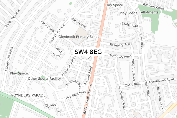
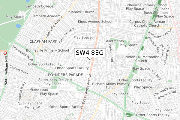
SW4 8EG is located in the Clapham Park electoral ward, within the London borough of Lambeth and the English Parliamentary constituency of Streatham. The Sub Integrated Care Board (ICB) Location is NHS South East London ICB - 72Q and the police force is Metropolitan Police. This postcode has been in use since October 2018.


GetTheData
Source: OS Open Zoomstack (Ordnance Survey)
Licence: Open Government Licence (requires attribution)
Attribution: Contains OS data © Crown copyright and database right 2024
Source: Open Postcode Geo
Licence: Open Government Licence (requires attribution)
Attribution: Contains OS data © Crown copyright and database right 2024; Contains Royal Mail data © Royal Mail copyright and database right 2024; Source: Office for National Statistics licensed under the Open Government Licence v.3.0
| Easting | 529960 |
| Northing | 174165 |
| Latitude | 51.451563 |
| Longitude | -0.131049 |
GetTheData
Source: Open Postcode Geo
Licence: Open Government Licence
| Country | England |
| Postcode District | SW4 |
| ➜ SW4 open data dashboard ➜ See where SW4 is on a map ➜ Where is London? | |
GetTheData
Source: Land Registry Price Paid Data
Licence: Open Government Licence
| Ward | Clapham Park |
| Constituency | Streatham |
GetTheData
Source: ONS Postcode Database
Licence: Open Government Licence
| January 2024 | Drugs | On or near Clarence Avenue | 215m |
| January 2024 | Criminal damage and arson | On or near Prague Place | 494m |
| January 2024 | Vehicle crime | On or near Prague Place | 494m |
| ➜ Get more crime data in our Crime section | |||
GetTheData
Source: data.police.uk
Licence: Open Government Licence
| Thorncliffe Road | Clapham Park | 38m |
| Thorncliffe Road | Clapham Park | 76m |
| Rosebery Road (Sw4) | Clapham Park | 227m |
| Kings Avenue Atkins Road | Clapham Park | 337m |
| Clarence Avenue Clapham Park | Clapham Park | 354m |
| Clapham South Underground Station | Clapham South | 1,154m |
| Clapham Common Underground Station | Clapham | 1,239m |
| Brixton Underground Station | Brixton | 1,666m |
| Balham Underground Station | Balham | 1,780m |
| Streatham Hill Station | 1.5km |
| Clapham High Street Station | 1.6km |
| Balham Station | 1.8km |
GetTheData
Source: NaPTAN
Licence: Open Government Licence
| Percentage of properties with Next Generation Access | 100.0% |
| Percentage of properties with Superfast Broadband | 100.0% |
| Percentage of properties with Ultrafast Broadband | 66.7% |
| Percentage of properties with Full Fibre Broadband | 66.7% |
Superfast Broadband is between 30Mbps and 300Mbps
Ultrafast Broadband is > 300Mbps
| Percentage of properties unable to receive 2Mbps | 0.0% |
| Percentage of properties unable to receive 5Mbps | 0.0% |
| Percentage of properties unable to receive 10Mbps | 0.0% |
| Percentage of properties unable to receive 30Mbps | 0.0% |
GetTheData
Source: Ofcom
Licence: Ofcom Terms of Use (requires attribution)
GetTheData
Source: ONS Postcode Database
Licence: Open Government Licence


➜ Get more ratings from the Food Standards Agency
GetTheData
Source: Food Standards Agency
Licence: FSA terms & conditions
| Last Collection | |||
|---|---|---|---|
| Location | Mon-Fri | Sat | Distance |
| 91 Kings Avenue | 17:30 | 12:00 | 159m |
| 42 Thornbury Road | 17:30 | 12:00 | 200m |
| 56 Clarence Avenue | 17:30 | 12:00 | 243m |
GetTheData
Source: Dracos
Licence: Creative Commons Attribution-ShareAlike
| Facility | Distance |
|---|---|
| Harris Academy Clapham Clarence Avenue, Clarence Avenue, London Sports Hall, Outdoor Tennis Courts | 212m |
| Anytime Fitness (London Clapham South) Mullins Place, London Health and Fitness Gym | 242m |
| Hmp Brixton Jebb Avenue, London Artificial Grass Pitch | 389m |
GetTheData
Source: Active Places
Licence: Open Government Licence
| School | Phase of Education | Distance |
|---|---|---|
| Maytree Nursery School 4 Allingham Road, London, SW4 8EG | Nursery | 0m |
| Harris Academy Clapham Clarence Avenue, 33 Clarence Avenue, Clapham, London, SW4 8LD | Secondary | 177m |
| Glenbrook Primary School Clarence Crescent, Clapham Park, London, SW4 8LD | Primary | 177m |
GetTheData
Source: Edubase
Licence: Open Government Licence
The below table lists the International Territorial Level (ITL) codes (formerly Nomenclature of Territorial Units for Statistics (NUTS) codes) and Local Administrative Units (LAU) codes for SW4 8EG:
| ITL 1 Code | Name |
|---|---|
| TLI | London |
| ITL 2 Code | Name |
| TLI4 | Inner London - East |
| ITL 3 Code | Name |
| TLI45 | Lambeth |
| LAU 1 Code | Name |
| E09000022 | Lambeth |
GetTheData
Source: ONS Postcode Directory
Licence: Open Government Licence
The below table lists the Census Output Area (OA), Lower Layer Super Output Area (LSOA), and Middle Layer Super Output Area (MSOA) for SW4 8EG:
| Code | Name | |
|---|---|---|
| OA | E00015941 | |
| LSOA | E01003159 | Lambeth 022C |
| MSOA | E02000639 | Lambeth 022 |
GetTheData
Source: ONS Postcode Directory
Licence: Open Government Licence
| SW4 8EW | Kings Avenue | 70m |
| SW4 8EN | Kings Avenue | 70m |
| SW4 8BL | Kings Avenue | 96m |
| SW4 8EP | Kings Avenue | 96m |
| SW4 8EL | Kings Avenue | 97m |
| SW4 8LJ | Clarence Crescent | 104m |
| SW4 8BJ | Kings Avenue | 119m |
| SW2 4DH | Thornbury Road | 120m |
| SW2 4DE | Rosebery Road | 129m |
| SW2 4JQ | Thorncliffe Road | 135m |
GetTheData
Source: Open Postcode Geo; Land Registry Price Paid Data
Licence: Open Government Licence