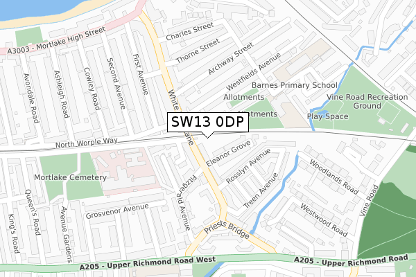
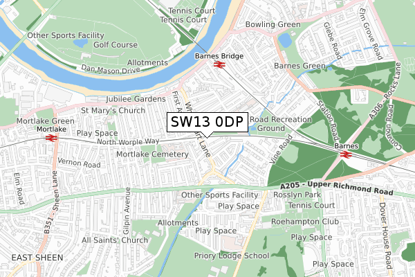
SW13 0DP is located in the Mortlake & Barnes Common electoral ward, within the London borough of Richmond upon Thames and the English Parliamentary constituency of Richmond Park. The Sub Integrated Care Board (ICB) Location is NHS South West London ICB - 36L and the police force is Metropolitan Police. This postcode has been in use since September 2019.


GetTheData
Source: OS Open Zoomstack (Ordnance Survey)
Licence: Open Government Licence (requires attribution)
Attribution: Contains OS data © Crown copyright and database right 2024
Source: Open Postcode Geo
Licence: Open Government Licence (requires attribution)
Attribution: Contains OS data © Crown copyright and database right 2024; Contains Royal Mail data © Royal Mail copyright and database right 2024; Source: Office for National Statistics licensed under the Open Government Licence v.3.0
| Easting | 521412 |
| Northing | 175761 |
| Latitude | 51.467802 |
| Longitude | -0.253459 |
GetTheData
Source: Open Postcode Geo
Licence: Open Government Licence
| Country | England |
| Postcode District | SW13 |
| ➜ SW13 open data dashboard ➜ See where SW13 is on a map ➜ Where is Barnes? | |
GetTheData
Source: Land Registry Price Paid Data
Licence: Open Government Licence
| Ward | Mortlake & Barnes Common |
| Constituency | Richmond Park |
GetTheData
Source: ONS Postcode Database
Licence: Open Government Licence
| January 2024 | Burglary | On or near Arabella Drive | 398m |
| January 2024 | Violence and sexual offences | On or near Arabella Drive | 398m |
| January 2024 | Other theft | On or near Arabella Drive | 398m |
| ➜ Get more crime data in our Crime section | |||
GetTheData
Source: data.police.uk
Licence: Open Government Licence
| Priests Bridge (Upper Richmond Road West) | East Sheen | 287m |
| Priests Bridge (Upper Richmond Road West) | East Sheen | 300m |
| Ludovik Walk | Roehampton | 302m |
| Priory Lane (Upper Richmond Road) | Barnes | 338m |
| White Hart Lane (Sw14) (Mortlake High Street) | Mortlake | 354m |
| Barnes Bridge Station | 0.5km |
| Barnes Station | 0.8km |
| Mortlake Station | 0.9km |
GetTheData
Source: NaPTAN
Licence: Open Government Licence
GetTheData
Source: ONS Postcode Database
Licence: Open Government Licence

➜ Get more ratings from the Food Standards Agency
GetTheData
Source: Food Standards Agency
Licence: FSA terms & conditions
| Last Collection | |||
|---|---|---|---|
| Location | Mon-Fri | Sat | Distance |
| 147 White Hart Lane | 17:30 | 12:00 | 145m |
| Archway Street | 17:30 | 12:00 | 216m |
| 17 | 17:30 | 12:00 | 307m |
GetTheData
Source: Dracos
Licence: Creative Commons Attribution-ShareAlike
| Facility | Distance |
|---|---|
| East Sheen Primary School Upper Richmond Road West, London Artificial Grass Pitch | 364m |
| Paddock School Priory Lane, London Sports Hall | 511m |
| Rosslyn Park Rugby Club Priory Lane, London Health and Fitness Gym, Grass Pitches, Artificial Grass Pitch | 583m |
GetTheData
Source: Active Places
Licence: Open Government Licence
| School | Phase of Education | Distance |
|---|---|---|
| Barnes Primary School Cross Street, Barnes, London, SW13 0QQ | Primary | 205m |
| East Sheen Primary School Upper Richmond Road West, East Sheen, London, SW14 8ED | Primary | 362m |
| Paddock School Priory Lane, London, SW15 5RT | Not applicable | 527m |
GetTheData
Source: Edubase
Licence: Open Government Licence
The below table lists the International Territorial Level (ITL) codes (formerly Nomenclature of Territorial Units for Statistics (NUTS) codes) and Local Administrative Units (LAU) codes for SW13 0DP:
| ITL 1 Code | Name |
|---|---|
| TLI | London |
| ITL 2 Code | Name |
| TLI7 | Outer London - West and North West |
| ITL 3 Code | Name |
| TLI75 | Hounslow and Richmond upon Thames |
| LAU 1 Code | Name |
| E09000027 | Richmond upon Thames |
GetTheData
Source: ONS Postcode Directory
Licence: Open Government Licence
The below table lists the Census Output Area (OA), Lower Layer Super Output Area (LSOA), and Middle Layer Super Output Area (MSOA) for SW13 0DP:
| Code | Name | |
|---|---|---|
| OA | E00019389 | |
| LSOA | E01003857 | Richmond upon Thames 003F |
| MSOA | E02000786 | Richmond upon Thames 003 |
GetTheData
Source: ONS Postcode Directory
Licence: Open Government Licence
| SW13 0JL | White Hart Lane | 31m |
| SW13 0QA | White Hart Lane | 59m |
| SW13 0JN | Eleanor Grove | 67m |
| SW14 8SS | The Retreat | 86m |
| SW13 0JW | White Hart Lane | 86m |
| SW13 0JQ | Charlesworth Place | 86m |
| SW13 0PW | White Hart Lane | 91m |
| SW14 8AF | Portobello Terrace | 109m |
| SW13 0JY | Rosslyn Avenue | 110m |
| SW14 8SY | Buxton Road | 112m |
GetTheData
Source: Open Postcode Geo; Land Registry Price Paid Data
Licence: Open Government Licence