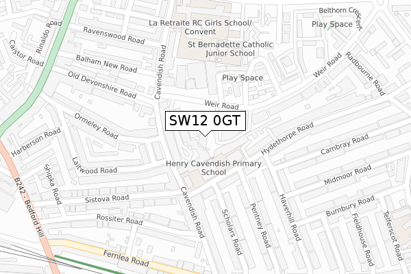
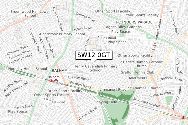
SW12 0GT is located in the Streatham Hill West & Thornton electoral ward, within the London borough of Lambeth and the English Parliamentary constituency of Streatham. The Sub Integrated Care Board (ICB) Location is NHS South East London ICB - 72Q and the police force is Metropolitan Police. This postcode has been in use since September 2017.


GetTheData
Source: OS Open Zoomstack (Ordnance Survey)
Licence: Open Government Licence (requires attribution)
Attribution: Contains OS data © Crown copyright and database right 2024
Source: Open Postcode Geo
Licence: Open Government Licence (requires attribution)
Attribution: Contains OS data © Crown copyright and database right 2024; Contains Royal Mail data © Royal Mail copyright and database right 2024; Source: Office for National Statistics licensed under the Open Government Licence v.3.0
| Easting | 529083 |
| Northing | 173421 |
| Latitude | 51.445077 |
| Longitude | -0.143934 |
GetTheData
Source: Open Postcode Geo
Licence: Open Government Licence
| Country | England |
| Postcode District | SW12 |
| ➜ SW12 open data dashboard ➜ See where SW12 is on a map ➜ Where is London? | |
GetTheData
Source: Land Registry Price Paid Data
Licence: Open Government Licence
| Ward | Streatham Hill West & Thornton |
| Constituency | Streatham |
GetTheData
Source: ONS Postcode Database
Licence: Open Government Licence
| June 2022 | Bicycle theft | On or near Theatre/Concert Hall | 35m |
| June 2022 | Other theft | On or near Theatre/Concert Hall | 35m |
| June 2022 | Vehicle crime | On or near Theatre/Concert Hall | 35m |
| ➜ Get more crime data in our Crime section | |||
GetTheData
Source: data.police.uk
Licence: Open Government Licence
| Belthorn Crescent | Balham | 303m |
| Belthorn Crescent | Balham | 312m |
| Balham New Road (Balham High Road) | Balham | 416m |
| Balham New Road (Balham High Road) | Balham | 434m |
| Radbourne Road Hydethorpe Road | Streatham Hill | 476m |
| Balham Underground Station | Balham | 659m |
| Clapham South Underground Station | Clapham South | 879m |
| Tooting Bec Underground Station | Tooting Bec | 1,515m |
| Balham Station | 0.6km |
| Wandsworth Common Station | 1.4km |
| Streatham Hill Station | 1.4km |
GetTheData
Source: NaPTAN
Licence: Open Government Licence
GetTheData
Source: ONS Postcode Database
Licence: Open Government Licence


➜ Get more ratings from the Food Standards Agency
GetTheData
Source: Food Standards Agency
Licence: FSA terms & conditions
| Last Collection | |||
|---|---|---|---|
| Location | Mon-Fri | Sat | Distance |
| 50 Weir Road | 17:30 | 12:00 | 116m |
| Hydethorpe Road | 17:30 | 12:00 | 146m |
| 273 Cavendish Road | 17:30 | 12:00 | 191m |
GetTheData
Source: Dracos
Licence: Creative Commons Attribution-ShareAlike
| Facility | Distance |
|---|---|
| La Retraite Roman Catholic Girls School Atkins Road, London Sports Hall, Grass Pitches, Studio, Artificial Grass Pitch | 321m |
| Agnes Riley Gardens Poynders Road, London Artificial Grass Pitch | 536m |
| Gateway Community Centre (Closed) Oldridge Road, Balham, London Sports Hall | 544m |
GetTheData
Source: Active Places
Licence: Open Government Licence
| School | Phase of Education | Distance |
|---|---|---|
| Henry Cavendish Primary School Hydethorpe Road, London, SW12 0JA | Primary | 88m |
| St Bernadette Catholic Junior School 1 - 4 Atkins Road, Clapham Park, London, SW12 0AB | Primary | 306m |
| La Retraite Roman Catholic Girls' School Atkins Road, London, SW12 0AB | Secondary | 306m |
GetTheData
Source: Edubase
Licence: Open Government Licence
The below table lists the International Territorial Level (ITL) codes (formerly Nomenclature of Territorial Units for Statistics (NUTS) codes) and Local Administrative Units (LAU) codes for SW12 0GT:
| ITL 1 Code | Name |
|---|---|
| TLI | London |
| ITL 2 Code | Name |
| TLI4 | Inner London - East |
| ITL 3 Code | Name |
| TLI45 | Lambeth |
| LAU 1 Code | Name |
| E09000022 | Lambeth |
GetTheData
Source: ONS Postcode Directory
Licence: Open Government Licence
The below table lists the Census Output Area (OA), Lower Layer Super Output Area (LSOA), and Middle Layer Super Output Area (MSOA) for SW12 0GT:
| Code | Name | |
|---|---|---|
| OA | E00015958 | |
| LSOA | E01003157 | Lambeth 023C |
| MSOA | E02000640 | Lambeth 023 |
GetTheData
Source: ONS Postcode Directory
Licence: Open Government Licence
| SW12 0NA | Weir Road | 78m |
| SW12 0JR | Margaret Rutherford Place | 100m |
| SW12 0LT | Weir Road | 119m |
| SW12 0HY | Hydethorpe Road | 122m |
| SW12 0BS | Cavendish Road | 136m |
| SW12 0PL | Cavendish Road | 136m |
| SW12 0HZ | Hydethorpe Road | 138m |
| SW12 9QQ | Ranmere Street | 156m |
| SW12 0NB | Weir Road | 159m |
| SW12 9RE | Old Devonshire Road | 162m |
GetTheData
Source: Open Postcode Geo; Land Registry Price Paid Data
Licence: Open Government Licence