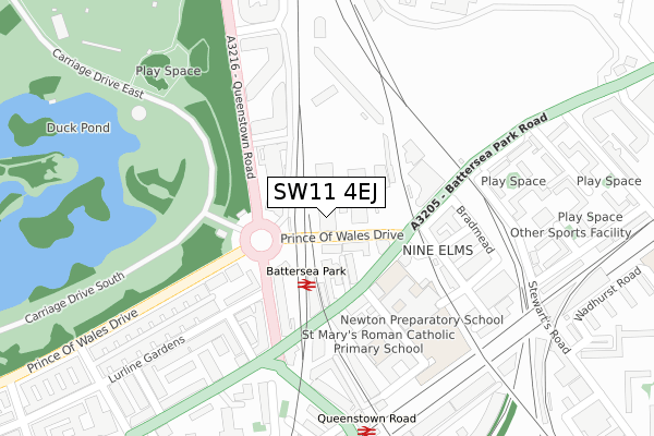
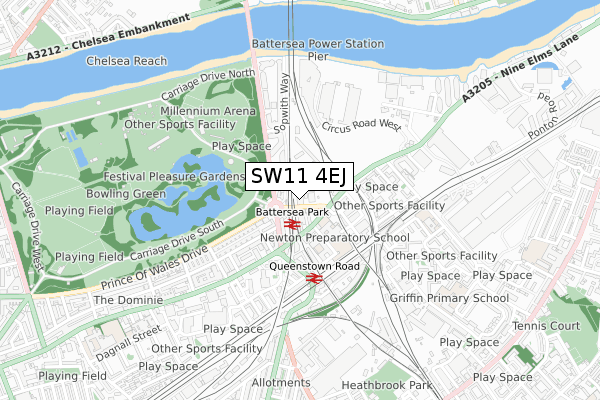
SW11 4EJ is located in the Nine Elms electoral ward, within the London borough of Wandsworth and the English Parliamentary constituency of Battersea. The Sub Integrated Care Board (ICB) Location is NHS South West London ICB - 36L and the police force is Metropolitan Police. This postcode has been in use since February 2019.


GetTheData
Source: OS Open Zoomstack (Ordnance Survey)
Licence: Open Government Licence (requires attribution)
Attribution: Contains OS data © Crown copyright and database right 2025
Source: Open Postcode Geo
Licence: Open Government Licence (requires attribution)
Attribution: Contains OS data © Crown copyright and database right 2025; Contains Royal Mail data © Royal Mail copyright and database right 2025; Source: Office for National Statistics licensed under the Open Government Licence v.3.0
| Easting | 528774 |
| Northing | 177097 |
| Latitude | 51.478184 |
| Longitude | -0.147041 |
GetTheData
Source: Open Postcode Geo
Licence: Open Government Licence
| Country | England |
| Postcode District | SW11 |
➜ See where SW11 is on a map ➜ Where is London? | |
GetTheData
Source: Land Registry Price Paid Data
Licence: Open Government Licence
| Ward | Nine Elms |
| Constituency | Battersea |
GetTheData
Source: ONS Postcode Database
Licence: Open Government Licence
| Battersea Dogs And Cats Home | Nine Elms | 62m |
| Battersea Park Station (Battersea Park Road) | Battersea | 120m |
| Battersea Dogs And Cats Home | Nine Elms | 141m |
| Battersea Park Station (Battersea Park Road) | Battersea | 156m |
| Battersea Park Station (Queenstown Road) | Battersea | 165m |
| Pimlico Underground Station | Pimlico | 1,526m |
| Clapham North Underground Station | Clapham | 1,874m |
| Battersea Park Station | 0.1km |
| Queenstown Road (Battersea) Station | 0.4km |
| Wandsworth Road Station | 1.1km |
GetTheData
Source: NaPTAN
Licence: Open Government Licence
| Percentage of properties with Next Generation Access | 100.0% |
| Percentage of properties with Superfast Broadband | 100.0% |
| Percentage of properties with Ultrafast Broadband | 100.0% |
| Percentage of properties with Full Fibre Broadband | 100.0% |
Superfast Broadband is between 30Mbps and 300Mbps
Ultrafast Broadband is > 300Mbps
| Percentage of properties unable to receive 2Mbps | 0.0% |
| Percentage of properties unable to receive 5Mbps | 0.0% |
| Percentage of properties unable to receive 10Mbps | 0.0% |
| Percentage of properties unable to receive 30Mbps | 0.0% |
GetTheData
Source: Ofcom
Licence: Ofcom Terms of Use (requires attribution)
GetTheData
Source: ONS Postcode Database
Licence: Open Government Licence


➜ Get more ratings from the Food Standards Agency
GetTheData
Source: Food Standards Agency
Licence: FSA terms & conditions
| Last Collection | |||
|---|---|---|---|
| Location | Mon-Fri | Sat | Distance |
| Havelock Terrace | 18:30 | 12:00 | 147m |
| Queenstown Road | 17:30 | 12:00 | 152m |
| Havelock Terrace | 18:30 | 185m | |
GetTheData
Source: Dracos
Licence: Creative Commons Attribution-ShareAlike
| Risk of SW11 4EJ flooding from rivers and sea | Very Low |
| ➜ SW11 4EJ flood map | |
GetTheData
Source: Open Flood Risk by Postcode
Licence: Open Government Licence
The below table lists the International Territorial Level (ITL) codes (formerly Nomenclature of Territorial Units for Statistics (NUTS) codes) and Local Administrative Units (LAU) codes for SW11 4EJ:
| ITL 1 Code | Name |
|---|---|
| TLI | London |
| ITL 2 Code | Name |
| TLI3 | Inner London - West |
| ITL 3 Code | Name |
| TLI34 | Wandsworth |
| LAU 1 Code | Name |
| E09000032 | Wandsworth |
GetTheData
Source: ONS Postcode Directory
Licence: Open Government Licence
The below table lists the Census Output Area (OA), Lower Layer Super Output Area (LSOA), and Middle Layer Super Output Area (MSOA) for SW11 4EJ:
| Code | Name | |
|---|---|---|
| OA | E00171047 | |
| LSOA | E01033098 | Wandsworth 002F |
| MSOA | E02000924 | Wandsworth 002 |
GetTheData
Source: ONS Postcode Directory
Licence: Open Government Licence
| SW8 4BG | Battersea Park Road | 86m |
| SW8 4BJ | Prince Of Wales Drive | 94m |
| SW8 4BU | Battersea Park Road | 139m |
| SW8 4LT | Queenstown Road | 141m |
| SW8 4BT | Battersea Park Road | 160m |
| SW11 4BU | All Saints Court | 166m |
| SW11 4DP | Lurline Gardens | 179m |
| SW8 4LS | Battersea Park Road | 179m |
| SW8 4LH | Queenstown Road | 189m |
| SW8 4AG | Bradmead | 189m |
GetTheData
Source: Open Postcode Geo; Land Registry Price Paid Data
Licence: Open Government Licence