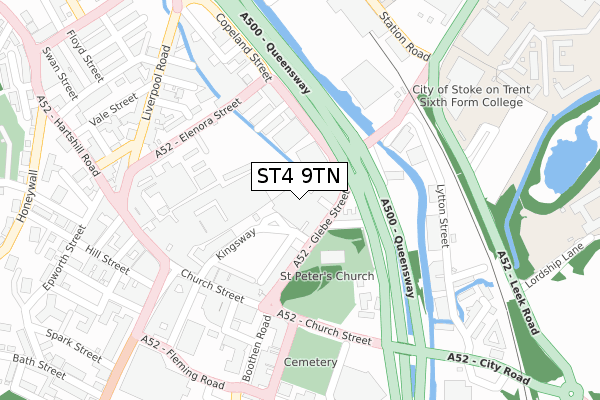
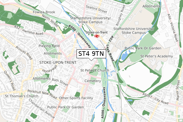
ST4 9TN is located in the Hartshill Park & Stoke electoral ward, within the unitary authority of Stoke-on-Trent and the English Parliamentary constituency of Stoke-on-Trent Central. The Sub Integrated Care Board (ICB) Location is NHS Staffordshire and Stoke-on-Trent ICB - 05W and the police force is Staffordshire. This postcode has been in use since January 2019.


GetTheData
Source: OS Open Zoomstack (Ordnance Survey)
Licence: Open Government Licence (requires attribution)
Attribution: Contains OS data © Crown copyright and database right 2024
Source: Open Postcode Geo
Licence: Open Government Licence (requires attribution)
Attribution: Contains OS data © Crown copyright and database right 2024; Contains Royal Mail data © Royal Mail copyright and database right 2024; Source: Office for National Statistics licensed under the Open Government Licence v.3.0
| Easting | 387876 |
| Northing | 345308 |
| Latitude | 53.004965 |
| Longitude | -2.182121 |
GetTheData
Source: Open Postcode Geo
Licence: Open Government Licence
| Country | England |
| Postcode District | ST4 |
| ➜ ST4 open data dashboard ➜ See where ST4 is on a map ➜ Where is Stoke-on-Trent? | |
GetTheData
Source: Land Registry Price Paid Data
Licence: Open Government Licence
| Ward | Hartshill Park & Stoke |
| Constituency | Stoke-on-trent Central |
GetTheData
Source: ONS Postcode Database
Licence: Open Government Licence
| January 2024 | Criminal damage and arson | On or near Charlton Street | 410m |
| January 2024 | Violence and sexual offences | On or near Charlton Street | 410m |
| December 2023 | Violence and sexual offences | On or near Charlton Street | 410m |
| ➜ Get more crime data in our Crime section | |||
GetTheData
Source: data.police.uk
Licence: Open Government Licence
| Stop X (Glebe Street) | Stoke-upon-trent | 118m |
| Civic Centre (Copeland Street) | Stoke-upon-trent | 132m |
| Stop N (Church Street) | Stoke-upon-trent | 190m |
| Stop Q (Church Street) | Stoke-upon-trent | 195m |
| Stop P (Church Street) | Stoke-upon-trent | 206m |
| Stoke-on-Trent Station | 0.3km |
| Longton Station | 3.5km |
| Longport Station | 4.7km |
GetTheData
Source: NaPTAN
Licence: Open Government Licence
GetTheData
Source: ONS Postcode Database
Licence: Open Government Licence


➜ Get more ratings from the Food Standards Agency
GetTheData
Source: Food Standards Agency
Licence: FSA terms & conditions
| Last Collection | |||
|---|---|---|---|
| Location | Mon-Fri | Sat | Distance |
| Glebe Street | 18:30 | 11:45 | 53m |
| Stoke Post Office | 18:00 | 12:00 | 207m |
| Trade Street | 18:30 | 10:00 | 290m |
GetTheData
Source: Dracos
Licence: Creative Commons Attribution-ShareAlike
| Facility | Distance |
|---|---|
| The Training Exchange (Closed) Hill Street, Stoke-on-trent Health and Fitness Gym | 308m |
| Stoke Recreation Centre (Closed) Booth Street, Stoke-on-trent Health and Fitness Gym, Sports Hall, Studio, Squash Courts | 558m |
| Sir Stanley Matthews Sports Centre Leek Road, Stoke-on-trent Artificial Grass Pitch, Health and Fitness Gym, Grass Pitches, Sports Hall, Studio | 638m |
GetTheData
Source: Active Places
Licence: Open Government Licence
| School | Phase of Education | Distance |
|---|---|---|
| City of Stoke-On-Trent Sixth Form College Leek Road, Stoke-on-Trent, ST4 2RU | 16 plus | 311m |
| Staffordshire University College Road, Stoke-on-Trent, ST4 2DE | Not applicable | 488m |
| Stoke Minster CofE Primary Academy Boothen Old Road, Stoke-on-Trent, ST4 4EE | Primary | 766m |
GetTheData
Source: Edubase
Licence: Open Government Licence
The below table lists the International Territorial Level (ITL) codes (formerly Nomenclature of Territorial Units for Statistics (NUTS) codes) and Local Administrative Units (LAU) codes for ST4 9TN:
| ITL 1 Code | Name |
|---|---|
| TLG | West Midlands (England) |
| ITL 2 Code | Name |
| TLG2 | Shropshire and Staffordshire |
| ITL 3 Code | Name |
| TLG23 | Stoke-on-Trent |
| LAU 1 Code | Name |
| E06000021 | Stoke-on-Trent |
GetTheData
Source: ONS Postcode Directory
Licence: Open Government Licence
The below table lists the Census Output Area (OA), Lower Layer Super Output Area (LSOA), and Middle Layer Super Output Area (MSOA) for ST4 9TN:
| Code | Name | |
|---|---|---|
| OA | E00072164 | |
| LSOA | E01014293 | Stoke-on-Trent 019A |
| MSOA | E02002969 | Stoke-on-Trent 019 |
GetTheData
Source: ONS Postcode Directory
Licence: Open Government Licence
| ST4 1HG | Glebe Street | 52m |
| ST4 1JN | Brook Street | 91m |
| ST4 1HL | Glebe Street | 109m |
| ST4 1HP | Glebe Street | 151m |
| ST4 1PP | Leason Street | 156m |
| ST4 1JH | Kingsway | 162m |
| ST4 1BL | Church Street | 176m |
| ST4 1PR | Copeland Street | 176m |
| ST4 1QD | Elenora Street | 178m |
| ST4 1LP | St Peters Close | 197m |
GetTheData
Source: Open Postcode Geo; Land Registry Price Paid Data
Licence: Open Government Licence