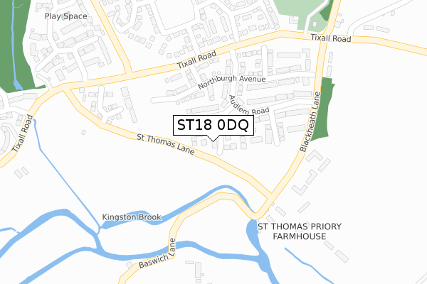
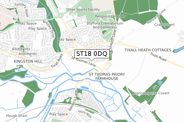
ST18 0DQ is located in the Milwich electoral ward, within the local authority district of Stafford and the English Parliamentary constituency of Stafford. The Sub Integrated Care Board (ICB) Location is NHS Staffordshire and Stoke-on-Trent ICB - 05V and the police force is Staffordshire. This postcode has been in use since March 2019.


GetTheData
Source: OS Open Zoomstack (Ordnance Survey)
Licence: Open Government Licence (requires attribution)
Attribution: Contains OS data © Crown copyright and database right 2024
Source: Open Postcode Geo
Licence: Open Government Licence (requires attribution)
Attribution: Contains OS data © Crown copyright and database right 2024; Contains Royal Mail data © Royal Mail copyright and database right 2024; Source: Office for National Statistics licensed under the Open Government Licence v.3.0
| Easting | 394842 |
| Northing | 323130 |
| Latitude | 52.805713 |
| Longitude | -2.077950 |
GetTheData
Source: Open Postcode Geo
Licence: Open Government Licence
| Country | England |
| Postcode District | ST18 |
| ➜ ST18 open data dashboard ➜ See where ST18 is on a map ➜ Where is Stafford? | |
GetTheData
Source: Land Registry Price Paid Data
Licence: Open Government Licence
| Ward | Milwich |
| Constituency | Stafford |
GetTheData
Source: ONS Postcode Database
Licence: Open Government Licence
1, DARLEY AVENUE, STAFFORD, ST18 0DQ 2020 2 NOV £319,995 |
5, DARLEY AVENUE, STAFFORD, ST18 0DQ 2019 17 DEC £449,995 |
7, DARLEY AVENUE, STAFFORD, ST18 0DQ 2019 6 DEC £469,995 |
2, DARLEY AVENUE, STAFFORD, ST18 0DQ 2019 27 SEP £434,995 |
3, DARLEY AVENUE, STAFFORD, ST18 0DQ 2019 20 AUG £429,995 |
8, DARLEY AVENUE, STAFFORD, ST18 0DQ 2019 28 JUN £429,995 |
4, DARLEY AVENUE, STAFFORD, ST18 0DQ 2019 21 JUN £389,995 |
6, DARLEY AVENUE, STAFFORD, ST18 0DQ 2019 21 JUN £339,995 |
GetTheData
Source: HM Land Registry Price Paid Data
Licence: Contains HM Land Registry data © Crown copyright and database right 2024. This data is licensed under the Open Government Licence v3.0.
| June 2022 | Criminal damage and arson | On or near Parking Area | 204m |
| June 2022 | Violence and sexual offences | On or near Parking Area | 204m |
| June 2022 | Anti-social behaviour | On or near Hampton Gardens | 469m |
| ➜ Get more crime data in our Crime section | |||
GetTheData
Source: data.police.uk
Licence: Open Government Licence
| Crematorium (Tixall Road) | Stafford | 316m |
| Crematorium (Tixall Road) | Stafford | 347m |
| Wolseley Road (Tixall Road) | Kingston Hill | 456m |
| Wolseley Road (Tixall Road) | Kingston Hill | 457m |
| 256 Tixall Road (Tixall Road) | Kingston Hill | 618m |
| Stafford Station | 3km |
GetTheData
Source: NaPTAN
Licence: Open Government Licence
| Percentage of properties with Next Generation Access | 100.0% |
| Percentage of properties with Superfast Broadband | 100.0% |
| Percentage of properties with Ultrafast Broadband | 100.0% |
| Percentage of properties with Full Fibre Broadband | 100.0% |
Superfast Broadband is between 30Mbps and 300Mbps
Ultrafast Broadband is > 300Mbps
| Percentage of properties unable to receive 2Mbps | 0.0% |
| Percentage of properties unable to receive 5Mbps | 0.0% |
| Percentage of properties unable to receive 10Mbps | 0.0% |
| Percentage of properties unable to receive 30Mbps | 0.0% |
GetTheData
Source: Ofcom
Licence: Ofcom Terms of Use (requires attribution)
GetTheData
Source: ONS Postcode Database
Licence: Open Government Licence


➜ Get more ratings from the Food Standards Agency
GetTheData
Source: Food Standards Agency
Licence: FSA terms & conditions
| Last Collection | |||
|---|---|---|---|
| Location | Mon-Fri | Sat | Distance |
| The Saltings | 17:15 | 10:00 | 576m |
| Avon Rise | 17:15 | 09:15 | 813m |
| Staffordshire University | 17:15 | 10:00 | 932m |
GetTheData
Source: Dracos
Licence: Creative Commons Attribution-ShareAlike
| Facility | Distance |
|---|---|
| Beacon Sport And Fitness Weston Road, Stafford Sports Hall, Health and Fitness Gym, Artificial Grass Pitch, Grass Pitches, Studio | 738m |
| The Weston Road Academy Blackheath Lane, Stafford Sports Hall, Grass Pitches, Outdoor Tennis Courts | 951m |
| St Leonards Works (Sport & Social Club) (Closed) St. Leonards Avenue, Stafford Sports Hall | 1.2km |
GetTheData
Source: Active Places
Licence: Open Government Licence
| School | Phase of Education | Distance |
|---|---|---|
| Veritas Primary Academy Weston Road, Stafford, ST18 0FL | Primary | 914m |
| The Weston Road Academy Blackheath Lane, Stafford, ST18 0YG | Secondary | 974m |
| St John's CofE Primary Academy Weston Road, Stafford, ST16 3RZ | Primary | 1.2km |
GetTheData
Source: Edubase
Licence: Open Government Licence
The below table lists the International Territorial Level (ITL) codes (formerly Nomenclature of Territorial Units for Statistics (NUTS) codes) and Local Administrative Units (LAU) codes for ST18 0DQ:
| ITL 1 Code | Name |
|---|---|
| TLG | West Midlands (England) |
| ITL 2 Code | Name |
| TLG2 | Shropshire and Staffordshire |
| ITL 3 Code | Name |
| TLG24 | Staffordshire CC |
| LAU 1 Code | Name |
| E07000197 | Stafford |
GetTheData
Source: ONS Postcode Directory
Licence: Open Government Licence
The below table lists the Census Output Area (OA), Lower Layer Super Output Area (LSOA), and Middle Layer Super Output Area (MSOA) for ST18 0DQ:
| Code | Name | |
|---|---|---|
| OA | E00166321 | |
| LSOA | E01029732 | Stafford 011E |
| MSOA | E02006198 | Stafford 011 |
GetTheData
Source: ONS Postcode Directory
Licence: Open Government Licence
| ST18 0ZJ | St Thomas Priory | 227m |
| ST18 0ZH | The Priory | 242m |
| ST18 0YH | Bayswater Square | 270m |
| ST18 0YD | Baswich Lane | 316m |
| ST18 0YF | St Thomas Lane | 320m |
| ST18 0ZQ | Holden Park | 340m |
| ST18 0YE | Baswich Lane | 351m |
| ST18 0WB | Blenheim Close | 360m |
| ST18 0YW | Dewsbury Crescent | 449m |
| ST18 0WE | Holyrood Close | 451m |
GetTheData
Source: Open Postcode Geo; Land Registry Price Paid Data
Licence: Open Government Licence