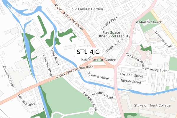
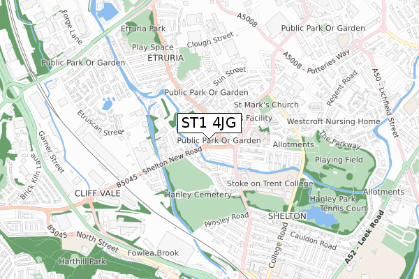
ST1 4JG is located in the Hanley Park, Joiner's Square & Shelton electoral ward, within the unitary authority of Stoke-on-Trent and the English Parliamentary constituency of Stoke-on-Trent Central. The Sub Integrated Care Board (ICB) Location is NHS Staffordshire and Stoke-on-Trent ICB - 05W and the police force is Staffordshire. This postcode has been in use since September 2018.


GetTheData
Source: OS Open Zoomstack (Ordnance Survey)
Licence: Open Government Licence (requires attribution)
Attribution: Contains OS data © Crown copyright and database right 2024
Source: Open Postcode Geo
Licence: Open Government Licence (requires attribution)
Attribution: Contains OS data © Crown copyright and database right 2024; Contains Royal Mail data © Royal Mail copyright and database right 2024; Source: Office for National Statistics licensed under the Open Government Licence v.3.0
| Easting | 387563 |
| Northing | 346655 |
| Latitude | 53.017066 |
| Longitude | -2.186838 |
GetTheData
Source: Open Postcode Geo
Licence: Open Government Licence
| Country | England |
| Postcode District | ST1 |
| ➜ ST1 open data dashboard ➜ See where ST1 is on a map ➜ Where is Stoke-on-Trent? | |
GetTheData
Source: Land Registry Price Paid Data
Licence: Open Government Licence
| Ward | Hanley Park, Joiner's Square & Shelton |
| Constituency | Stoke-on-trent Central |
GetTheData
Source: ONS Postcode Database
Licence: Open Government Licence
| January 2024 | Anti-social behaviour | On or near Howard Place | 191m |
| January 2024 | Violence and sexual offences | On or near Howard Place | 191m |
| January 2024 | Violence and sexual offences | On or near Howard Place | 191m |
| ➜ Get more crime data in our Crime section | |||
GetTheData
Source: data.police.uk
Licence: Open Government Licence
| Shearer Street | Shelton | 13m |
| Pyenest Street (Shelton New Road) | Shelton | 52m |
| Cemetery Road (Shelton New Road) | Shelton | 181m |
| Howard Place (Snow Hill) | Shelton | 185m |
| Howard Place (Snow Hill) | Shelton | 239m |
| Stoke-on-Trent Station | 1.1km |
| Longport Station | 3.4km |
| Longton Station | 4.5km |
GetTheData
Source: NaPTAN
Licence: Open Government Licence
| Percentage of properties with Next Generation Access | 100.0% |
| Percentage of properties with Superfast Broadband | 100.0% |
| Percentage of properties with Ultrafast Broadband | 100.0% |
| Percentage of properties with Full Fibre Broadband | 100.0% |
Superfast Broadband is between 30Mbps and 300Mbps
Ultrafast Broadband is > 300Mbps
| Percentage of properties unable to receive 2Mbps | 0.0% |
| Percentage of properties unable to receive 5Mbps | 0.0% |
| Percentage of properties unable to receive 10Mbps | 0.0% |
| Percentage of properties unable to receive 30Mbps | 0.0% |
GetTheData
Source: Ofcom
Licence: Ofcom Terms of Use (requires attribution)
GetTheData
Source: ONS Postcode Database
Licence: Open Government Licence

➜ Get more ratings from the Food Standards Agency
GetTheData
Source: Food Standards Agency
Licence: FSA terms & conditions
| Last Collection | |||
|---|---|---|---|
| Location | Mon-Fri | Sat | Distance |
| Havelock Place | 17:30 | 11:00 | 165m |
| Howard Place | 17:30 | 11:15 | 180m |
| Etruria Vale Road | 17:30 | 11:00 | 369m |
GetTheData
Source: Dracos
Licence: Creative Commons Attribution-ShareAlike
| Facility | Distance |
|---|---|
| Shelton Pool (Closed) Simon Place, Stoke-on-trent Swimming Pool | 309m |
| Stoke On Trent College (Cauldon Campus) (Closed) Stoke Road, Stoke-on-trent Health and Fitness Gym, Sports Hall | 354m |
| Stoke On Trent College Sports Academy Stoke Road, Stoke-on-trent Health and Fitness Gym, Sports Hall, Studio | 379m |
GetTheData
Source: Active Places
Licence: Open Government Licence
| School | Phase of Education | Distance |
|---|---|---|
| PEAK EDUCATION - STOKE 60 SNOWHILL, SHELTON, STOKE ON TRENT, ST1 4LY | Not applicable | 127m |
| Regent College 77 Shelton New Road, 77 Shelton New Road, Stoke-on-Trent, ST4 7AA | Not applicable | 139m |
| St Mark's CofE Primary School Wood Terrace, Shelton, Stoke-on-Trent, ST1 4LR | Primary | 327m |
GetTheData
Source: Edubase
Licence: Open Government Licence
The below table lists the International Territorial Level (ITL) codes (formerly Nomenclature of Territorial Units for Statistics (NUTS) codes) and Local Administrative Units (LAU) codes for ST1 4JG:
| ITL 1 Code | Name |
|---|---|
| TLG | West Midlands (England) |
| ITL 2 Code | Name |
| TLG2 | Shropshire and Staffordshire |
| ITL 3 Code | Name |
| TLG23 | Stoke-on-Trent |
| LAU 1 Code | Name |
| E06000021 | Stoke-on-Trent |
GetTheData
Source: ONS Postcode Directory
Licence: Open Government Licence
The below table lists the Census Output Area (OA), Lower Layer Super Output Area (LSOA), and Middle Layer Super Output Area (MSOA) for ST1 4JG:
| Code | Name | |
|---|---|---|
| OA | E00072136 | |
| LSOA | E01014281 | Stoke-on-Trent 015A |
| MSOA | E02002965 | Stoke-on-Trent 015 |
GetTheData
Source: ONS Postcode Directory
Licence: Open Government Licence
| ST1 4PL | Bedford Road | 82m |
| ST1 4PE | Pyenest Street | 96m |
| ST1 4PP | Thorndyke Street | 105m |
| ST1 4PS | Havelock Place | 139m |
| ST1 4PT | Clarke Street | 153m |
| ST4 7AE | Lomas Street | 166m |
| ST1 4DE | Etruria Vale Road | 174m |
| ST4 2DL | Cemetery Road | 174m |
| ST1 4LY | Snow Hill | 185m |
| ST1 4DF | Etruria Vale Road | 187m |
GetTheData
Source: Open Postcode Geo; Land Registry Price Paid Data
Licence: Open Government Licence